Feeds:
Posts
Comments

Archive for February, 2009

Lost Cities

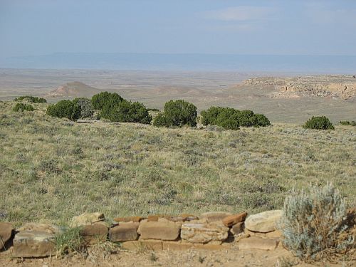
Reconstructed Room Block at Lost City Museum, Overton, Nevada

Reconstructed Room Block at Lost City Museum, Overton, Nevada

The title of this blog comes from the Navajo legend about Chaco Canyon, recorded in several forms, which describes it as the home of the Great Gambler, a stranger who came to the Anasazi and managed to enslave them by gambling with them and winning until they had nothing left to bet but themselves.  As the story goes, the Gambler forced his new slaves to construct the great houses of the canyon, including one in particular where he himself lived.  Most versions of the story identify Pueblo Alto as this house, which is odd and intriguing since it is today one of the least remarkable or impressive of the major great houses, and the banner image on the blog is therefore cropped from a picture I took of Pueblo Alto.

Beyond that specific context, however, I’ve found that the theme of gambling runs continually through my thinking on Chaco and what lessons it holds for our society today.  In one sense, building the great houses of Chaco at all in its harsh and unpredictable environment can be seen as a gigantic bet on continued favorable climatic conditions, and ultimately and unsuccessful one.  And, as we are now finding to our increasing discomfort, many of the more impressive works of our own society are based on similar bets, and the odds are beginning to look a lot longer than they did before.

I’m writing this in Las Vegas, Nevada.  This is a city famously devoted to gambling in all its forms, and it’s also one of the most obvious examples of the large-scale gambling on environmental conditions which has in some ways been the halmark of modern America.  While I’ve been here I’ve looked at a lot of the city, including many parts that visitors don’t usually see, and what has struck me most is that it really seems like a city on the edge, not only environmentally but economically as well.  This is one of those places that invested heavily in the housing boom and is suffering correspondingly from the housing collapse, and there are signs and ads all over town offering sales of various sorts and directly referencing the recession.  The same is true of ads I’ve heard on the local radio stations.  This has been a pretty prosperous place for a long time, but now it seems like the possibility of it turning into an enormous slum is looming ominously on the horizon.  Not that that will necessarily happen, of course; it’s never wise to try to predict the future.  But the potential is clearly there.  The past success of a given bet is no guarantee of continued success.
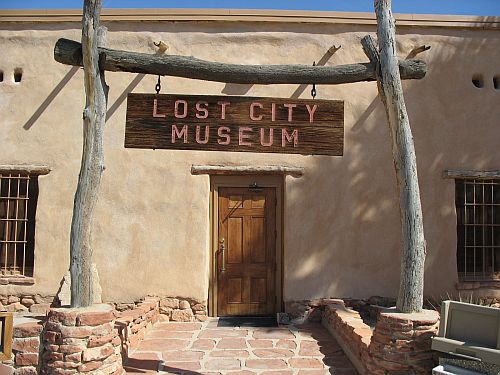
Lost City Museum, Overton, Nevada

Lost City Museum, Overton, Nevada

This isn’t the first time people have made bets like this in what is now southern Nevada.  Just before I came here I visited the Lost City Museum in Overton, Nevada, which was constructed to house the artifacts from the salvage excavations of sites threatened by the creation of Lake Mead.  The name “Lost City” was given to the extensive series of ruins in the Moapa Valley by early promoters in the towns established there in the late nineteenth century, and for several decades they were a major tourist attraction for places like Overton and, especially, St. Thomas, further downstream, which itself became a lost city when it was inundated by the lake and has now reappeared as the waters have receded in response to severe drought.

The ruins, also known as “Pueblo Grande de Nevada,” were from the Virgin Anasazi culture, which flourished here for a long time and was partly contemporaneous with the rise and fluorescence of Chaco far to the east.  There is no clear evidence of contact between the people here and those of Chaco, but there are some interesting parallels in their development, including extensive regional trade networks and the import of considerable amounts of basic goods like pottery.  Although the system here was on a much smaller scale than that of the cultures to the east, it was still pretty impressive given the extreme harshness of the local environment.

It’s generally agreed that the Pueblo II period, roughly AD 900 through 1100, the time of the greatest extent of both Chaco and the Virgin branch, was a time of unusually favorable climate in most of the southwest, and that this had some relationship to the spread of the Pueblo cultural tradition to its greatest extent at this time.  Around AD 1100, however, the climate seems to have deteriorated remarkably for a long time, culminating in the “Great Drought” of the late thirteenth century, and the fact that the prehistoric cultures of the southwest underwent many considerable changes at this time is often thought to be related to that deterioration.

Among the changes at this time, beginning somewhat earlier than some of the others, was the disappearance of the Virgin branch.  This, in other words, was when Lost City was lost.  After AD 1160 or so, Pueblo occupation of the area seems to have ceased entirely.

Original Foundations of a Room Block at Lost City Museum, Overton, Nevada

Original Foundations of a Room Block at Lost City Museum, Overton, Nevada

Why Lost City was lost is in some respects clear, given the environmental difficulties at the time, but in other respects a bit murky, given that the timing is somewhat out of sync with the rest of the region.  In any case, there is an abiding mystery remaining, and that is what happened to the people.

In most of the southwest, although the details are not always clear, the overall answer to what happened to the people when they left sites that are no longer occupied is pretty clear: they went to the areas that are still occupied by their descendents, namely the Rio Grande Valley and the Western Pueblo areas, including Hopi, Zuni, and Acoma-Laguna.  In fact, we spend a certain amount of time at Chaco disabusing visitors of the “vanishing Anasazi” idea.  The Chacoans didn’t vanish.  They moved.
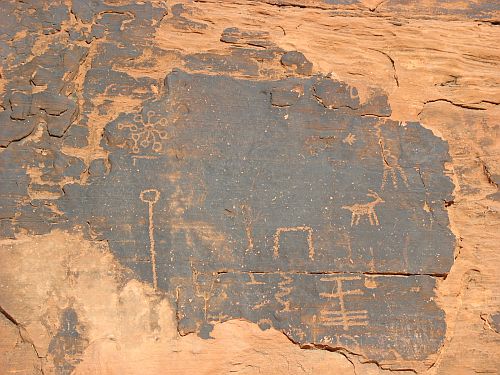
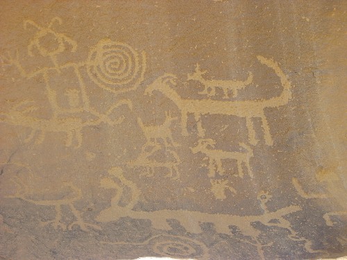
Abstract Petroglyph Panel at Valley of Fire State Park, Nevada

Abstract Petroglyph Panel at Valley of Fire State Park, Nevada

The Virgin Anasazi, however, did vanish.  Or, at least, there is no clear evidence of them moving anywhere else.  While the Virgin area was abandoned earlier than most others, it is not possible to trace a wave of movement to the east into the areas still occupied at the time, such as the Kayenta, Mesa Verde, and Hopi regions.  If the Virgin people emigrated en masse, presumably some trace of their movements should remain, either in the demographics of nearby areas or in artifacts showing a similar material culture showing up in those areas.  There is, however, no such evidence.  If the Virgin Anasazi moved to other regions, they did so in small groups and assimilated completely to the culture of the areas they went to.  This is of course totally possible, and the Hopi, at least, consider the Virgin people among their ancestors, but not all archaeologists accept it, given the paucity of positive evidence.

But if the Virgin Anasazi didn’t emigrate, what happened to them?  One possibility is that they drastically changed their material culture to adapt to the changing climate and became the hunting-and-gathering Southern Paiutes who inhabited the region at European contact.  This is in fact the account preferred by the Southern Paiutes themselves, who consider the Virgin Anasazi their ancestors, but Paiute material culture is so different from that of the Anasazi that most archaeologists are skeptical and are willing to accept at most that the Virgin branch assimiliated (again, completely) to the culture of the Paiutes, who they see as entering the region as the climate changed.

The only other option, which many archaeologists seem to prefer, is that the Virgin Anasazi, who were never very numerous, died out entirely as they conditions.  I’m a bit dubious of this given the considerable flexibility shown by Pueblo groups further east, but I’m no expert on this area, which is in some ways even more difficult to live in than the Colorado Plateau.

Abstract Petroglyph Panel at Atlatl Rock, Valley of Fire State Park, Nevada

Abstract Petroglyph Panel at Atlatl Rock, Valley of Fire State Park, Nevada

In any case, what is clear is that the bet made by the inhabitants of Lost City was ultimately unsuccessful.  It is unclear how they responded to this loss, but given that we seem to be in a similar situation in the same area, I think more study of the issue is crucially important.

Somewhere the dice are rolling.  The result is, as always, uncertain, but the odds are long.  There are already two lost cities in southern Nevada: Pueblo Grande and St. Thomas.  Will Las Vegas become the third?

Reconstructed Ceiling Hatch at Lost City Museum, Overton, Nevada
Reconstructed Ceiling Hatch at Lost City Museum, Overton, Nevada
Read Full Post »

Hosta Butte from New Alto

Hosta Butte from New Alto

Chapter 6 of The Prehistoric Pueblo World is entitled “A Demographic Overview of the Late Pueblo III Period in the Mountains of East-Central Arizona.”  If that sounds insanely specific, well, it is.  And it gets worse; in the very first paragraph it turns out that instead of covering all of the mountains of east-central Arizona, the chapter will focus specifically on the Grasshopper Plateau, with occasional reference to areas further east in the mountains for comparison.  This extremely tight geographical and temporal focus is in stark contrast to the broader approach taken in most of the other chapters.

There is a reason for this, though it’s not entirely apparent just from reading the chapter.  The Grasshopper Plateau is one of the most intensively studied areas in the southwest, because it was for many years the location of the main archaeological field school of the University of Arizona.  U of A did other field schools in this area, particularly early on, most famously at Forestdale and Point of Pines, but it is at Grasshopper that the field schools did their most sustained and detailed work over the course of 30 years.

And, sure enough, the authors of this chapter are all associated with U of A and its field schools.  J. Jefferson Reid, who headed the field school from 1979 to 1992, is the lead author.  María Nieves Zedeño is an associate research anthropologist at the university’s Bureau of Applied Research in AnthropologyJohn R. Welch got his Ph.D. from the anthropology department.  Barbara K. Montgomery was also affiliated with U of A at the time of publication, but she has since moved on.

It’s not surprising, then, that all these people from the same university would focus on an area of intense study by that university.  It wouldn’t really be a problem, either, except that the chapter itself is rather strange and difficult to understand.  The basic point, which is repeated several times in different ways, is that the Grasshopper area was occupied seasonally by small, mobile groups of hunter-gatherers who probably also did some small-scale farming up until around AD 1250, when those people began to consolidate their settlements into small clusters around “focal” settlements with community integrative architectural features.  In this area those features were generally plazas or courtyards, whereas further east, where this process began significantly earlier, they were great kivas.  Then, around AD 1280, there was a huge influx of people into the area, apparently as a result of the massive convulsions throughout the southest resulting from the so-called “Great Drought” that had begun a few years earlier.  This massive increase in population density, combined with the reduced resource availability triggered by the drought, resulted in both increased reliance on farming and increased social stress and uncertainty, with the ultimate result being aggregation into large pueblos for defense in the same manner as elsewhere in the region.

That’s pretty much it, and pretty much what was going on everywhere else at the same time.  The authors of this chapter, however, present several different and apparently totally separate lines of evidence for it, and include a great deal of theoretical and methodological background as well, before ultimately concluding based on modern ethnographic evidence that this aggregation was a temporary change in the overall pattern of mobility in this area, which ultimately failed in the Pueblo IV period with a resulting depopulation allowing the later entrance of other groups practicing the same mobile lifestyles as before.

Overall, this reads like a much more technical account of the same processes described in more accessible terms by the authors of the other chapters.  Which is not necessarily a knock on the authors, since this isn’t exactly a book aimed at a popular audience, but for the nonspecialist reader it’s not really the best introduction to an area that has been very intensively studied for a long time.

Read Full Post »

Peñasco Blanco Framing Huerfano Mesa

Peñasco Blanco Framing Huerfano Mesa

One piece of data that sometimes gets mentioned in support of more hierarchical models of Chacoan social organization is the diversity of sizes found among Chacoan great houses both inside and outside the canyon.  The idea behind this argument is that the great houses fall into a few rough groups based on size, with the number of great houses increasing as the size decreases, which suggests that they were all organized into a coherent, hierarchical system with the largest ones (mostly in the canyon) at the top and the others playing subordinate roles.  One conclusion that follows from this interpretation is that the entire Chacoan system was a single highly organized polity with a central leadership at Chaco.  Given this type of organization, it is natural to further conclude that that central leadership was composed of a socioeconomic elite with political power over the other people in the system.

While I’m by no means opposed in principle to the idea of a hierarchical Chaco, I’ve never found this particular argument for it very convincing.  A hierarchical social system is certainly one possible source for a hierarchical settlement pattern, but it’s by no means the only one; I can think of several other possible ways such a pattern could emerge just off the top of my head.  Recent scholarship on Chaco, in fact, has largely turned away from the idea of Chaco as a single, centralized polity, with the idea of a collection of loosely connected separate polities being more popular now and supported by a variety of lines of evidence (some more convincing than others).  Even within this trend toward decentralized interpretations there are varying opinions about social hierarchy, which is actually a separate issue that is often conflated with centralization.  I’ll have more to say on that in later posts.  Here, my main concern is with the idea that settlement hierarchies serve as evidence for social stratification and regional integration.

Casa Chiquita

Casa Chiquita

Chaco is not the only part of the ancient southwest where this argument has been used.  Another, the subject of Peter Pilles‘s chapter 5 of The Prehistoric Pueblo World, is the Sinagua, who occupied the area that is now north-central Arizona around the modern towns of Flagstaff, Sedona, and Camp Verde.  While Pilles stops short of actually endorsing the argument that Sinagua settlement patterns indicate social hierarchy, he does discuss it at the end of the chapter.  First, however, he gives a useful overview of Sinagua settlement patterns, focusing on the period that is the main focus of the book as a whole, the “Pueblo III” period from approximately 1150 through 1350.

As Pilles points out at the beginning of the chapter, however, Sinagua archaeology tends to use a different system of chronology from the Pecos system in which “Pueblo III” covers this period.  Sinagua archaeology is distinctive in several ways from the traditional approach used in the Anasazi area, both because of clear cultural differences between the Sinagua and the Anasazi and because of the pivotal role played by the Museum of Northern Arizona in early research on the Sinagua.  (MNA was, and remains, active in Anasazi research as well, particularly in the Kayenta area, but other institutions have always been prominent in Anasazi studies as well and it never played the dominant role there that it has for the Sinagua.)  As a result, Sinagua chronology is based on a system of “phases” which correspond only roughly to the “periods” of the Pecos system.

Vent at Hungo Pavi

Vent at Hungo Pavi

To make things even more complicated, there are actually two series of Sinagua phases, one for each of the major regional areas of Sinagua settlement.  The northern area, encompassing the Flagstaff, Wupatki, and Anderson Mesa subareas, has one series of phases, while the rather different southern area, basically the Verde Valley and the nearby uplands and tributaries of the Verde River, has another.  The northern Elden and Turkey Hill phases correspond roughly to Pueblo III, as does the southern Honanki phase.

In addition, chronology in the Sinagua region is considerably cruder than in the various Anasazi regions.  The main reasons for this are a relatively small amount of excavation, resulting in few tree-ring dates, and the inconvenient fact that Sinagua pottery shows little variation over time, meaning that, unlike in the Anasazi case, pottery assemblages are of limited usefulness in making chronological placements of unexcavated sites.  The main tool for such placement is, therefore, Anasazi pottery imported into Sinagua sites.  Since this is not always present in large enough numbers for reliable sampling, Sinagua sites cannot always be dated at all, and even when they can be the chronological control is pretty crude by Anasazi standards.  This leads to some problems, as we will see when we return below to the settlement hierarchy question.

Drainage Path over Slickrock

Drainage Path over Slickrock

The name “Sinagua” comes from the Spanish for “without water,” originally applied to the San Francisco Peaks, which the early Spanish explorers found surprisingly dry for such large mountains.  This is indeed a dry area, so water sources were always a key factor in settlement patterns.  In the northern Sinagua area, the main water sources were isolated springs, while in the south the permanently flowing Verde River was the main source.  This resulted in very different patterns of settlement locations in the two areas.  In general, northern sites (or clusters of sites) were more isolated from each other, while southern sites were lined up in a row along the river, though the specifics varied over time.

The main reason for that variation also seems to have been water-related.  The amount of moisture available varied over time, and in wetter times people expanded into areas that had been too unproductive to farm during dry years, only to retreat back to better-watered areas when the dry years returned.  This pattern is visible all over the southwest over the course of the centuries, although from the way Pilles tells it the Sinagua area seems to have been oddly out of sync with other regions.  In most of the southwest the wettest time was the Pueblo II period, from roughly 900 through 1150, and this is when most of the Anasazi regions saw their greatest extension (most notably, but by no means only, the Chaco Phenomenon).  For the Sinagua, however, this seems to have been a relatively dry period and a time of settlement locations in areas with more reliable water supplies.  In the north, this meant the higher elevations near the Peaks, while in the south it meant lowland locations closer to the river.  A pattern of small sites surrounding a larger site seems to be present at this time in both areas, and these apparent communities often had either a large communal pithouse or a Hohokam-style ballcourt, either of which would have presumably served to integrate the community.  Although there was some masonry construction at this time, the older pithouse form was still predominant, with northern (and southern upland) sites having large pithouses with ramp entry and southern lowland sites having more of a variety of designs, with some similar to Hohokam pithouses.  There was clearly a certain amount of Hohokam cultural influence during this period, but Pilles argues against previous interpretations that saw cultural changes as being due mostly to Hohokam immigration.

It is during the following Elden and Honanki phases, after 1150, that the Sinagua reached their greatest geographic extent and cultural florescence.  Pilles attributes the substantial growth during this time to favorable climatic change, which is an interesting and potentially important contrast to the deteriorating climate and resulting cultural changes in the Anasazi region at the same time.  With the wetter conditions they experienced, the Sinagua expanded into lower elevations in the north and higher elevations in the south.  There were a wide variety of site types, ranging from very common small pueblos to larger habitation sites with various layouts.  None of these, however, were very large compared to Anasazi sites, especially at this time, though some of them grew considerably larger in subsequent phases after 1300.  Almost all of the larger sites before 1300 are in the Flagstaff and Wupatki areas rather than the south.

Fajada Butte from Una Vida

Fajada Butte from Una Vida

Pilles identifies four types of large sites, although the numbers for some are so small that I’m a little dubious about some of these assignments.  In any case, they are:

  1. Massed room block pueblos: by far the most common; basically just large blocks of rooms that generally seem to have grown gradually, with rooms being added on as necessity dictated.
  2. Plaza-oriented pueblos: roomblocks arranged around a central plaza; these are not very common and are found mainly on the fringes of the Sinagua area, near the neighboring Anasazi and Salado regions where these layouts are more common.
  3. Courtyard-oriented pueblos: also rare, but these are distinctively Sinagua and seem to have played some sort of important role regionally; they have courtyards defined by walls, generally two of them with room blocks inside the inner one.
  4. Clustered room block pueblos: basically just multiple room blocks in close proximity; only three of these, two of which are in the Verde Valley.

In addition to the various types of masonry structures, pithouses and cave dwellings known as “cavates” were also common at this time.  These are sometimes clustered into apparent communities that would have held populations comparable to those of the larger masonry pueblos.

After reviewing these site types, Pilles concludes that the preferred type of habitation at this time was a small masonry pueblo of 5 to 20 rooms.  Smaller and larger sites are present as well, but they seem to have served special purposes which remain somewhat obscure.  These are all much smaller than typical Anasazi sites in room count, but it is important to note that Sinagua rooms are typically significantly larger than Anasazi rooms, probably because the Sinagua, unlike the Anasazi, rarely had separate rooms for storage.  Large numbers of storage jars are often found in excavated Sinagua habitation rooms.  Still, even when this is taken into account, Sinagua sites are generally much smaller than contemporaneous Anasazi sites.

As for the patterns of these sites and their locations at this point, Pilles notes that overall there seems to be a mix of isolated large sites, isolated small sites, and clustered small sites.  This is clearer in the north than in the Verde Valley, where sites are strung out along the river and larger sites are sometimes in close proximity to each other.  Still, throughout the region there seems to be a mix of dispersed and aggregated settlements.

This is… odd.  It’s much more typical to find the same type of settlement distribution across a region, particularly a small one like this.  Pilles suggests two main possibilities for explaining this distribution.

Petroglyph Panel Showing What Appears to Be a Mountain Lion

Petroglyph Panel Showing What Appears to Be a Mountain Lion

The first is that the dispersed and aggregated communities aren’t really contemporary.  As I mentioned above, temporal control for Sinagua sites, especially those known only through survey (which is almost all of them), is considerably weaker than for Anasazi sites, so what we may be looking at here is a process of rapid aggregation, with the dispersed small sites having been occupied for only a short time before the communities aggregated into large pueblos.  The time frame under discussion here is somewhere in the range of 100 to 200 years, so a process of aggregation like this would have been very rapid, but when compared with the better-dated Ansazi sites of this period, many of which do indeed show clear evidence of very rapid aggregation apparently in response to increased warfare, it seems pretty plausible.  Pilles stops short of endorsing this interpretation, which is understandable given the limited data, but he does present it favorably.

The second possibility, which Pilles also considers at length without ultimately passing judgment on, is that the different site types and distributions indicate a hierarchical regional system.  (And here we get back to the issue we started with.)  The idea here is that the large aggregated pueblos existed at the same time as the small dispersed pueblos, which were in some sort of subordinate relationship to them.  If this was the case, the different sizes of sites could reflect different levels of a hierarchical society.  The different site layouts could also reflect this, although since most of them are only present in a very small number of large sites and some seem to reflect outside influence this piece of evidence is considerably weaker than the size differences.  Pilles also mentions burial data that has been interpreted as showing a change during the early Elden phase from a “limited stratified society” to a hierarchical chiefdom.

Within a postulated regional hierarchy, the courtyard pueblos seem to be the best candidates for regional centers.  Pilles lists a whole series of characteristics that suggest this: locations on prominent hilltops or ridges along probable trade routes, greater numbers of luxury and trade goods, associated public architecture such as large pithouses and ballcourts, and the courtyards themselves.  Not all of the courtyard sites have all of these attributes, however, and since there are so few of them the relevance of the list of attributes seems just a little questionable.

Burial data known from the courtyard sites also suggest some form of stratification.  The most famous example is the “magician” burial at Ridge Ruin, which had a surprisingly extensive collection of valuable grave goods associated with an older man.  To try to understand this rich burial at what seemed like a fairly small and unimpressive site, the excavators consulted some Hopis, who concluded from the evidence that the man had been a high-ranking member of a society, effectively a war chief.  Since the Sinagua were one of the many groups that eventually immigrated to Hopi and contributed to the developing society there, the Hopis’ interpretation carries particular weight in this context.  Pilles mentions other rich burials as well, and notes that they are generally of older men, which he contrasts with the Anasazi tendency for the richest burials to be of older women.  I’m not sure where he got that last part, since the richest Anasazi burials I know of, at Pueblo Bonito, are definitely of older men.  Something to look into, certainly.

Kiva A at Pueblo Bonito from Above

Kiva A at Pueblo Bonito from Above

Pilles also mentions the presence of community integrative architecture and the persistence of community locations over time as evidence for stratification, which I don’t really see.  It’s quite possible for egalitarian societies to stay in one place for centuries and build communal buildings.  Pilles doesn’t offer any additional reasons to believe it suggests hierarchy in this particular case.

Of all this evidence offered for hierarchy, I think the burial data is the most convincing, although the general lack of excavation means that it is rather more limited than would be preferable.  It’s clear that something interesting was going on in the Sinagua area, which seems to have been something of a frontier zone where influences from various directions met and combined in ways that we now have trouble understanding.  I’m not really convinced that social hierarchy was a major aspect of the resulting mix, but I’m not convinced that it wasn’t either.  I do, however, find the “rapid aggregation” theory more plausible than the “social hierarchy” theory for explaining the narrow matter of the mixed settlement pattern.

Few (though not quite no) archaeologists seriously argue that there was any significant direct connection between Chaco and the Sinagua, but the parallels are interesting for both the similarities and the differences that they reveal.  I don’t have any clear thoughts about the implications of those comparisons, but they certainly merit further study.

Petroglyph Panel Showing People

Petroglyph Panel Showing People

Read Full Post »

Chetro Ketl, the Talus Unit, and Pueblo Bonito from the Cliff Top

Chetro Ketl, the Talus Unit, and Pueblo Bonito from the Cliff Top

One of the most noticeable things about Chaco Canyon, which visitors frequently mention, is that it’s a very harsh environment.  It’s difficult to imagine how the Chacoans could have accomplished all that they did in such an environment, and the fact that they did is one of the most impressive and inspiring things about the place.

Another very noticeable thing about Chaco Canyon, however, is that the Chacoans don’t live there anymore.  Despite the obvious evidence all over the canyon of the grandeur and majesty of the Chacoan experiment, it’s very difficult to escape the impression from that same evidence that it was ultimately a failed experiment.  While the nature of the Chacoan system remains surprisingly murky, the fact that it was at least in some ways very different from the Pueblo societies that succeeded it has become increasingly clear, and the obvious implication is that there was something about the Chaco Phenomenon that was ultimately incompatible with the difficult environment in which it briefly flourished.  This leads to the further implication that the fact that the modern Pueblos succeeded while Chaco did not has something to do with the many significant changes that occurred in the southwest between the Chacoan era and Spanish contact.

Looking East from Peñasco Blanco

Looking East from Peñasco Blanco

There are two main categories of factors that seem at first glance most likely to play a role in this undoubtedly complicated chain of events: environmental and social.  The environmental factors include such things as rainfall patterns and hydrological conditions, which can shift over the course of various time frames with important consequences for human adaptations.  An admittedly imperfect picture of ancient climatic conditions can be assembled form several sources of evidence, such as tree-rings and sedimentation patterns.  The social factors, which can be considerably more difficult to interpret and understand, include such things as the organization of a society, its receptiveness to outsiders, and its flexibility in the face of major change.

These factors are by no means independent, of course, and they can affect each other in all sorts of ways.  Any reasonable explanation of a complex societal change must involve both.  In a case like that of the prehistoric southwest, however, involving a series of interactions among agricultural societies in an environment marginal at best for agricultural production, the question of which type of factor was most important in the eventual outcome becomes at least somewhat interesting.

One interpretation, focusing on environmental factors with social factors playing a reactive (though still important) role, is that after the fall of Chaco the Pueblo people moved to areas that were more reliable for subsistence and developed societal structures that used efficient strategies of resource usage to create enduring, sustainable communities.  This is more or less the argument that David Stuart makes in Anasazi America.  And, indeed, the massive shift of population into the Rio Grande valley during the Pueblo IV period suggests that the relative abundance of the riverine ecosystem there, compared to the increasingly harsh and erratic environment on the Colorado Plateau, led to that area becoming such an important population and cultural center for the region.  The importance of the Rio Grande, which had previously been a sparsely populated fringe area, definitely implies that environmental factors were key to these shifts, with the societal factors involved correspondingly less important.

Not everyone went to the Rio Grande, however.  Some people stayed on the Colorado Plateau, despite its worsening ecological conditions, implying that we shouldn’t be too quick to give environmental factors a leading role in cultural changes during this time.  Many parts of the Plateau were apparently completely abandoned, but others witnessed considerable influxes of people, presumably from the areas being abandoned.  Not all of these clusters of communities that developed in the post-Chaco era managed to survive to the historic period, but on the Colorado Plateau three did, and the remnants of them are there to this day: Acoma, Zuni, and Hopi.

The Acoma and Zuni areas were both fairly substantially occupied during the Chacoan era and seem to have participated in the Chaco system to some extent, and some Zuni-area communities even carried on some of its motifs long after the demise of the system itself.  While these aren’t the most fertile areas in the region, they’re habitable enough, and their long histories of continuous occupation bear witness to their attractions.  I’ll have more on them in future posts, but here I’m going to focus on the third cluster, Hopi, which has a very different history.

Pictographs behind Wijiji

Pictographs behind Wijiji

As E. Charles Adams notes in the fourth chapter of The Prehistoric Pueblo World, the environment in the Hopi area is and always has been rather marginal for agriculture even by southwestern standards.  For most of the span of prehistory its population density was correspondingly low, with the small population present during and immediately after the Chacoan era living in dispersed communities of pithouses and small pueblos, apparently integrated by great kivas in typical fashion for this time.  There is no clear evidence of Hopi participation in the Chaco system, and there are no really plausible candidates for Hopi great houses, though there were some great houses in the nearby Low Mountain area and there presumably would have been some interaction with at least regional varieties of Chacoan society.  Adams suggests that the lack of strong connections between Chaco and Hopi was probably due to the Hopi area’s small population and marginal agricultural productivity, even during this time of favorable climate throughout most of the southwest.

Even the collapse of the Chacoan system around AD 1150 doesn’t seem to have had any perceptible effects at Hopi.  Around 1250, however, as the deterioration of environmental conditions began to reach crisis levels, there was a sudden and massive influx of people from all directions to Hopi, changing the character and future of the area forever.  The main visible sign of these changes was a shift from the previous dispersed pattern of settlement to settlement aggregation on a major scale, involving large but compact pueblos oriented around plazas, with great kivas totally disappearing.

Adams sees these plazas as the key to understanding the changes of this period.  He notes that immigrants seem to have come from all directions: Kayenta and possibly Mesa Verde to the north, the Mogollon culture area to the south, the Sinagua to the west, and possibly the Chinle Valley and Wide Ruins area to the east.  This influx of people around the time that things started to get really bad environmentally suggests that some of the adaptations to the chaninging times tried by groups in other areas had failed, and the people sought refuge at Hopi, which had found a better way to cope.

But what was that better way?  It surely wasn’t migrating to an area with better or more reliable environmental conditions; Hopi was, if anything, worse than most surrounding areas in this respect.  In these circumstances, it seems obvious that social rather than environmental factors must have been primary.

Adams agrees, and he sees the main social factor operative being the adoption of the plaza-oriented community layout and the accompanying kachina cult, which used the plazas for public rituals to integrate the increasingly diverse communities.  The key thing about the kachina cult is that it was based on membership in secret societies based on the possession and use of ritual knowledge, rather than being based, as community organizations apparently had been before, on kinship connections.  The adoption of the cult and its accompanying plazas, which appear to have originated among the Mogollon of the Upper Little Colorado River area, helped to keep communities together by reducing the importance of kinship to community institutions and instituting forms of ritual and social organization that could potentially include everyone who chose to immigrate to the area.

Petroglyph Panel with a Foot and Other Images

Petroglyph Panel with a Foot and Other Images

This “pro-immigrant” ideology and the resulting influx of immigrants was politically advantageous to the large and growing communities that resulted.  In this era of strife and warfare, fueled by competition over increasingly scarce resources, there was a huge advantage in maintaining a large population relative to other groups.  Despite the declining resource base, then, the most successful political leaders tried to get people to join their communities, and the kachina cult offered them a useful means for bringing them into the existing community when they arrived.

This is not to say that environmental factors were irrelevant, of course, and Adams points out that part of the success of Hopi can be attributed to a concerted effort to make the most of the resources available, through agricultural intensification and the use of locally abundant coal to fire pottery.  Overall, however, it’s clear that the main advantage Hopi had was its innovative social organization and the large population that resulted from it.

This, then, may be the lesson of Hopi, which was a very successful response to a very difficult situation.  The contrast to Chaco, which also seems to have been socially innovative but in ways that are unclear to us today, is striking and important.  The Chacoans were building huge, finely constructed great houses and extending their influence throughout the region while the Hopis were living in small pithouses and generally staying out of the way.  The Chacoan great houses are empty and crumbling now, awe-inspiring even in their ruined state but very much places of the past, while the Hopi mesas are home to several vibrant, living communities and are clearly places of the present and the future.  If we are to be looking for models to emulate in our own time of troubles, which should we choose?

Looking West from Peñasco Blanco

Looking West from Peñasco Blanco

Read Full Post »

The Modern Town of Kayenta, Arizona

The Modern Town of Kayenta, Arizona

Chapter 3 of The Prehistoric Pueblo World, by Jeffrey Dean, looks at the Kayenta area of northeastern Arizona.  Dean is a dendrochronologist at the University of Arizona‘s Laboratory of Tree-Ring Research, and he’s done a lot of work on the paleoclimatology of the southwest, but here he focuses mainly on the culture history of the Kayenta Anasazi and alludes only briefly to possible environmental factors affecting that history.

This chapter brings us closer to Chaco than the previous one, but as Dean notes at the beginning we’re still very much within the Western Anasazi culture area, which is distinct from the Eastern Anasazi area in a number of ways.  Most of these ultimately reduce to the Western area, including Kayenta, being simpler and more flexible in social structure: sites are smaller, construction is simpler, there is much less functional differentiation among sites, regional interactions are apparently limited mainly to low-level trade, and the pace of change and development is markedly slower.  The two areas, which are divided by the Chuska Mountains, seem to have developed separately perhaps as early as the Late Archaic period, with consistent differences apparent already in the Basketmaker II era.  Those differences were reduced a bit in the following Basketmaker III period, when the two regions were as similar as they ever got.  The similarities seem to mainly involve Kayenta settlements becoming more like eastern settlements, with aggregated villages appearing, the most famous of which, Juniper Cove, even had a great kiva (the only one known from the whole Kayenta sequence).

The Pueblo I period marked the return of major east-west differences, with the Eastern Anasazi rapidly developing toward the major achievements of the Pueblo II era while the west remained largely in Basketmaker III conditions.  Kayenta architecture and site layout hardly changed at all, with the main developments being in ceramics and settlement locations.  The upland areas that had been largely abandoned during Basketmaker III were reoccupied, and lowland settlements moved from the edges of floodplains out onto the floodplains themselves.  The real sudden changes in Kayenta lifestyles came with the transition to Pueblo II around AD 1000, when there was a major shift from pithouses to above-ground unit pueblos, similar to those seen in the Eastern Anasazi tradition, with a block of rooms fronted by a kiva and a midden, though with the innovation in some cases of a “grinding room” between the roomblock and the kiva.  As in the rest of the Pueblo world, Pueblo II was a time of explansion for the Kayenta people, who dispersed throughout the area and reached their widest geographical coverage, going beyond the Colorado and San Juan Rivers to the west and north, south as far as the Little Colorado River, and east as far as the Lukachukai Mountains.  This was still a small-scale pattern of widely dispersed households with little aggregation, however, in contrast to the “communities” seen further east at this time, when Chaco Canyon also reached the height of its apparent influence.

The Kayenta expansion was fairly short-lived, however, and around AD 1150 the “Transition” period began, with one of the most notable changes being a reversal of the expansionary trend of the Pueblo II period.  Kayenta contracted back to the small area of valleys and upland mesas around the modern town of Kayenta that had always been the culture’s heartland.  It was also at this time that the first signifcant aggregation began, with the unit pueblos coalescing into larger villages located near good farmland, which was in short and decreasing supply due to deteriorating environmental conditions.  Between the developing clusters of sites there came to be significant empty areas.  A variety of site types also began to develop, with the main alternatives being highly aggregated “plaza-oriented” sites with roomblocks arranged around a plaza, pithouse villages with aggregations of the pithouses that had continued to be used for habitation in some areas, and idiosyncratic sites in unusual topographical situations where the layout of the site was dictated by the topography.

The Transition period was fairly short, as transitions tend to be, and the following period, known as the Tsegi Phase, is a major focus of Dean’s chapter.  This phase began around AD 1250 and continued until the major depopulation of the area around AD 1300.  It represented the culmination of the trends that began during the Transition, with settlement being increasingly aggregated and concentrated in the core Kayenta region.  Gaps between Kayenta settlements and other cultural areas widened.

Contact with some other groups, however, actually increased.  The longstanding relationship between Kayenta and the Tusayan area to the south continued, and may have played a mediating role in contacts between Kayenta and areas much further to the south, such as the White Mountains.  There was also a considerable amount of contact with Mesa Verde populations, particularly in the Chinle Valley which separated the core Kayenta area from the core Mesa Verde areas to the northeast.  Mesa Verde pottery is the most abundant type of trade ware found in Kayenta sites at this time, and while there is Kayenta pottery at Mesa Verde sites as well, the proportions are much lower, indicating a possible asymmetry of some sort to the relationship.  Within the Chinle Valley there are several cliff dwellings with Mesa Verdean architecture but Kayenta-style masonry.  Most of these sites seem to have had stronger Mesa Verde ties, judging from pottery assemblages, with the major exception of Poncho House, which seems to have been an important point of contact and trade.

This is a time when the functional uniformity of Kayenta sites began to wane, and several different types of structures with specialized functions begin to appear in the increasingly aggregated villages.  The basic unit of habitation shifts from the unit pueblo to the room cluster, which contains one or two habitation rooms, several storage rooms, and sometimes a grinding room, all arranged around an unroofed courtyard.  These are sometimes combined into larger complexes, either as independent sites or as smaller sections of much larger sites.

Slot Canyon near Inscription House, Arizona

Slot Canyon near Inscription House, Arizona

To the three types of sites developed during the Transition another is added: the courtyard pueblo.  This is an important addition in which room clusters are grouped around small “courtyards” rather than larger plazas, with the overall settlement often being oriented along rows of “streets.”  There is a lot of variation in courtyard pueblos, and they seem to occur mainly in locations where plaza pueblos wouldn’t fit, such as the tops of steep mesas and cliff alcoves.  These are more defensive locations than the more moderate high points where plaza pueblos are typically found, and it’s hard to avoid the thought that defense played a key role in village siting.  Steven LeBlanc‘s notion of smaller sites needing more defensive locations than larger ones comes to mind.  Dean seems less inclined to posit warfare as an explanation for settlement types and hierarchies, but he does concede that this is one area where others have proposed warfare and done quite a bit of research on its spatial implications.

In addition to the larger, more aggregated sites, there are higher levels of social organization than the single site apparent at this time.  They range from groups of room clusters near choice farmland to valley-wide networks of sites organized around “central pueblos” that seem to have served specialized community functions.  These central sites don’t seem to be particularly wealthier or even necessarily larger than other sites in their area, but they do show specialized architecture in the form of “spinal” roomblocks featuring a unique type of “double-faced” masonry around which the rest of the rooms are situated.  These spinal roomblocks don’t seem to have had a single function, judging from the contents of the ones that have been excavated, but they and their surrounding roomblocks seem to have functioned as community centers for the surrounding villages.  Dean notes that some have interpreted the specialized architecture of central pueblos as defensive in nature, although he seems to prefer a religious explanation.  These central pueblos themselves seem to have been organized into line-of-site networks spanning entire valleys and possibly greater areas, although they don’t seem to all combine into one huge network, suggesting the presence of multiple antagonistic alliances.

After this very un-Kayenta-like period of aggregation came the final abandonment of the Kayenta area around AD 1300.  Dean presents this as a response to both “push” and “pull” factors.  The pushes included environmental deterioration (probably the biggest factor), high population density in the core Kayenta area, and (although Dean doesn’t mention it) possible conflict and warfare.  The pulls, which probably increased in importance over time as emigration reduced the urgency of the pushes, were apparently related mainly to social developments in the Tusayan region, which had always had close contact with Kayenta, that encouraged the absorption of immigrants.  This was likely linked to the adoption of the kachina cult and possible also with increasing social complexity.  The events of this era, with social changes facilitating considerable immigration from multiple directions, resulted in the creation of one of the most successful and enduring social adaptations in the history of the southwest: Hopi.

Luckily for me, at this point Dean directly addresses the issue of what this all has to do with Chaco.  His conclusion: not much.  He decries the “Chacocentric paradigm” within which much southwestern archaeology takes place, and argues that while Kayenta clearly had at least some contact with the Chaco system, there is no evidence that it was ever directly involved in that system.  Kayenta was always simpler and less organized than Chaco, and it is missing all the key features of the Chaco system: great houses, great kivas, roads, earthworks, etc.  There are some parallels, especially in the spread of Chaco and Kayenta to their widest geographic extent and their subsequent fall/contraction over the same time period, but they are pretty weak and abstract, and probably to be accounted for by environmental changes throughout the region.  Dean does, however, suggest that more research on possible connections between Chaco and Kayenta would be welcome.

Ultimately, Dean concludes that Kayenta developments during what is elsewhere known as the Pueblo III period were due to both preexisting conditions and contingent variables.  The conditions include the innate nature of Kayenta society and the overall state of the natural environment in northeastern Arizona, while the variables include population, low- and high-frequency environmental fluctuations, the behavioral options for dealing with change developed within the culture, and the historical results of dealings with other groups and responses to environmental changes.  He sees the key strength of Kayenta society as being its simplicity, which resulted in a greater degree of flexibility than was seen further east.  The ubiquitous unit pueblos could and did combine into aggregated villages or split apart as conditions required, and the low levels of hierarchy that developed during the Tsegi Phase were unusual but probably necessary reactions to conditions affecting a basically egalitarian society in a very marginal environment.  That marginal environment, which had a limiting effect on agriculture not seen in more fertile areas to the east, kept Kayenta society from becoming too hierarchical and inflexible to respond to rapidly changing circumstances.  The increased density necessitated by the poor conditions of the Tsegi Phase, however, may have led to significant social stresses, which, combined with possible competition/conflict, may have been the key factor in the development of settlement hierarchies.

This is all well and good, but this paean to the flexible, adaptive nature of Kayenta society does begin to run up against the ultimate fact of abandonment.  Doesn’t that suggest that this ultimately not a successful way for a society to adapt?

Interestingly enough, Dean deals with this complication by redefining abandonment so that it is not equivalent to societal failure.  He notes that constant movement has long been a key part of Pueblo life, and that transfering a system to an area with better resources can be a way to save it rather than an indication of its failure.  In the Kayenta case, movement to Hopi was just one more example of a flexible society adapting to changing conditions.  (The fact that little of the Kayenta system seems to have survived in a recognizable form at Hopi casts a little doubt on this interpretation, but I still like it overall.)

In the end, Dean sees Kayenta history as having little to do with Chaco.  Rather, it chronicles the creative responses of a simple, flexible society to two main issues, a growing population and environmental fluctuation in a marginal agricultural area, and secondarily a third issue, interactions with other groups, including that mysterious, complicated place on the other side of the mountains.

Looking East from Kayenta

Looking East from Kayenta

Read Full Post »

Chuska Mountains from Tsin Kletzin

Chuska Mountains from Tsin Kletzin

The second chapter of The Prehistoric Pueblo World, and the first to cover one of the regions that are the main focus of the book, looks at the furthest western end of the Pueblo world: the area north and west of the Colorado River, in what is now the Arizona Strip, southwestern Utah, and southern Nevada.  This chapter, by Margaret Lyneis, begins with a general introduction to the issues at stake in this region, particularly the question of the major decline in population after 1150.  Lyneis mentions several theories for what happened to the population here that is often called the “Virgin Branch” of the Anasazi tradition, including migration eastward into other Anasazi regions (for which she finds no evidence in regions further east), migration northward to join the Fremont people (which she seems to find fairly plausible), a shift to a more mobile hunter-gatherer lifestyle that leaves little archaeological record (about which she seems somewhat dubious), and physical and cultural extinction (which seems to be her preferred choice, although she isn’t very clear about it).  Her intention for the chapter seems to be to evaluate the archaeological record in this region for the Pueblo III period with this question and related ones in mind.  She doesn’t seem to be particularly concerned with finding a definitive answer, however, and in any case she doesn’t.

Lyneis divides this region into four major districts: the eastern and western plateau areas north of the Colorado River, divided by Kanab Creek, the St. George Basin further west, and the lower valleys of the Virgin and Muddy Rivers even further west.  These basically seem to fall into two groups, with the plateaus distinguished from each other mostly in that the eastern part is somewhat better-known archaeologically and the St. George Basin distinguished from the lower river valleys mainly in elevation.  In the plateaus, site density seems to increase with elevation up to 8000 feet, although many of these sites may be seasonal (presumably summer).  In the river valleys, settlement is concentrated along the rivers, and since there is very little rainfall irrigation would have been necessary for agriculture.

This is not a very well-understood part of the Southwest archaeologically.  Even chronology, typically an area of study that is more highly developed in the Southwest than elsewhere, is fairly rough and difficult, owing largely to the fact that few sites in this area have been excavated and very few tree-ring dates are therefore available.  As is usual in the absence of tree-rings, dating relies mainly on pottery types, but the lack of excavation and other difficulties make this pretty difficult in the far west.  Most dating is done by comparison of local Virgin wares to similar wares from the Kayenta area further east that are better-known, as well as the presence of trade wares from other regions.

All that said, there is still some information about chronology available, and surprisingly (to me, at least), it indicates that the Anasazi presence here is not the result of a late spread of Pueblo traditions during the expansionary Pueblo II period.  Rather, the Virgin area is part of the Pueblo world from the very beginning, and there are sites (though not many) in every part of the region going back to Basketmaker II times and continuing through the Basketmaker III and Pueblo I periods before the major period of population growth in Pueblo II.  As usual, it is harder to tell how long Pueblo occupation of the area continued, but there is evidence from trade wares that at least the eastern plateau area continued to be occupied into the late twelfth century and perhaps beyond.  There is less evidence of late occupation further west, but not none.  Lyneis notes, and this seems pretty plausible to me, that the breakdown of trade networks involving Kayenta pottery in the late Pueblo II/early Pueblo III time frame make later occupations in the far west less visible, given the reliance on Kayenta pottery for dating.  Nonetheless, it is clear that the peak of population came during Pueblo II, as is the case almost everywhere else in the Southwest.

As for settlement patterns, a key focus of this volume as a whole, Lyneis describes the “dispersed household” as the fundamental unit of settlement, with a low population density for the region throughout its history.  It is possible that these households were at least loosely clustered in some places and at some times, although there has been very little research into this.  In any case, whether the households were physically clustered or not they clearly must have interacted with each other, since a single household would be much too small to function as a self-contained community.

There are two main layouts seen for these households, which vary geographically within the overall region.  In the western river valleys and plateaus, which is to say most of the region, a typical household consists of one or more habitation rooms and several storerooms, which are generally oriented in a curve or arc, creating a sort of courtyard.  Beyond the possible small-scale clustering mentioned above, there are a few clear examples of larger-scale aggregation of these households, although they don’t show any particular temporal patterning (a strong contrast to the increasing aggregation over time seen in other regions) and it doesn’t seem that there was a great deal of large-scale community integration as reflected in communal architecture.  In addition to these few large aggregations of households, there are also sites formed from the combination of two or more households into a larger site, often circular, which nonetheless still clearly shows the spatial distinctions between the component household areas.

The eastern plateaus are generally similar in settlement patterns to the more westerly areas, with little aggregation and even the larger sites not being very big in absolute terms, but there are a few differences.  Most of these seem to reflect influence from the Kayenta tradition to the east, although the extent to which this shows direct immigration of Kayenta people west is unclear.  The main differences are that roomblocks in this area tend to be straighter than those to the west, with linear arrangements rather than arcs, and that the rooms are bigger on average.

One additional element to Lyneis’s discussion of architecture and settlement patterns concerns the presence of kivas in this area.  Traditionally, the Virgin Anasazi have been distinguished from other branches in part by the fact that they did not build or use structures comparable to the kivas found elsewhere in the Anasazi cultural sphere, and the occasional presence of kivas in the far west has been attributed to Kayenta influence.  Lyneis doesn’t really challenge this consensus, but she does note that of the few kivas found in sites on the plateaus not all are in contexts otherwise associated with Kayenta influence.

Although the settlement patterns Lyneis describes are pretty similar throughout the region, the small geographic differences do seem to pattern in the same way, with the eastern plateaus being a bit different from the three western areas, which are quite similar to each other.  This is the case with trade-good distribution as well, and Lyneis identifies two likely trade networks: one linking the Lowland Muddy-Virgin area with the western plateaus (with the St. George Basin presumably being involved as well, although Lyneis doesn’t mention this specifically) and another linking the eastern plateaus to the Kayenta region.  These two networks did interact with each other, but the evidence does seem to show that they were separate networks rather than segments of one larger network.  Most notably, while Kayenta and San Juan wares are found in both regions in small quantities, there is a significant dropoff in the amounts found between sites on the east and west sides of Kanab Creek.  This implies that these wares were mainstays of the eastern exchange network but were less frequently transmitted on to the western network, which was based more on pottery from the western plateaus moving to the Lowland Muddy-Virgin valleys.  This western network was particularly active during the mid-Pueblo II period, when around 39% of the pottery found in the Lowland Muddy-Virgin area was made in the western plateaus, including not just decorated wares but utilitarian graywares as well.  This level of exchange is remarkable and reminiscent of the massive amounts of both decorated and utility wares moving from the Chuska Mountains into Chaco Canyon at the same time.  Also similar to the Chuska-Chaco connection, the movement of western plateau pottery into the lowland valleys seems to have declined precipitously in the late Pueblo II period, when it is replaced by very different wares coming up from the lower Colorado River valley, where the Patayan culture was making pottery in a very different way from that typical of the Anasazi.  This dropoff was not paralleled in the small numbers of Kayenta and San Juan decorated wares, however, suggesting that the eastern trade network was indeed independent of the western one and continued after its demise.

Lyneis interprets this evidence as showing non-centralized trade among largely autonomous communities of egalitarian households.  She contrasts this to the more centralized interpretations of scholars such as David Wilcox, who sees a vast region-wide network connecting the far west to Chaco, with Kayenta expansion serving as a disruptive force.

However these trade networks are interpreted, their decline definitely precedes the depopulation of the area, perhaps by a rather long time if it is correct that population continuity is disguised by the lack of Kayenta trade wares with which to date late sites.  When the regional abandonment does come, it seems to progress rapidly west-to-east, with the lowlands being abandoned around 1160 and the plateaus by 1200.  Lyneis considers environmental factors to be the most likely explanation for these population changes, especially in the plateau areas where agriculture is marginal even under the best circumstances.  There is some evidence in the climatic record for a significant deterioration of conditions around the time of abandonment, so this idea has some support at least for the plateaus.  There is not as much evidence for the lowland river valleys, and while the Virgin River may well have experienced lower flow as a result of drought, the Muddy River is fed by underground springs and would not be as directly affected by local precipitation.  Lyneis gives some other possible environmental reasons for reduced productivity along the rivers, including channel-cutting, flooding, and increased salinatization (which has been a persistent problem for agriculture in southern Nevada in modern times), but I think her strongest suggestion may be that, with environmental deterioration forcing the abandonment of most of the region, the residents of the valleys may have lost their valuable trading partners (remember all that pottery coming in from the western plateaus?) and been forced to leave.

And this brings us back to the question of where these people went.  Lyneis suggests that immigrants from the Kayenta area or their descendents may well have gone back to the Kayenta homeland, but that there is no evidence that the indigenous Virgin populations followed them east.  There is an apparent population maximum in the eastern plateaus about 50 years after the maximum population in the Lowland Muddy-Virgin area, but Lyneis concludes that this probably represents continued Kayenta immigration rather than Virgin emigration.  She does not come to an ultimate conclusion about what did happen to the Virgin Branch, which is not surprising given the paucity of evidence about the Virgin generally.

There is one question remaining in the context of this post, however, and that is what any of this has to do with Chaco.  I don’t really have an answer except that understanding what else was going on throughout the region can only help in understanding the mysterious things about Chaco and its time, although above I did note a few interesting parallels in trade network organization between the far west and the Chaco region which may have some enlightening comparative value that could be found with further study.  Overall, however, this is just one chapter in a book with many, and while some of those other chapters will undoubtedly have more direct relevance to Chaco, this one serves more to set the scene.

Read Full Post »

Burned Kiva at Peñasco Blanco

Burned Kiva at Peñasco Blanco

Southwestern archaeology is distinctive among regional archaeological traditions, at least in the United States, in that the cultural tradition it addresses is still very much a living part of the area.  The modern Pueblos are an inescapable feature of both the physical and cultural landscape of the Southwest, and comparisons to them are both inevitable and potentially quite fruitful for archaeologists looking at ancient sites that clearly belong to the same culture.  There have been occasional fads of considering the ancient people of the Southwest “lost” or “mysterious” (such as the whole “vanishing Anasazi” thing that pops up from time to time), and we do get quite a few questions from visitors that clearly have something like this behind them, but among serious researchers in the field there has never been any real doubt that the modern Pueblos are the direct descendents of the people who built the ancient sites.

This unusual circumstance is both a blessing and a curse.  It provides a ready source for ethnographic analogy that is clearly relevant, and since the modern Pueblos are fairly well documented ethnographically (not entirely by their own choice, it must be said), there’s a lot of material to work with and comb through for comparison to archaeological findings.  It has a tendency, however, to lead to an exclusive focus on modern Pueblo traditions as the only ways to explain the archaeology, and the result is an explanation that emphasizes continuity over change to a degree that can become a bit implausible.  Surely not everything that happened in the past can be understood by reference to what happens in the (ethnographic) present.

This can be bad enough in isolation, but it becomes considerably worse when, as happens with distressing regularity, archaeologists depend not only on the evidence of modern Pueblos but on preconceived ideas about them, often with an ideological tinge.  Ever since the first studies of the Pueblos in the late nineteenth century there has been a persistent interpretation of them as gentle, peaceful people living in efficient villages and practicing ecologically sound agriculture.  When the archaeologists saw this picture and then saw the striking similarities between the modern and ancient material culture and architecture many of them decided to project it back in time thousands of years, with the implication that there has been little meaningful change in that time.  The result is an image that is as popular as it is misleading.

Steven LeBlanc’s Prehistoric Warfare in the American Southwest is one attempt to correct at least part of this problem.  His intention is to show that warfare in the southwest was not only present in prehistoric times, but that it was a key feature of prehistoric societies that needs to be considered to come to any meaningful conclusions about southwestern prehistory.

LeBlanc sets the book up as part of a recent and emerging trend in anthropology to debunk the idea that people in “primitive” or “traditional” societies were generally peaceful, and that war, if it happened at all, was a minor part of society conducted for “ritual” purposes or otherwise peripheral to major concerns.  He points out many examples of southwestern archaeologists downplaying the importance of warfare, although I think he overplays his hand a little here and is forced to concede that there have been quite a few people who have at least mentioned the possibility of warfare.  As a result, the argument he makes in the book is not so much the straightforward and relatively uncontroversial one that warfare existed in the prehistoric southwest as the more difficult one that it was a major aspect of ancient social relationships.  He discusses the various types of archaeological evidence that can serve to demonstrate the presence of warfare (or the threat of warfare, which is functionally equivalent), emphasizing settlement patterns and configurations rather than direct evidence such as burned settlements and human remains showing signs of violent death, which he points out are likely to be pretty rare.  The fact that such direct evidence of warfare is actually surprisingly common in the southwestern archaeological record lends considerable support to LeBlanc’s thesis, and makes his main arguments based on settlement patterns more convincing.

While LeBlanc is quite clear about the preliminary nature of this research, and does not intend to demonstrate or prove the validity of any particular model of warfare’s nature or origins, he does discuss various models that have been offered and signals his support for a fairly straightforward environmental determinist account in which warfare increases as the population in an area approaches that area’s carrying capacity.  He takes pains to point out that this model is not demonstrated in the book, but he does note how the evidence he considers at various points relates to it.

LeBlanc divides the whole span of southwestern prehistory into three periods: early, middle, and late.  The early period, for which there is the least data for the longest span of time, runs from the earliest evidence for agriculture in the late centuries BC until around AD 900, basically covering the Basketmaker and Pueblo I periods in the northern southwest.  (LeBlanc covers the whole southwest, including the Hohokam and Mogollon areas, but my focus here is on the northern part and primarily the Anasazi cultural tradition.)  For this period there is sketchy evidence overall, and LeBlanc is unable to divide it into more satisfying chunks with which to find chronological patterns, but in general there is quite a bit of evidence for warfare, mainly in settlements either surrounded by palisades or positioned on defensible sites like hilltops.  There is also some direct evidence for warfare, especially in the well-preserved Basketmaker II cliff dwellings in Utah excavated by the Wetherills, but the lack of general detail for the era makes it hard to put any of this in perspective.  LeBlanc mostly falls back on his general framework, within which “primitive” warfare is endemic, and the data he has for this period fits that framework well.  I’m a little dubious about the universality of this approach, which is based largely on ethnographic evidence from places like New Guinea, but if it fits the data, so be it.

The middle period, which LeBlanc defines as AD 900 through 1150 or so, is marked by a remarkable decline in evidence for warfare throughout the southwest.  While LeBlanc suggests some explanations for why warfare may have occurred but not been reflected in the archaeological record, they’re pretty weak, and it does seem to have been a remarkably peaceful time.  This fits well with LeBlanc’s carrying-capacity model, since paleoclimatological data show that this was a time of particularly suitable environmental conditions for agriculture, and it is resultingly the time when the Pueblo way of life reached its greatest extent.  In the Anasazi area this period is known as Pueblo II.  Among the various manifestations of the Pueblo tradition at this time, of course, was the Chaco Phenomenon.

Burned Kiva at Pueblo del Arroyo

Burned Kiva at Pueblo del Arroyo

The rise and fall of Chaco actually coincides remarkably well with this period of both favorable climate and reduced warfare.  The causality here is a bit murky.  It certainly seems plausible that improved climate set the conditions within which Chaco could arise, and the deterioration of the climate at the end of the period made it no longer possible for Chaco to continue, but where warfare fits into this is unclear.  LeBlanc is generally inclined to see the decline in warfare, which extends far beyond the sphere of direct interaction with Chaco, as being a direct result of the improved climate, with the implication being that peace caused Chaco, but he leaves open the possibility that at least in the eastern Anasazi area Chaco had a more direct role in the creation and enforcement of a peaceful regime.  This is one of those areas where more research would be helpful, though it’s not entirely clear how that research would be done.

All was not entirely happy and peaceful during this time, however, and LeBlanc notes that it is during this period when a series of quite gruesome examples of violent death appear throughout the northern southwest.  This is the evidence that Christy Turner has pointed to in constructing his theory of cannibalism as a key element in the Chaco system, and LeBlanc seems somewhat inclined to hear Turner out.  LeBlanc suggests that, whether or not cannibalism was actually practiced (and he’s by no means convinced it did), a lot of people were being treated very poorly at this time, and he, like Turner, links this to the Chaco system and its techniques for maintaining control over the area of its influence.  This control would have been maintained, in this interpretation, by occasional acts of brutal violence against people who were perceived as threats to Chacoan power.  Needless to say, from looking at things this way LeBlanc definitely puts himself in the camp of scholars who see a very centralized, politically powerful Chaco, capable to coordinated action to safeguard its extensive control.

There are some problems with this analysis, I think.  For one thing, I think LeBlanc gives Turner a bit too much deference in his interpretations of the physical evidence, many of which have been questioned by other physical anthropologists.  Be that as it may, however, there is still plenty of evidence for these episodes of death and mutilation of bodies, and there needs to be some explanation for them.  Since they do mostly fall within the sphere of Chacoan influence, it is natural to look to Chaco for an explanation, but I don’t think that’s necessarily the best way to look at it.

For one thing, although LeBlanc doesn’t really address this, a close look at his data tables shows that the documented examples of these events don’t have a clear connection either temporally or geographically with the Chaco system.  They are mostly in Colorado, to the north of the Chacoan heartland, and while there are some closer to Chaco there’s no particular correlation evident between distance from Chaco or evidence of Chacoan influence and presence of these events.  Also, while LeBlanc presents them as mostly synchronous with the Chaco system, this is only true in a very general way.  Of the events that can be well-dated, most seem to come in the 1100s, toward the end of the Chacoan heyday or even after it, with a few earlier but these mostly in the 900s, before the rise of Chaco as a major regional system.  While the lack of these events before and after this period does suggest that there is something odd going on here that probably does have something to do with Chaco, connecting it to the Chacoan system directly is not very plausible based on currently available evidence.

The rise in episodes of mutilation as the Chaco system declined may, instead, have more to do with the following period, AD 1150 to 1250 or so, which is perhaps the most difficult to understand.  There is certainly more evidence for warfare during this time than during the middle period proper, but not nearly as much as during the much more violent late period that follows.  LeBlanc suggests that this may have been a time when conditions reverted to the endemic warfare seen in the early period, with whatever had kept it at bay during the middle period gone.  Whether that was just the climate, which did begin to worsen at this time, or something more associated with the regional social networks like Chaco that developed at that time but then collapsed is hard to say, and LeBlanc doesn’t really go into it.  I do wonder, however, if looking at the mutilation episodes in the context of this period might be more useful than trying to tie them to Chaco.

The late period, from AD 1250 until Spanish contact or so, was clearly a time of intense warfare throughout the southwest, and LeBlanc documents a considerable amount of evidence for this, most notably the abandonment of vast swathes of territory, particularly in the north, and the aggregation of previously scattered communities into huge fortified compounds, the “Pueblos” which would later so capture the imagination of romantic Anglo-American minds.  LeBlanc goes into considerable detail about the effects of warfare on social relationships and structures during this well-documented time period, and he notes particularly not only the aggregation of the population into defensive sites but the clustering of these sites into small areas, with the number of sites per cluster and the overall number of clusters steadily decreasing over time.  There is a lot to say about this period and its importance for the development of the modern Pueblos, and I won’t go into detail about it here except to say that LeBlanc makes a convincing case that this was a time of huge and very painful changes and dislocations that resulted in a world very different from that which preceded it.

And that, ultimately, is the most important thing to keep in mind, I think.  It’s always dangerous to interpret the past in terms of the present, but in this particular case it’s particularly dangerous.  We know a lot about the modern Pueblos, so it’s tempting to project that knowledge back to the time of the people who were clearly their distant ancestors, but when it comes to things like Chaco, we need to remember that there have been a lot of very major changes in the southwest between the time of Chaco and our own time.  It would be foolish to disregard the continuities, but the changes are just as important.  They are also, I think, among the things that make the study of the ancient past interesting and rewarding.  There’s always more to find out.

Burned Kiva at Chetro Ketl

Burned Kiva at Chetro Ketl

Read Full Post »

Chocolate Canyon

Petroglyphs above Una Vida

Petroglyphs above Una Vida

I’ve just finished my volunteer position at Chaco Culture National Historical Park.  I came back home to Albuquerque only to look at the newspaper this morning and see an article about Chaco right on the front page.  It seems there has been a major breakthrough in Chacoan studies with an article published this week in the Proceedings of the National Academy of Sciences.  The article reports on a study that found conclusively that the Chacoans drank chocolate, and that the well-known cylinder jars found mostly at Pueblo Bonito apparently held liquid chocolate.

This is huge.  I have a hard time even wrapping my mind around how big a finding this is.  It’s long been known that certain Mesoamerican objects were present in the Chaco system, particularly macaws and copper bells, but they are few in number and somewhat ambiguous in context, so the extent of Mesoamerican influence in Chaco has been a hotly debated topic.  For a while, especially in the 1970s, there was a big debate between “Mexicanist” scholars proposing a very direct role for Mesoamericans in the beginnings of Chaco and “Indigenist” scholars proposing that the origins of the system were local and that any Mexican connections were secondary at best.  The indigenists basically won that round, and explanations of Chaco offered since the 1980s have generally emphasized continuity of local traditions rather than direct outside influence.

This is probably the right call; as Ben Nelson, an archaeologist specializing in northern Mexico, explains in his very interesting account of Mesoamerican influence in the Chaco Project synthesis volume, when looking at this kind of cultural contact what we don’t see is at least as important as what we do see.  And while there are certainly some unmistakably Mesoamerican items in Chaco, and we now have one more to add to the list, what’s really more important on a general level is what Chaco lacks: pyramids, ballcourts, and other monumental architecture built according to Mesoamerican plans and canons.  There is certainly monumental architecture at Chaco, but it very clearly continues southwestern traditions at a larger scale rather than copying outside styles.  Nelson considers the adoption of some Mesoamerican themes and objects to have likely been a local attempt to harness the prestige of exotic, distant places for local ends, with the particular adoptions reflecting a tendency to pick and choose among the available options, with local tradition and opinion probably dictating what could and could not be introduced.  He notes, without quite endorsing, the idea that the adoption of some of these ideas and their accompanying paraphernalia could have been part of an attempt by an emerging local elite class to provide justification for social inequality, which was certainly a major characteristic of Mesoamerican societies.

Which brings us back to chocolate.  In their PNAS paper, Patricia Crown and Jeffrey Hurst report on chemical studies done on potsherds found in the Pueblo Bonito mounds that seem to have come from both cylinder jars and pitchers, both distinctively Chacoan forms of problematic function.  These studies established quite clearly that the sherds that probably came from cylinder jars had absorbed reside from chocolate, which has a unique chemical signature, while the ones that came from pitchers or were ambiguous did not.  This seems to show that chocolate was definitely present and apparently associated solely with cylinder jars, which, as Nelson noted, are one of the aspects of Chacoan society that show strong similarities to Mesoamerican prototypes.  Indeed, as Crown and Hurst point out, in Maya society there is a lot of evidence for cylinder jars being part of rituals involving the consumption of liquid chocolate.  Previous tests of this type on Maya ceramics have come to similar conclusions about the presence of chocolate in the jars, so this all seems to fit together nicely.

Crown and Hurst suggest that the use of chocolate this far from anywhere where it could be grown suggests both extensive trade networks and some sort of cultural interaction over great distances.  This is the most conclusive evidence for such widespread interaction so far.  The previously known evidence for Mesoamerican influence at Chaco has mostly been either somewhat ambiguous as to the nature of the connection (cylinder jars, the collonade at Chetro Ketl, etc.) or in the form of durable goods that could have been traded somewhat indirectly (copper bells, possibly shell ornaments, etc.).  Macaws are a special case.  While all the remains found at Chaco are of adult birds, suggesting that the Chacoans were bringing them in from the south as adults rather than breeding them, it’s hard to say how far they had to go to get them.  There is evidence from Casas Grandes in Chihuahua from the post-Chacoan era of breeding of macaws, and it has even been suggested, though not to my knowledge established definitively, that the Mimbres culture in southwestern New Mexico bred macaws during Chacoan times.

Chocolate is a different matter, however.  Crown and Hurst have a map in their article showing probable places of chocolate cultivation during Aztec times, and they are all very far from Chaco.  The closest are in scattered parts of the northern of central Mexico, and even those are pretty marginal for production.  Cacao is a tropical plant.  Those beans were traveling a long way to get to Chaco.

As for the sociocultural implications, Crown and Hurst focus on the possible role of chocolate and cylinder jars in ritual, although they note that the question of whether these items were added to existing ritual or brought in as part of the introduction of new rituals is still open.  They do mention, rather offhandedly, that consumption of chocolate among the Maya was associated with social elites as well as ritual practices.  This brings to mind Nelson’s mention of the possible role of Mesoamerican items in nascent social hierarchies and their justification.

Previous work of this sort, establishing the use of chocolate, has focused on the Maya, and that is the main culture Crown and Hurst focus on in their explanations of the implications for Chaco.  They do note, however, that many cultures in Mesoamerica used and traded chocolate during Chacoan times, so it is impossible at this point to pin down the exact source of the Chacoan chocolate and the interactions it represents.  As I’ve noted before, despite some striking parallels (now even more striking), the idea of direct Maya interaction with Chaco is a bit farfetched, and the more likely explanation for parallels is probably to be found in cultures on the other end of the Mesoamerican culture area.  Nelson suggests that the most intense interaction was probably with the cultures of the west coast of Mexico.  It will take a lot more research to trace these connections, but a major door has now been opened.

Read Full Post »