Feeds:
Posts
Comments

Archive for August, 2009

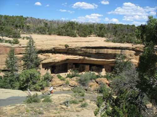
Spruce Tree House, Mesa Verde

Spruce Tree House, Mesa Verde

Although Chaco Canyon is one of the most important places in the United States where the remains of the impressive achievements of the prehistoric Anasazi people are preserved and open to the public, it is by no means the best-known or most popular.  Indeed, outside of the southwest Chaco is actually quite obscure.  I found this surprising when I first began to work there; having grown up in the southwest, I had sort of always known about Chaco.  Not in much detail, but it was always part of my understanding of the world.  It turns out, however, that people in other parts of the country, unless they’re particularly interested for some reason in southwestern archaeology, generally just haven’t ever heard of Chaco.
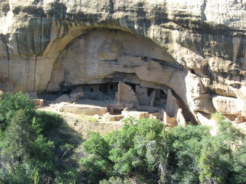
Oak Tree House, Mesa Verde

Oak Tree House, Mesa Verde

Not that they’re unaware of the Anasazi, of course.  But it’s not the Chaco Anasazi of the San Juan Basin that get the most public attention and tourist visitation.  Much better known are the cliff dwellings of Mesa Verde.  Indeed, for a lot of people “Anasazi” and “cliff dweller” seem to be basically synonymous.  We would get a lot of people at Chaco asking if there were any cliff dwellings there.  (The answer is no.)

Cliff Palace, Mesa Verde

Cliff Palace, Mesa Verde

Cliff dwellings are, indeed, quite spectacular, and it’s no surprise that they would attract much more attention than other settings.  They are not very practical places to live, however, and very few people even among the Anasazi ever lived in them.  The vast majority of cliff dwellings known in the southwest date to a very short period of time, roughly the last half of the thirteenth century AD, after which much of the Colorado Plateau, including Mesa Verde, seems to have been totally abandoned.  Throughout this period, even when the cliff dwellings were occupied, the vast majority of people in the region lived in other types of sites, generally large, aggregated villages.

Square Tower House, Mesa Verde

Square Tower House, Mesa Verde

So why do cliff dwellings get so much attention?  One reason is that they’re much better-preserved than open sites.  The shelter of the cliff alcoves in which they are located protects cliff dwellings remarkably well, so that when they are excavated they tend to yield an astonishing variety of well-preserved material, including perishable materials like wood, cloth, and feathers.  As a result, excavations of cliff dwellings have provided a huge amount of information about the daily life of their inhabitants.  Chacoan great houses, due to their large size and fine construction, tend to preserve material better than most open sites as well, but nowhere near as well as cliff dwellings do.
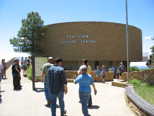
Far View Visitor Center, Mesa Verde

Far View Visitor Center, Mesa Verde

In addition, many of the cliff dwellings, especially at Mesa Verde, were very actively promoted as tourist destinations by local entrepreneurs and guides, especially the Wetherill family of Mancos, Colorado (which also played a key role in early excavations there and elsewhere, including at Chaco).  Their spectacular settings and amazing preservation make cliff dwellings interesting even to those who have little interest in archaeology in general, so it was easy to make Mesa Verde and other areas with cliff dwellings into major tourist attractions, especially if they were in relatively close proximity to towns.  Since Chaco had none of these advantages, it has languished in relative obscurity.

Mesa Verde from Durango, Colorado

Mesa Verde from Durango, Colorado

The fact that Mesa Verde gets so much attention now, however, shouldn’t obscure the fact that, except perhaps for a brief period in the thirteenth century, it was never a very important place in the region.  During the heyday of Chaco in the eleventh and early twelfth centuries Mesa Verde, while occupied at a fairly high level of population, was decidedly marginal compared to Chaco.  After the fall of Chaco it appears to have gained in prestige, and it may have been something of a local center for a while, but even at that time it’s likely that Aztec and other sites in the Totah region between Chaco and Mesa Verde were more important overall.

Far View Communities Sign, Mesa Verde

Far View Communities Sign, Mesa Verde

Considering this context, one obvious question arises: What, exactly, was the nature of the relationship between Chaco and Mesa Verde?  Visitors at Chaco, especially those who have just visited Mesa Verde (which is a lot of them), often ask this and related questions.  It’s rather confusing, because the information presented at Mesa Verde is very centered on Mesa Verde itself and doesn’t discuss much about the regional context, so people often get the sense that Mesa Verde was a lot more important than it actually seems to have been.  When they come to Chaco and see all this talk about how important Chaco was, they start to wonder how to reconcile the rather different stories they are getting at the two places.

Upper-Story Doorway at Far View House, Mesa Verde

Upper-Story Doorway at Far View House, Mesa Verde

So what was the relationship between the two?  The short answer is that no one knows.  This has been a very difficult topic to deal with in southwestern archaeology, especially since research on Chaco and research on Mesa Verde have generally been conducted by different people and institutions, with the resulting differences in focus and interpretation making it hard to combine the (voluminous) data on the two areas into a coherent whole.  Even recent attempts to synthesize data on the relationship have not been able to accomplish much.
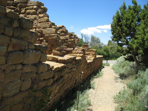
Back Wall of Far View House, Mesa Verde

Back Wall of Far View House, Mesa Verde

One of the odder aspects of the situation is that there is remarkably little evidence of Chacoan influence at Mesa Verde itself.  While there are Chacoan outliers all over southwestern Colorado, and some of them show considerable evidence of quite direct and substantial influence from Chaco itself, the only site at Mesa Verde that has been suggested as a possible outlier, Far View House, shows only a rather vague resemblance to Chacoan architectural styles.  While its layout is rather similar to a McElmo-style Chacoan site, and its masonry is sort of McElmo-like as well, it’s much cruder than at many other likely outliers in Colorado that are even further from Chaco, such as Escalante and Lowry to the north.  It certainly looks like Far View House was inspired by Chacoan ideas in some fashion, but it really doesn’t look like Chaco itself had much to do with it.  It looks more like a local imitation of Chacoan style, made by people who were aware of Chaco and its style but didn’t know much about the details of it.
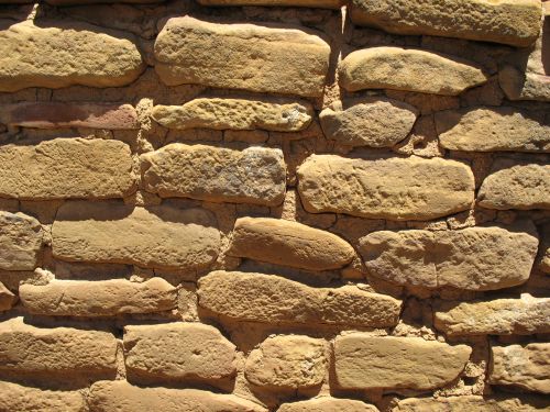
Masonry at Far View House, Mesa Verde

Masonry at Far View House, Mesa Verde

One of the really weird things about this is that, while Mesa Verde is rather distant from Chaco and correspondingly shows little Chacoan influence or evidence of having been incorporated into a Chacoan system of any kind, other sites further away, and in the same direction, show much more evidence of having been part of such a system.  While many of the furthest outliers, such as Edge of the Cedars, look like local imitations similar to Far View House, others, such as Lowry and Chimney Rock, are among the most clearly Chacoan-influenced outliers around, despite being among the most distant.

Masonry at Escalante Pueblo

Masonry at Escalante Pueblo

This suggests that if the Chacoan system was a reasonably well-integrated network with social or political aspects, its boundaries were quite complicated.  It apparently included the whole southern San Juan Basin as far north as the San Juan River, the whole middle and upper San Juan valley and the valleys of the major northern tributaries of the San Juan, and the Dolores River valley and Great Sage Plain further north, but not Mesa Verde, which lies right between the San Juan and the Great Sage Plain.

Masonry at Lowry Great House

Masonry at Lowry Great House

The implications of this are hard to understand, but one possibility is that the system was not, in fact, as well-integrated as it might seem at first glance, and that it may have been more a network of independent small polities loosely affiliated through adherence to a common social system or religious cult centered on Chaco.  This type of explanation has been pretty popular in Chacoan research over the past few years.  Another explanation, less popular these days, is that Chaco was a single integrated polity with far-flung and complicated boundaries, and that the people of Mesa Verde resisted its expansion and were never fully incorporated into it, so it expanded around them instead.  At this point it’s hard to say which of these is more plausible, and it’s quite possible that the real answer is something totally different from either.

McElmo-Style Masonry at Casa Chiquita

McElmo-Style Masonry at Casa Chiquita

One interesting sidenote is the odd and somewhat ambiguous evidence for continued Chacoan influence in Colorado even after the fall of Chaco itself.  Great houses, or structures that sort of resemble great houses, at least, continued to be built well into the 1200s in the Mesa Verde area, and it’s possible (though highly speculative) that part of the rise of Mesa Verde in the thirteenth century, to the extent that it did rise to regional prominence, was tied to a revival of Chacoan ideology symbolized by the construction of D-shaped structures with apparent ritual purposes.

Masonry at Spruce Tree House, Mesa Verde

Masonry at Spruce Tree House, Mesa Verde

The best known of these structures is probably the Sun Temple at Mesa Verde itself, which seems to be associated with Cliff Palace and which also seems to have some astronomical alignments.  Interestingly, the masonry at the Sun Temple looks a lot more Chacoan than anything at Far View House, despite the fact that the Sun Temple was built long after Chaco had faded into obscurity and the fact that other sites built at Mesa Verde at the same time, such as Cliff Palace and Spruce Tree House, have much cruder masonry.
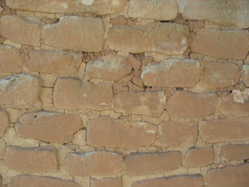
Masonry at the Sun Temple, Mesa Verde

Masonry at the Sun Temple, Mesa Verde

There are a lot of questions remaining about this issue, and much more research remains to be done, but there are some tantalizing hints that untangling the connections between Chaco and Mesa Verde may shed light on a whole slew of continuing mysteries about the prehistory of the southwest.  There’s enough there to keep archaeologists busy for a long, long time.

Pipe Shrine House with Far View House in Background, Mesa Verde

Pipe Shrine House with Far View House in Background, Mesa Verde

Read Full Post »

Speaking of Arizona

Arizona Welcome Sign

Arizona Welcome Sign

In addition to the editorial on behalf of funding to purchase private land within the expanded boundaries of Petrified Forest National Park, the Arizona Republic has another recent piece noting some tantalizing clues to an Arizona connection in the enormously complicated series of investigations into the illicit artifact trade.  In discussing the indictment of an antiquities dealer by authorities in Colorado a few days ago, I noted the intriguing lack of any reports of investigations in Arizona.  This news seems to suggest, as I had suspected, that authorities in Arizona have been active as well, but like their counterparts in New Mexico, and unlike those in Utah and Colorado, they have not yet moved to the point of indicting anyone.

Potholes Left by Looters at Homol'ovi Ruins State Park, Winslow, Arizona

Potholes Left by Looters at Homol'ovi Ruins State Park, Winslow, Arizona

The article states that “at least two prominent collectors have been subject to raids,” but the only person named specifically is one Ron Cipolla, an antiquities dealer in the Phoenix suburb of Fountain Hills.  Cipolla’s attorney confirmed a raid but declined to say anything more about the case.  The article mentions a raid on another collector, but it is only credited to vague “sources” and has no specifics.  It quotes Scottsdale dealer Walter Knox, who seems to get quoted a lot in articles on the cases, as saying that there have been at least two raids on Arizona dealers “with warrants involving tax-related issues”; it is not clear if these are connected to the investigations, and I’m hesitant about trusting Knox’s account of any of this, as definitely seems to have an axe to grind.

Old Trails Museum, Winslow, Arizona

Old Trails Museum, Winslow, Arizona

The article also mentions that Steven Shrader, a resident of Santa Fe, New Mexico who was included in the initial round of indictments in June and committed suicide soon afterward, had previously worked as a salesman for a roofing company in Mesa, Arizona.  Shrader, a key link in the web of connections between pothunters and dealers, seems to have drifted around a lot.  In addition to this earlier Arizona connection, he was listed in the indictments as a resident of Durango, Colorado but had apparently moved to Santa Fe by the time they were issued.

Mohave County Courthouse, Kingman, Arizona

Mohave County Courthouse, Kingman, Arizona

One interesting tidbit in the article is a statement by Beth Grindell of the Arizona State Museum in Tucson saying that some antiquities dealers have recently voluntarily donated collections, some of them “quite sizable,” to the museum, apparently in response to the investigations.  This suggests that the indictments, and the accompanying revelations about the extent of the investigations producing them, are having effects on the antiquities trade already.

National Bank of Arizona, Flagstaff, Arizona

National Bank of Arizona, Flagstaff, Arizona

There still isn’t a whole lot of information available about the Arizona connection, but this article suggests that there is some stuff going on there.  Stay tuned.

Bail Bonds, Flagstaff, Arizona

Bail Bonds, Flagstaff, Arizona

Read Full Post »

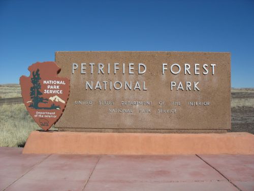
Entrance Sign at Petrified Forest National Park

Entrance Sign at Petrified Forest National Park

One thing people often don’t realize about national parks is that not all of the land within their boundaries is necessarily owned by the federal government.  The way the establishment of a new park, or the expansion of an existing one, works is that Congress passes a bill defining the boundaries of the park, and all of the land within those boundaries immediately becomes part of the park and is transferred to the National Park Service from whatever agency was managing it before (usually the Bureau of Land Management).  The establishment of National Monuments works the same way except that it’s done by the president through an executive order rather than by an act of Congress, and that the Park Service is not necessarily the agency given responsibility for the monument; sometimes the BLM retains the land and the responsibility for it, with only the nature of that responsibility changing, as in the recent cases of Grand Staircase-Escalante National Monument and Canyons of the Ancients National Monument.  In either case, however, any private land that happens to be within the park or monument boundary remains in private hands.  The establishment of a park or monument does not necessarily involve the acquisition of private land by the government.  It’s often more a matter of changing the rules under which land that is already public is to be managed.

Entrance Sign at Canyons of the Ancients National Monument

Entrance Sign at Canyons of the Ancients National Monument

The result of this process, if there is private land within the boundaries of the park being established, is often the creation of what are called “inholdings”: parcels of private land surrounded by protected park land.  This can become a real headache for the private landowners, though it isn’t necessarily, depending on the specific physical orientation of the parcels and the park’s policies regarding access.  Early on, before the creation of the Park Service in 1916, parks and monuments tended to exist more on paper than in reality, and the owners of inholdings were barely affected at all.  This was basically the case with the establishment of Chaco Canyon National Monument by President Theodore Roosevelt in 1907.  The establishment of the monument, in conjunction with the passage of the Antiquities Act in 1906, mostly meant that the government could prosecute anyone who excavated without permission on any of the federal parcels within the monument boundary, which in this particular case mostly meant that Richard Wetherill couldn’t continue to excavate at Pueblo Bonito, which was on federal land.  Since Chaco is in what is known as the Checkerboard Area, however, where the federal government had long before granted every other section to the Atlantic & Pacific Railroad, only half of the land within the boundary was federal, and the other half was private, with no restrictions on excavation beyond those imposed by the landowner.  Many of the major sites in the canyon were on the private parcels rather than the public ones, and some were partly outside the boundary entirely.  Most of the private land within the boundary eventually ended up in the hands of the University of New Mexico, which used it for field school excavations throughout the 193os and 1940s before ceding it to the Park Service with the stipulation that UNM would get preferential treatment in conducting research within the monument in the future.  This agreement was one of the background conditions of the Chaco Project when it was formed in the early 1970s.

Entrance Sign at Hovenweep National Monument

Entrance Sign at Hovenweep National Monument

After UNM gave its land to the Park Service, there remained very little private land within the monument boundaries, although there was still some land owned by the State of New Mexico and some Navajo allotment land.  Subsequent expansions of the boundaries, however, particularly in the early 1980s when Congress expanded the boundaries and changed the name of the monument to Chaco Culture National Historical Park, led to additional private, state, and allotment land within the expanded boundaries.  The park has since bought up or otherwise arranged to acquire most of this, but there are still a couple of inholdings left.

Plaque at Petrified Forest National Park Honoring Stephen Tyng Mather

Plaque at Petrified Forest National Park Honoring Stephen Tyng Mather

Another park that has recently expanded its boundaries is Petrified Forest, which more than doubled the amount of land within its boundaries in 2004.  While the BLM has already transferred its land within the expanded boundaries to the Park Service, the overwhelming majority of the land there is private.  (This is quite clear in the official park map.)  Several of the major landowners have been quite willing to sell their land to the park, but so far Congress has not yet appropriated the money to do so.  It appears that there is some momentum in that direction now, however, and a bill currently pending in the Senate includes a provision that would provide about a quarter of the total amount needed to buy all the land.  It’s not everything, but it’s a start, and the Arizona Republic has a nice editorial supporting the bill and explaining why this is important, with a focus on archaeological resources and reference to the recent pothunting investigations.  Although many of the private landowners have been supportive of efforts to preserve archaeological sites on their land, the resources they have available to do so are limited, especially if they don’t live on or near the land in question.  Petrified Forest is in a fairly isolated area where it isn’t too difficult for looters to sneak onto private land and dig, and while the landowners could prosecute the looters if they could catch them, catching them is just as difficult as it is on the vast swathes of public land elsewhere in the west.  While the Park Service has to grapple with this issue too, it has many more resources available to do so than the average private landowner, and hopefully the money will become available to allow it to take over responsibility.

Petrified Wood at Petrified Forest National Park

Petrified Wood at Petrified Forest National Park

Read Full Post »

Folsom Field at the University of Colorado at Boulder

Folsom Field at the University of Colorado at Boulder

On this day in 1927, workers excavating on behalf of the Colorado Museum of Natural History (now the Denver Museum of History and Science) at a site in northeastern New Mexico containing bones of an extinct species of prehistoric bison found, intact and in situ among the bison bones, a projectile point. The point, made of chert, was missing one corner but was otherwise complete. It was clearly of human manufacture, presumably by the prehistoric inhabitants of the area. Carl Schwachheim, a blacksmith from Raton, New Mexico who was supervising the excavations, immediately notified Jesse Figgins, the director of the museum, who sent telegrams to several geologists, paleontologists, and archaeologists inviting them to visit the site, which was about 20 miles southeast of Trinidad, Colorado and a few miles west of the small town of Folsom, New Mexico, after which it was named, to observe the point in person. In accordance with Figgins’s instructions, Schwachheim left the point unexcavated and kept a close eye on it to ensure that it remained undisturbed.

"Rush to the Rockies" Sign, Trinidad, Colorado

"Rush to the Rockies" Sign, Trinidad, Colorado

This was not the first artifact to be found in the course of the excavations. The previous summer, during the first season of excavation at the bone bed, the crew had found two broken points, but they were not in situ and there was no way to tell if or how they had originally related to the bones. The discovery, however, had prompted Figgins to instruct Schwachheim to watch carefully for artifacts or human remains and, if any were found, to leave them in place and let him know immediately. No in situ artifacts or remains were found during the course of the first season, and Figgins had given renewed instructions the beginning of the second season to watch out for artifacts and to leave them in place if found.

Statue of Ralphie the Buffalo at Folsom Field, Boulder, Colorado

Statue of Ralphie the Buffalo at Folsom Field, Boulder, Colorado

Schwachheim waited patiently for a few days after the discovery of the in situ point while Figgins contacted various researchers and arranged for them to visit the site. Barnum Brown, a paleontologist at the American Museum of Natural History in New York, happened to be in Denver at the time, and he agreed to accompany Figgins on a visit to the site. Brown could lend his expertise to analyzing the bison bones and the geology of the area, but to examine the artifact itself Figgins needed to find an archaeologist, preferably one with experience in the southwest.

Looking East toward the Great Plains from Las Vegas, New Mexico

Looking East toward the Great Plains from Las Vegas, New Mexico

Luckily for him, just about every southwestern archaeologist active at the time happened to be attending a conference at the ruins of Pecos Pueblo, which were being excavated by a crew from Phillips Andover Academy under the supervision of Alfred Vincent Kidder. This conference, which began on August 29 and continued until August 31, was the first Pecos Conference, a seminal event in the history of southwestern archaeology. Kidder organized it in order to bring together the various researchers active in the southwest at a time of quite extensive research. One of the main purposes of bringing all these scholars together was to develop a standard system of classification for the chronology of the prehistoric southwest, and the result was what is known as the Pecos Classification, which, with some modifications, is still in use today. Also still around today is the Pecos Conference itself, which is held annually at a different place in the southwest each year. The latest iteration, which I attended, was earlier this month in Cortez, Colorado.

First National Bank of Miracles, Trinidad, Colorado

First National Bank of Miracles, Trinidad, Colorado

Among the attendees at the original conference was Frank H. H. Roberts Jr. of the Smithsonian Institution‘s Bureau of American Ethnology, who agreed to accompany Figgins and Brown on a visit to the Folsom site. Roberts, a prominent figure in early southwestern archaeology, is known for his research and excavations at various sites in the area, including several in Chaco Canyon (most notably Shabik’eshchee Village). He, Figgins, and Brown arrived at Folsom on September 4 to examine the site and the point. Brown took some notes on the stratigraphy and geology of the site, and Roberts took a look at the point. He was sufficiently convinced of its association with the bison bones to decide that it was a discovery of considerable importance, and he returned with Kidder on September 8 to study the site some more. All of the researchers who examined the point concluded that it was contemporaneous with the bison bones.

Highway Construction, Trinidad, Colorado

Highway Construction, Trinidad, Colorado

This was a very big deal. The implications of it for American archaeology and understandings of prehistoric America were vast and unsettling to the scholarly orthodoxy of the time, which held that human occupation of the New World was quite recent, perhaps two thousand or so years old. Geologists and paleontologists, however, were well aware that the type of bison found at Folsom had gone extinct several thousand years ago, so the unambiguous association of human-made artifacts with the bison bones indicated that humans had been on the North American continent for much, much longer than the scholarly consensus held. Charles Mann has a good, accessible account of the importance of the discovery in his book 1491.

Bison Statue in Downtown Colorado Springs, Colorado

Bison Statue in Downtown Colorado Springs, Colorado

So how old is it? At the time, no one knew exactly. There were no techniques for direct dating of archaeological sites available in 1927. Andrew Douglas of the University of Arizona was working on tree-ring dating, which would be the first available chronometric technique, but at this point he had not yet completed the development of a master chronology against which specimens could be dated. He attended the Pecos Conference and presented on his work so far, which many could see had enormous potential that was not yet realizable. He encouraged his audience to gather samples from sites all over the southwest to submit to him in the hope that they would help fill in the gaps in the chronology so far. This would soon lead to success, and many sites throughout the southwest were nearly instantaneously dated with astonishing precision as early as the 1930s. In 1933 Harold Cook, curator of paleontology at the Colorado Museum, collected some samples of charcoal from near the Folsom site in the hopes of dating them by dendrochronology. This did not end up working, but the specimens were later dated by the newly developed radiocarbon technique, which determined that they were around 4,000 years old. This seemed surprisingly young, and it turned out that the charcoal was not associated with the site at all. Later radiocarbon dating of the bison bones themselves gave a rough date of about 8500 BC for the kill, which accords with radiocarbon dating of other Folsom culture sites. While we now know that human occupation of the western hemisphere goes back much further, this is still very old, and while only relative dating was available in 1927, it was apparent from the geological and paleontological context that a similarly ancient date was appropriate for the site.

Side Street in Trinidad, Colorado

Side Street in Trinidad, Colorado

Once the importance of the Folsom site had been determined, the American Museum of Natural History decided to join the Colorado Museum in excavating the following year. Over the course of the summer of 1928, the excavations, led by Peter Kaisen of the American Museum, covered a much larger area than had been dug during the previous two seasons, and test pits around the bone bed in various directions delimited its apparent extent. By August 29, exactly one year after the momentous discovery of the in situ point, Kaisen had decided that the excavations had covered the entire bed and were therefore complete. Over the three seasons of work, the crews had collected over 3,000 bison bones and at least 14 projectile points; more points were found in close association with the bones as they were unpacked and analyzed in the laboratory. Brown concluded that the bones represented at least 30 bison of all ages and both sexes, all killed at the same time, presumably by the people who made the points found with the bones and used them in the killing. The type of point was named the Folsom Point, and it served to define a whole cultural complex that would become better understood in the succeeding decades as more aspects of it were uncovered at a variety of sites throughout the Great Plains and adjacent areas of the Rocky Mountains.

Cheyenne Mountain, Colorado Springs, Colorado

Cheyenne Mountain, Colorado Springs, Colorado

As this work was going on elsewhere, however, the Folsom site itself languished. It was generally thought that the excavations in the 1920s had exhausted the site, and very little additional research was done until the 1990s, when a new research project led by David Meltzer of Southern Methodist University took another look at the site and did some more studies to try to map out its extent and see if there was more to it than the initial excavations had found. It turned out there was, and that the kill site covered more area than had been found in the 1920s. Additional excavations uncovered a significant number of additional bison bones, and geomorphological studies led to a better understanding of the geology of the site. Preliminary results were reported in a 2002 article by Meltzer, Lawrence Todd of Colorado State University, and Vance Holliday, then of the University of Wisconsin (now of the University of Arizona). This article not only documented the recent fieldwork at the site but also reported on archival research on the earlier excavations. It is the main source for the account I gave above.

Santa Fe Trail Highway Sign, Trinidad, Colorado

Santa Fe Trail Highway Sign, Trinidad, Colorado

The article contains much more information than I can summarize here, but it touches on a whole variety of interesting aspects of the Folsom type site. Among the most important are confirmation of the conclusions of the initial researchers that the site represents a single incident in which a group of mobile hunter-gatherers killed a herd of approximately 32 bison and performed some initial processing of the carcasses. The kill site does not appear to have been the location for more extensive processing, however, as the bone elements found there are primarily from low-utility parts of the carcass with little usable meat. This implies that the higher-utility parts were taken elsewhere for processing, probably to a temporary camp site nearby, but no such processing station or camp has yet been found. The authors speculate that there may well be one very close to the kill site, but since the site is deeply buried under later sediment, which kept the bones in a remarkable state of preservation, efforts to locate a campsite nearby have been totally unsuccessful. The kill site appears to be more extensive than first thought, however, and some parts of it apparently were not as well protected by later sediment, as some bones found nearby seem to have been moved by later erosion or redeposition. This implies that even if there was originally a campsite, it may no longer be present in any recognizable form.

Texas Welcome Sign

Texas Welcome Sign

There some other interesting things about the artifacts found at Folsom. Almost all are projectile points, most of which are broken. Only four other tools have been found, compared to at least 23 points, and two of those are now missing. This seems to confirm that the site, or at least the part known so far, is exclusively a kill site without any evidence of intensive processing or habitation. The points are made of high-quality stone from relatively distant locations, which the authors of the article attribute to direct procurement rather than trade for reasons they don’t explain. (They do cite an earlier publication by Meltzer that apparently lays out the case for this interpretation.) The main sources are in the Texas Panhandle to the southeast, including the Alibates Flint Quarries near Amarillo, and to the north near Colorado Springs and Sterling, Colorado. This implies that the group was highly mobile, and that they had frequent access to high-quality raw materials. There is also no evidence for intensive processing of the bison carcasses, such as cracking the bones for marrow, which suggests that they took only the best parts and were not under significant subsistence stress. This is typical of other Folsom-era sites, but is in striking contrast to the pattern at late prehistoric sites, including Pueblo ones, where processing was intense and nothing was wasted.

Pike's Peak, Colorado Springs, Colorado

Pike's Peak, Colorado Springs, Colorado

Basically, times were good for these people. Population density was likely very low, and there was plenty of everything to go around. There is often a tendency these days to consider hunter-gatherer adaptations as a “lower” level of subsistence than agriculture, but in terms of the everyday experience of average people, in many contexts a hunter-gatherer lifestyle works out just fine. If population gets too high or the environment deteriorates, however, things can change very fast. David Stuart’s Anasazi America, which gives an interpretation of developments in the southwest starting in Folsom times and continuing to the present day, is a good place to look for an account of how this works in practice.

Colorado Welcome Center, Trinidad, Colorado

Colorado Welcome Center, Trinidad, Colorado

I began reading about this in response to the recent news that a dealer in projectile points and other artifacts has been indicted as part of the recent series of investigations into the trade in illegally excavated antiquities, but I was immediately struck by how interesting and relevant the story of Folsom is in all sorts of ways, including the coincidental temporal connection to both the Pecos Conference at the time and the time when I was reading about it now. So I decided to write a bit about it in depth, even though it’s a little far afield from my usual domain.

"America the Beautiful" Monument, Colorado Springs, Colorado

"America the Beautiful" Monument, Colorado Springs, Colorado

Read Full Post »

Colorado Welcome Sign

Colorado Welcome Sign

It seems that authorities have indicted another suspect in the increasingly complicated series of investigations into the trade in illegal antiquities in the southwest.  Robert B. Knowlton of Grand Junction, Colorado has been charged with selling three artifacts illegally collected from public land to the undercover operative known as “the Source,” who apparently convinced him to mail the items to Utah from Colorado, which added a charge of interstate transportation of stolen property to the charges stemming from selling the items in the first place.

Four Corners Welcome Sign

Four Corners Welcome Sign

There doesn’t seem to be much information out yet about the circumstances behind this indictment, but there are a few interesting things about it.  For one, this is a new guy.  He wasn’t named in any of the prior charge.  His connection to the earlier cases seems pretty obvious, as the Source was the informant in those as well, but charges in those cases were heavily focused on people in and around Blanding, Utah with a few suspects from Durango, Colorado and Santa Fe, New Mexico involved as well.  In addition, this indictment was issued by a federal grand jury in Denver rather than the one in Salt Lake that issued the prior ones.  Some vague references in earlier articles on the investigation have suggested that authorities in each of the Four Corners states have been investigating separately, with the Source being the main link among the various cases, and Utah was just the first state to move to filing charges.  Subsequent revelations about searches of the homes of some artifact dealers in Santa Fe showed that New Mexico authorities have been active as well (although I don’t think they’ve filed any formal charges so far), and this indictment seems to show Colorado getting in on it too.  The lack of any Arizona connection so far is interesting, and it suggests that there may just be at least one more shoe left to drop here.

Westwater Cliff Dwelling, Utah

Westwater Cliff Dwelling, Utah

Also interesting is the nature of the artifacts Knowlton is accused of selling.  While one is a “cloud blower” pipe allegedly from the Big Westwater Site near Blanding, and thus part of the same late prehistoric Anasazi cultural tradition as most of the artifacts associated with the Blanding cases, the other two are Paleoindian lithics from a much earlier period: a Midland projectile point and a Hell Gap knife.  I don’t know very much about Paleoindian archaeology, so hearing about this indictment led me to look into this a bit.

Stone Tools at Chaco Visitor Center Museum

Stone Tools at Chaco Visitor Center Museum

It turns out that Midland points are very similar to the better-known Folsom points, dating to around 9000 BC, except that they aren’t fluted, and, indeed, in an interesting but rather short article from a while back George Agogino of Eastern New Mexico University (a major center for Paleoindian archaeology, due partly to its association with Blackwater Draw) questions if the “Midland complex” defined around this type of point is really anything more than a variant of the Folsom complex.  Henry Irwin and H. M. Wormington noted in a very useful article from around the same time on Paleoindian artifact assemblages that the sets of tools associated with the Midland and Folsom complexes are very similar.

Arrowheads at Chaco Visitor Center Museum

Arrowheads at Chaco Visitor Center Museum

As for the Hell Gap knife, Irwin and Wormington discuss it as well, noting that it is one of the few knife types to be associated with a specific cultural complex in the way that projectile points are.  This is, unsurprisingly, the Hell Gap complex, defined by the use of Hell Gap projectile points, which Agogino had named in an earlier article.  Although Irwin and Wormington don’t give any specific dates for the complexes they discuss beyond putting the Clovis complex around 9200 BC and the others between 9000 and 6000, Agogino gives a radiocarbon date of 8890 BC for the level in which he found the Hell Gap points, which he considers roughly contemporary with dates for Folsom levels at other sites.  (I don’t know how widely accepted these dates are nowadays, but I’m going to be looking into contemporary understandings of the Paleoindian period.)

Four Corners Monument

Four Corners Monument

One passage from Agogino’s Midland article stood out when I was reading it:

The Folsom point type is distinct, unique, and attractive, making it easy to recognize. Today, Folsom points are among the most sought after artifacts in private collections, and their relative scarcity has prompted speculators to sell prime specimens for considerable sums.

This case seems to show the truth of this statement even forty years later, although the specific artifacts Knowlton is accused of selling don’t fit the narrow definition of “Folsom points” against which Agogino is arguing.  Knowlton apparently told the Source that he bought the knife from a woman who found it near the airport in Moab, Utah and that he bought the point from a park ranger who found it near Telluride, Colorado after a fire.  One thing to note about these locations is that they’re a bit far afield geographically as well as temporally from the previous cases.  Although Moab isn’t too far from Canyonlands National Park, where some of the Blanding people were accused of digging, Telluride is a whole different geographical and cultural area.  In addition, although Knowlton lives in Grand Junction, the sale apparently took place in Fort Collins, Colorado, which is way on the other end of the state from any of the rest of this.

Map of Four Corners Monument Area

Map of Four Corners Monument Area

The Santa Fe branch of the investigation, although still rather murky, seems to have extended it both considerably to the southeast of Blanding and into the trade in items illicitly acquired from the modern Pueblos.  This Colorado indictment, on the other hand, is taking things in a very different direction: north, east, and very far backward in time.

T-Shirt Shed at Four Corners Monument

T-Shirt Shed at Four Corners Monument

Read Full Post »

Kiva A at Pueblo Bonito

Kiva A at Pueblo Bonito

When I was working at Chaco one of the frequent questions we would get from visitors was about the extent of reconstruction of the sites there.  This would be phrased in various ways, with the background assumptions ranging from the idea that the sites were totally untouched to the idea that they were totally reconstructed.  The truth, of course, lies somewhere in between, but much closer to the untouched end than many people seemed to think.

Walls at Pueblo Bonito Showing Capping

Walls at Pueblo Bonito Showing Capping

Compared to a lot of other parks, Chaco has taken a pretty hands-off approach to reconstruction.  Most of the modern construction you see today on the sites in the canyon is only what is necessary for stabilization, which in most cases means capping along the tops of all the walls, and in some cases rebuilding of things like doorways where they have begun to deteriorate.  There has also been substantial re-mortaring of the stonework, especially on the exposed exterior walls, but in those cases the original stones are generally left in place.  Other than those few things, pretty much everything you see is original, and the fact that it’s in such good shape is due to the quality of the original construction rather than to anything the Park Service has done.  The figure we would usually cite was 15% reconstruction, 85% original; I don’t know where those numbers come from, and I suspect they’re largely guesswork, but some visitors just really want numbers, so we gave them some.

Casa Rinconada, Looking North

Casa Rinconada, Looking North

There are a few exceptions.  On some of the buildings there has been a bit more reconstruction than is typical throughout the park.  The most extensively rebuilt structure is Casa Rinconada, which was excavated in the 1930s when reconstruction was at its height of popularity.  The walls of Casa Rinconada were in a substantially reduced state when it was excavated, with big breaches in them at regular intervals, which is typical of great kivas when they are first found.  Gordon Vivian, who excavated the site as part of a UNM field school, also supervised the reconstruction.  He seems to have done a pretty good job, but as always it took some guesswork to restore the parts that hadn’t survived, and some of the stuff at the upper levels of the site was probably never there originally.  There’s also no real way to know how far up the walls went, so the height of the walls that you see today is basically a guess too.

Secret Passage into Casa Rinconada

Secret Passage into Casa Rinconada

Pueblo Bonito and Chetro Ketl have also seen a bit more reconstruction than average, although nowhere near as much as Rinconada.  For one thing, their great kivas have also been restored in much the same manner as Rinconada, but less ambitiously, and the one at Chetro Ketl even shows some of the other floor and bench layers that were found when it was initially excavated.  Also, Neil Judd’s expedition in the 1920s repaired the many holes that had been punched in the back wall of Pueblo Bonito by pothunters in the late nineteenth century.  This work was done to erase that episode of Bonito’s history, so the masonry was intended to blend in seamlessly with the surrounding stonework, and it does.  It’s nearly impossible to tell where the original ends and where the reconstruction begins.  Judd’s group also did some restoring and stabilizing of the upper parts of the back wall.  Other than that, and the ubiquitous capping, Pueblo Bonito is basically unreconstructed.

Chetro Ketl from Above

Chetro Ketl from Above

Chetro Ketl was severely damaged by a flood in the late 1940s, and major parts of the north-central section along the back wall were basically totally rebuilt at that time.  Aside from that, however, there hasn’t been much reconstruction.  The other sites, whether excavated (e.g., Pueblo del Arroyo) or unexcavated (e.g., Hungo Pavi), have just been capped and shored up, without any additional rebuilding.

Plaza at Aztec West, Showing Reconstructed Great Kiva

Plaza at Aztec West, Showing Reconstructed Great Kiva

This is in contrast, of course, to many other parks in the southwest, where sites have been substantially rebuilt.  This work was done mostly in the 1930s, much of it by the CCC as part of the New Deal, and it therefore reflects understandings of the architecture as of that time.  The most spectacular example of rebuilding is probably the great kiva at Aztec, which was completely restored in the 1930s in accordance with somewhat speculative interpretations of its original condition made by Earl Morris when he excavated it a couple of decades earlier.  Like many other examples of rebuilding, however, the great kiva is now generally thought to be inaccurate in some respects, most notably the roof level, which is almost certainly much too high.

Reconstructed Great Kiva, Aztec Ruins National Monument

Reconstructed Great Kiva, Aztec Ruins National Monument

This is the big problem with rebuilding: if you rebuild something according to even the best understanding of the archaeology at the time you do it, but understandings of the archaeology then change (which is not an uncommon occurrence at all), you’re kind of stuck.  What can you do?  Tear down the earlier reconstruction and start over?  But what if the new interpretations get superseded in their turn?  Just tear down the reconstruction and leave the ruins in place?  That seems like an awful lot of wasted effort.  The usual solution in these cases is to leave the reconstruction in place and put up a sign explaining to visitors how it is now thought to be inaccurate.  Hardly the most elegant way to deal with the issue, but at that point options are limited.

Inaccurately Reconstructed Room at Agate House, Petrified Forest National Park

Inaccurately Reconstructed Room at Agate House, Petrified Forest National Park

Another problem comes when sites that have been heavily reconstructed are used for certain types of research.  It’s very important to ensure that the research is looking at the original, rather than the rebuilt, parts of the site.  I mentioned this problem recently in connection with archaeoastronomical research at Wupatki, which has been very substantially reconstructed.

Partially Reconstructed Wall at Spruce Tree House, Mesa Verde

Partially Reconstructed Wall at Spruce Tree House, Mesa Verde

As a result of these concerns, today substantial reconstruction is rare.  Excavated sites are generally preserved in place as they are, with interpretive signs and literature provided to explain how they may have looked like originally.  This is satisfactory for most visitors, but some want more obvious visual cues.  For them the parks that have lots of reconstruction, such as Aztec, Bandelier, Mesa Verde, Petrified Forest, and others, are preferable to parks like Chaco that have a lighter touch.  But so be it.  You can’t please everyone.

Casa Rinconada from Pueblo Bonito

Casa Rinconada from Pueblo Bonito

Read Full Post »

Durango Too

Main Avenue, Durango, Colorado

Main Avenue, Durango, Colorado

Via Paul Barford, I see that the BLM has confiscated an apparently huge collection of artifacts from Vern and Marie Crites, residents of Durango, Colorado who were charged in June with looting-related crimes along with a bunch of people from Blanding, Utah.  The Criteses seem to have handed the stuff over voluntarily, and while the spokeswoman for the prosecutor’s office quoted in the article insists that this doesn’t change the status of the prosecution, it seems pretty likely on the face of it that this indicates that negotiations for a plea deal are in the works.

Animas River, Durango, Colorado

Animas River, Durango, Colorado

While most of the coverage of these cases has focused on Blanding, where most of the suspects are from, the initial indictments included a few people from other places, including the Criteses, Steven Shrader, a friend of theirs who was listed as a resident of Durango but seems to have moved to Santa Fe at some point, Richard Raymond Bourret, also of Durango, and David Waite of Albuquerque.  Shrader committed suicide soon after the indictments came down.

Navajo Rug Advertising Toh Atin Gallery, Durango, Colorado

Navajo Rug Advertising Toh Atin Gallery, Durango, Colorado

As I mentioned recently when word got out that the investigation had reached some dealers in Santa Fe, Shrader seems like the key figure here in linking the Blanding cases, which mostly seem to be straightforward pothunting, with whatever is going on in Santa Fe, which is rather murky at this point.  Since the Criteses (and Bourret) appear to have been Shrader’s only close connections among the other suspects, and since the charges against them seem to be more similar to what the Blanding folks are accused of, it makes sense to see Durango as the crucial link between Blanding, where the stuff was being dug up, and Santa Fe, where it was being sold.  It’s interesting to note that the Criteses seem to be cooperating to some degree with authorities after the suicide of their friend, which is reminiscent of the way Dr. James Redd’s wife and daughter negotiated a plea deal after his suicide.

Strater Hotel, Durango, Colorado

Strater Hotel, Durango, Colorado

Meanwhile, antiquities dealers in Santa Fe seem to be pretty upset by all this.  It’s hard to blame them.  So far only a few dealers have been targeted by the investigation, but since the details of what exactly the feds are looking for are by no means clear, a much wider set of players in the market for antiquities could be at risk.

Durango & Silverton Narrow Gauge Railroad, Durango, Colorado

Durango & Silverton Narrow Gauge Railroad, Durango, Colorado

It’ll be interesting to see how this all turns out.  I have a feeling things are going to get a lot more complicated.

Jerky Safari Booth, Durango, Colorado

Jerky Safari Booth, Durango, Colorado

Read Full Post »

Fajada Butte with Green Vegetation

Fajada Butte with Green Vegetation

Archaeoastronomy has been a major research topic at Chaco Canyon for a long time, especially since the discovery of the “Sun Dagger” petroglyph atop Fajada Butte in 1977.  While the Sun Dagger is the best-known proposed astronomical marker in the canyon, many others have been suggested in the years since its discovery.  These have been accepted as valid by the archaeological community to varying degrees; the Sun Dagger is among the most widely accepted, but many others, particularly those identified by Anna Sofaer’s Solstice Project, have met with much more skepticism.

Wall Dividing East and West Plazas, Pueblo Bonito

Wall Dividing East and West Plazas, Pueblo Bonito

The root of much of this skepticism lies in a fundamental difficulty with archaeoastronomical research.  Basically, there’s usually no way to prove that a given alignment was intentional rather than coincidental.  If you draw enough lines something is bound to line up, so the risk of a proposed alignment being coincidental is always there, and there’s no sure way to demonstrate that coincidence is not the explanation, at least when dealing with prehistoric cultures lacking writing systems.  The main way these alignments become accepted, then, is by demonstration of various qualities of them that are unlikely to be coincidental.  These can include the precision of the alignment, as at the north-south and east-west walls at Pueblo Bonito, the way the alignment sheds light on other puzzling aspects of the site, as at Chimney Rock, or the combination of multiple alignments in a single marker, as at the Sun Dagger.  The more of these other lines of evidence for intentionality there are, the more likely it is that the alignment is intentional rather than coincidental, but coincidence can never be completely ruled out.

Plaque at Fajada Butte View Describing the "Sun Dagger" Petroglyph

Plaque at Fajada Butte View Describing the "Sun Dagger" Petroglyph

A good example of the role of coincidence in archaeoastronomy comes in a short article by Jonathan Reyman, one of the pioneers of archaeoastronomical research at Chaco and elsewhere, reporting on some research he did on an alignment at Wupatki that turned out to be completely coincidental and spurious.  While it is usually not possible to show that an alignment is definitely coincidental, much as it is impossible to show that it is definitely intentional, in this case it happened to be quite clear.

Wupatki Pueblo

Wupatki Pueblo

What happened was that Reyman and his crew arrived at Wupatki, intending to test the alignment of a window in the east wall of Room 44 at Wupatki Pueblo.  This room was unusual in several respects, which led Reyman to believe that it might have had astronomical functions.  It is high in the building, which afforded it good visibility, it has a t-shaped doorway in its south wall, it has a window in the east wall, which is very unusual at Wupatki, where there are few windows, and its floor is paved with flagstones, also very unusual.  In addition, Room 44 contained bins with unusual artifact assemblages found during excavation, and one of the bins had two macaw skeletons in it.  All of this made Room 44 a plausible candidate for a sunrise alignment marker of some sort, so Reyman and his team made arrangements to come to Wupatki in the summer of 1976 to do some measurements.

Wupatki Pueblo from the South, Showing T-Shaped Doorway into Room 44

Wupatki Pueblo from the South, Showing T-Shaped Doorway into Room 44

When they arrived at the monument, they looked through documentation on the site, which has been excavated and substantially rebuilt.  Unfortunately, most of the pertinent documentation was out on loan, so they couldn’t look through everything, but what they did have available seemed to show that Room 44 was in basically the same condition it had been in when it was excavated in 1933.  So they did their measurements and found that the window did indeed have alignments to the sunrises on the summer and winter solstices as well as on the equinoxes.  Success!

View of Wupatki Pueblo from the East, Showing Spurious Window in Room 44

View of Wupatki Pueblo from the East, Showing Spurious Window in Room 44

The very next day, however, the documentation that had been out on loan was returned to the monument, and when Reyman looked at it he realized that his results were totally spurious.  It turned out that Room 44 had been almost completely reconstructed in the 1930s.  When it was first excavated, only the northwest corner was still in place, and the rest of the walls had been reduced almost completely to the floor level.  After excavation, the Park Service decided to turn this part of the site into a ranger station and museum, so they rebuilt the walls entirely, added a door in the south wall and a window in the east wall, put on a roof, and paved the floor, which was originally clay, with flagstones.  Later, when a separate headquarters for the monument was built, the Park Service dissassembled some but not all of this reconstruction, including the roof and the upper parts of the walls, but left the paved floor and the window and doorway in place for some reason, and they remained in place when Reyman arrived in 1976.  Since it was very unlikely that the Park Service and the Museum of Northern Arizona, which did the reconstruction in the 1930s, intended to put in alignments to the solstice and equinox sunrises when they built the window in Room 44, Reyman was forced to conclude that it was all just a coincidence and that there was no evidence that Room 44 ever had any astronomical alignments (or, for that matter, any windows or doorways).

Wupatki National Monument Headquarters

Wupatki National Monument Headquarters

Despite the disappointing nature of this exercise, Reyman decided to publish his account of it anyway, as a cautionary tale for would-be archaeoastronomers.  Many of the prehistoric sites in the southwest, especially those managed by the National Park Service, have been substantially reconstructed, and it’s very important to check the documentation of that reconstruction before taking any measurements to make sure that there is actually something original there to measure.

Very Faint Spiral Petroglyph at Wupatki National Monument

Very Faint Spiral Petroglyph at Wupatki National Monument

Read Full Post »

Beyond Blanding

Sotheby's International Realty, Santa Fe, New Mexico

Sotheby's International Realty, Santa Fe, New Mexico

As several bloggers have recently noted, it appears that the investigation into looted antiquities that resulted in the arrests in Blanding, Utah in June extends well beyond Blanding.  While the Blanding cases have gotten the most attention, it’s important to note that not all of the people indicted in June were Blanding residents.  One, listed in the court papers as a resident of Durango, Colorado, but apparently actually a resident of Santa Fe, New Mexico, was one Steven Shrader, who seems to have been largely unknown in Blanding but who seems to have been at the core of another ring of dealers in illicit antiquities centered on Santa Fe.  Shrader was the one who introduced the undercover operative known as “the Source” to four dealers in Santa Fe whose houses were later searched by authorities.  Those searches resulted in the confiscation of a wide variety of goods.

Plaza, Santa Fe, New Mexico

Plaza, Santa Fe, New Mexico

Shrader committed suicide soon after being charged.  Interestingly, his home was not among those searched.  The charges against him seem to have revolved more around the trafficking than the possession of illegal antiquities.  The dealers whose houses were searched include one Tommy Cavaliere, who is described as being “of American Indian descent” and as having used his connections to procure items from various pueblos.  It would be very interesting to know which tribe(s) Cavaliere is associated with, as there is something a bit off about the way his role has been reported.  An article in the Salt Lake Tribune describes him as having gone into the pueblos and bought items from tribal members, but it later says that many of those items are “not items a tribal member would have been permitted to sell.”

Institute of American Indian Arts Museum, Santa Fe, New Mexico

Institute of American Indian Arts Museum, Santa Fe, New Mexico

So how did Cavaliere get this stuff?  Did he buy it from tribal members who were violating the law themselves?  Did he steal it, using his connections to gain access to the pueblos then taking things without the knowledge of the residents?  Or what?  Again, knowing who Cavaliere is and what his exact relationship was to the pueblos would be helpful here.  It’s interesting that the specific pueblos mentioned (Taos, Zia, Acoma, Santo Domingo, and Hopi) are all open to the public, although not unrestrictedly.

Palace of the Governors, Santa Fe, New Mexico

Palace of the Governors, Santa Fe, New Mexico

Another interesting aspect of these Santa Fe cases is that the stuff involved seems to be of a rather different nature from the artifacts in Blanding.  Probably because of Cavaliere’s involvement, the items are not all particularly old, and many seem to have perhaps been of recent manufacture and contemporary use.  This isn’t that surprising, since the Santa Fe area is known more for contemporary Indian art than for artifacts, but it suggests that the laws at play in the investigation are different.  The dealers interviewed by the reporters who have written about the Santa Fe cases seem to think that this is related to NAGPRA and a new interpretation of it by the Obama administration, which is trying to expand the reach of the law to private collections as well as federally funded museums.  NAGPRA is involved in the Blanding cases as well, of course, but there the Archaeological Resources Protection Act is of at least equal importance.  In Santa Fe, the crimes seem to be not so much about pothunting as about a network of illegal dealings in tribal paraphernalia acquired through various sources.

Lensic Theater, Santa Fe, New Mexico

Lensic Theater, Santa Fe, New Mexico

The Santa Fe investigations, then, seem to be looking at something rather different from the direct looting involved in the Blanding cases.  The connection between the two is Shrader, who was apparently involved in both circles, presumably through his connections in both Durango and Santa Fe.  This sheds some light on why he might have taken his own life when the hammer came down.  Unfortunately, since he is gone, any information he might have given on the nature of these networks is gone as well.

IronStone Bank, Santa Fe, New Mexico

IronStone Bank, Santa Fe, New Mexico

Read Full Post »

Kloor Interviews Hurst

"SJ" (Presumably Standing for "San Juan") on Hill above Blanding, Utah

"SJ" (Presumably Standing for "San Juan") on Hill above Blanding, Utah

Keith Kloor links to an interview he did recently with Winston Hurst, the local archaeologist in Blanding, Utah.  Hurst is in a difficult and unenviable situation with the recent pothunting arrests in Blanding, and he has an interesting and nuanced, if somewhat frustrated, perspective on the arrests and the issue in general.  He was at the Pecos Conference, where he received some sort of award.  He seemed rather somber.  I don’t have much to add, but the interview is short, interesting, and definitely worth a read.

Public Safety Building, Blanding, Utah

Public Safety Building, Blanding, Utah

Read Full Post »

Older Posts »