Feeds:
Posts
Comments

Archive for the ‘Chipped Stone’ Category

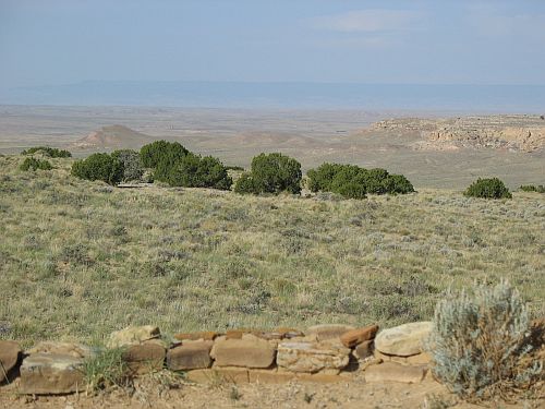
Mt. Taylor from Chaco

As I’ve discussed before, the patterns of use and importation of chipped stone at Chaco are somewhat puzzling. Unlike many other commodities, such as wood, corn, and pottery, which were imported from specific distant locations within the Chacoan sphere of influence in astonishing quantities during the height of Chaco’s regional power, chipped stone seems to have been largely a mundane, utilitarian concern. Throughout all periods of Chaco’s occupation most chipped stone was local. At Chaco’s peak of power and influence between AD 1020 and 1130 there was a slight uptick in imports of stone, particularly a distinctive pink chert from the Narbona Pass area to the west.

As I noted in the earlier post, however, obsidian follows a different pattern from the other imported stones. It is most common not at the height of Chaco’s regional power in the eleventh century but much earlier, in the Basketmaker III period between AD 500 and 750, when it is the most common nonlocal type of chipped stone. This was a time when Chaco may have seen an earlier period of regional importance, although figuring out what was going on at this time is very difficult for several reasons. By the Pueblo I period the amount of obsidian seems to drop precipitously, and it doesn’t start to recover until the very end of Chaco’s period of Pueblo occupation after AD 1120. This pattern puts obsidian decidedly out of phase with most other material culture imports to the canyon, which tend to correlate with the well-known evidence for social complexity and monumental architecture that we associate with the Chaco Phenomenon.

A recent paper by Andrew Duff, Jeremy Moss, Tom Windes, John Kantner, and Steven Shackley tries to put the obsidian evidence on a firmer footing by using geochemical sourcing to identify the source outcrops for a broad sample of obsidian found at Chaco and at various Chacoan outlier communities in the San Juan Basin. As they note, this is the latest chapter in a complicated story. Way back in the 1980s, the Chaco Project did an extensive sourcing study of obsidian found in its excavations in the canyon using X-ray fluorescence (XRF), a non-destructive sourcing technique that was then relatively new in archaeology. Their results, reported by Cathy Cameron in a number of publications, were surprising. They seemed to show that the closest source of obsidian, Mt. Taylor, provided very little of the obsidian found at Chaco (about 4%), while a distant source, Red Hill in Catron County, New Mexico, provided a very high proportion, especially in the assemblages from earlier sites. Also well-represented was obsidian from the Jemez Mountains, the second-closest source, with the proportion of Jemez obsidian increasing over time, a common pattern in the northern Southwest.

This seemed to indicate that there were substantial early ties between Chaco and the Red Hill area, far to the south but still just barely adjacent to some known Chacoan outliers. This result was mentioned in many publications on Chaco over the years, although many people didn’t really seem to know what to think of it. However, it soon began to be questioned. After this initial sourcing study had been done, Tom Windes submitted some samples of obsidian from Pueblo Alto and the Spadefoot Toad site for obsidian hydration dating, which involved a sourcing analysis as an intermediate step in the dating process. These analyses were inconclusive when it came to dating the artifacts (not uncommon in the Southwest, where obsidian hydration has a poor record as a dating technique), but the sourcing portion suggested strongly that the samples that had previously been sourced to Red Hill instead came from Mt. Taylor. Windes mentioned this anomaly in his site reports, as did Cameron in her subsequent publications on the subject, but a full published account didn’t appear until this new study.

The new study also used XRF to do the sourcing analysis, but both analytical techniques and source characterizations have improved considerably since the 1980s, so the results were quite different from the first effort. For some reason this study was unable to do a complete reanalysis of the earlier samples (although it implies that this may be possible in the future), so there was only limited overlap and the focus was mostly on recent samples collected by Windes at Basketmaker III and Pueblo I site in and around Chaco, as well as outlier sites studied by Kantner in the Red Mesa Valley near Mt. Taylor and by Duff at the southern edge of the Colorado Plateau near Red Hill.

The results were not really surprising, in that they have been known in broad outline since Windes submitted his samples for dating and reported on the sourcing anomalies, but it’s nice to see them formalized in a peer-reviewed paper. Basically, this study found that no samples from Chaco came from Red Hill, although a few came from other sources in the same general area, and that the most common source found at Chaco was Mt. Taylor. Over time there was a trend in the Chaco data showing a shift from Mt. Taylor to Jemez sources, accompanied by the well-known trend toward less obsidian in assemblages overall. The sample from the Blue J site near Mt. Taylor, in contrast, showed high proportions of Mt. Taylor obsidian increasing over time, in marked contrast to the Chaco pattern. The southern sites showed assemblages of obsidian almost entirely composed of Red Hill and other nearby sources.

Basically, the overall pattern was a classic distance-decay distribution, where the prevalence of a given source at a given site was mostly predictable by the distance between the source and the site. This is in sharp contrast to the pattern for many other imported goods at Chaco, which are present in high quantities in the source areas and at Chaco but not in between. This suggests strongly that obsidian was not part of any general Chacoan exchange system(s) but was procured by individual communities in accordance with their own needs, mostly using the closest sources. This is in keeping with the general tendency for chipped stone to be a relatively low-priority commodity in these societies.

The paper mentions the decline in overall abundance of obsidian after the Basketmaker III period at Chaco, but doesn’t spend much time discussing it beyond saying this:

The overall decrease in obsidian use noted at Chaco sites may reflect a shift in technological focus away from hunting and a subsequent focus on grinding technology as agriculture becomes the dominant subsistence strategy.

As I’ve noted before, this is almost certainly wrong; the decrease in question occurs at the end of the Basketmaker III period, at which time there is considerable evidence that Southwestern populations were already heavily dependent on agriculture. The decrease in obsidian is still odd, though. One thought I’ve had to explain it is that maybe the obsidian from after this period isn’t actually missing at all, but is at Pueblo Bonito, which had lots of obsidian but was excavated a long time ago using techniques that aren’t really comparable to the modern techniques used by the Chaco Project and later efforts that resulted in the collections being analyzed here. I would suggest that an XRF sourcing analysis of the Bonito obsidian would be interesting. As it is, there’s a huge shift in the proportions of the different sources at Chaco between Basketmaker III and Pueblo I. The earlier samples (dominated by the huge samples from the major villages of Shabik’eschee and 29SJ423) show a predominance of Mt. Taylor obsidian, while the later ones show mostly Jemez sources. The sample size is so much smaller for the later period, however, that I’m skeptical about taking this flip at face value. Including the Bonito assemblage might help to bridge this gap, or at least explain it.

Finally, it’s again noteworthy how unimportant obsidian appears to have been to the Chaco system. Even if the Pueblo Bonito evidence ends up indicating a more important role at Chaco itself, the various outlier communities appear to have used local sources and to have followed their own priorities in acquiring this commodity rather than getting it through any Chaco-controlled or -oriented system. This is one of the ways that Chaco appears to diverge from Mesoamerican societies, despite recent evidence that it may have had more contact with them than was previously believed. Obsidian was hugely important symbolically in Mexico, and control of major sources was a major source of power and wealth for various Mesoamerican polities. In the Southwest, however, nobody seems to have cared that much about controlling major obsidian sources, and obsidian seems to have been distributed as a fairly ordinary commodity without any particular symbolic importance. I think this is one of the strongest pieces of evidence suggesting that whatever influence Mesoamerican societies may have had on Chaco was indirect and mediated by Chacoan elites rather than imposed directly from Mexico, as some have argued.

In any case, while this isn’t really the most exciting paper, it’s still an important one in straightening out a part of Chacoan archaeology that had become pretty confused. Obsidian may not have been all that important at Chaco, but it’s still worth studying in part precisely because of its mundanity.
ResearchBlogging.org
Duff, Andrew I., Moss, Jeremy M., Windes, Thomas C., Kantner, John, & Shackley, M. Steven (2012). Patterning in procurement of obsidian in Chaco Canyon and in Chaco-era communities in New Mexico as revealed by X-ray fluorescence Journal of Archaeological Science, 39 (9), 2995-3007 DOI: 10.1016/j.jas.2012.04.032

Read Full Post »

How Far West? Plaza, Beaver Creek, Yukon Territory

On this date in 1942, US Army engineering crews working east from Delta Junction, Alaska and west from Whitehorse, Yukon met up near Beaver Creek, Yukon, completing the Alaska Highway.  For the first time, Alaska was accessible from the Lower 48 by road.  This was a remarkable achievement, especially since it was done in only a few months; construction had begun in March and accelerated in June when the Japanese invaded the Aleutian Islands, making the need for a military route to Alaska seem more pressing.  Also noteworthy about the construction effort was that about a third of the soldiers who worked on the project were black, and their impressive accomplishments apparently played a role in the total integration of the military a few years later.

Two years after the highway was completed, while it was still under US Army control, Frederick Johnson of the Peabody Foundation (now the Peabody Museum of Archaeology at Phillips Andover) conducted an archaeological survey along the route as part of a multidisciplinary expedition that had begun the year before with biological and geological studies.  Johnson published a short article in 1946 describing the survey and illustrating some of the artifacts found.  The main importance of this (apparently largely forgotten) article was just to preliminarily describe the archaeology of a large region that, because it had been so difficult to get to before the construction of the highway, was almost completely unknown.  Johnson says as much in the article, while also noting the theoretical importance of gaining an understanding of this region because of its potential role in the peopling of the New World as a migration corridor.  He doesn’t press the latter point, however, and it’s pretty clear that the artifacts he describes are much too recent to have had anything to do with the initial migrations into North America (although there’s no way he could have known this at the time and he doesn’t say anything about it).

White River, Yukon Territory

The presence of geologists in the group was useful for Johnson’s purposes, as it meant that the stratigraphy of the sites he excavated could be evaluated with an expert eye.  Most or all of the artifacts from the sites he discusses in detail, and perhaps of all the sites he found, came from what appeared to be a single layer of reddish-brown soil under a layer of volcanic ash over five inches thick in some places but much thinner in others and apparently absent entirely in some.  This ash is presumably the so-called White River Ash from the eruption(s) of Mt. Churchill, which is in this general area; these eruptions may have been pretty important in the prehistory of this region and beyond.  The artifacts therefore predate the eruption(s), but not necessarily by very long.

The artifacts themselves, all of stone and almost all chipped rather than ground, consist of projectile points, scrapers, gravers, and a variety of miscellaneous forms.  Johnson notes that the assemblages from all the excavated sites are quite similar, which is noteworthy because the area covered was so large.  This implies they probably date to about the same period (as does the similar geology of the strata in which they were found) and may have been made by people from the same cultural tradition.  The sites themselves all appear to represent the same kind of occupation, which Johnson terms a “workshop” where stone tools were made or repaired.  Only one site had a firepit, and none had anything suggesting the presence of structures.  Beyond that there isn’t much Johnson can say, since the state of knowledge of subarctic prehistory was so rudimentary at the time and the area he was discussing had essentially no prior information at all.

Kluane Lake, Yukon Territory

As it happens, the part of the Alaska Highway I drove on my way up to Anchorage is near some of the sites Johnson mentions, many of which are in the Kluane Lake area of the southwest Yukon.  It was interesting to see placenames I recognized in this article.  I’ve been reading quite a bit about Alaska archaeology recently, and it’s really quite fascinating.  I’m not sure quite where Johnson’s findings fit into the overall picture, since his article seems to be virtually forgotten by now and recent work basically never cites it.  His pictures of artifacts are probably good enough to tell where they would fall in currently understood culture sequences, however, and I have an idea of where that might be but I’ll have to look into it a bit more before discussing it further.  I’m still not sure if this blog will be the best venue for discussing Alaska stuff, but it’s what I’ve got for now and I figured I should mark the occasion of the highway’s anniversary by talking a bit about its much deeper past.
ResearchBlogging.org
Johnson, F. (1946). An Archaeological Survey along the Alaska Highway, 1944 American Antiquity, 11 (3) DOI: 10.2307/275560

Read Full Post »

Stone Tools at Chaco Visitor Center Museum

When it comes to stone tools, archaeologists make a basic distinction between “chipped-stone” and “ground-stone” tools.  Chipped-stone tools are generally those that need to be sharp, such as projectile points, knives, scrapers, and drills, and are typically made of hard stone that keeps an edge.  Some ground-stone tools, such as axes, are also sharp, but for the most part ground-stone tools rely on other qualities of stone for purposes like hammering and grinding.  In the Southwest, ground-stone tools are usually made of sandstone, basalt, or other types of stone that are plentiful in the area immediately around a site.  These tools are heavy, and it generally wouldn’t have made any sense to import special types of stone to make them when, as is the case throughout the Southwest, there were plenty of rocks around.  The types of stone used for ground-stone tools are also generally those used for masonry in areas where masonry construction was typical, including at Chaco, where sandstone was the usual material.

Chipped-stone tools are a different story.  They are usually small and highly portable, and the best materials to make them are often scattered and not convenient for every habitation site.  Thus, widespread trade in chipping stone has very early origins.  Hunter-gatherers need very good stone for their projectile points, and also tend to be very mobile, so their chipped-stone tools tend to be very well-made and to be made of high-quality material from a wide variety of sources.  Settled agriculturalists such as the Chacoans don’t rely so heavily on chipped-stone tools for their subsistence needs (ground-stone tools like metates are much more important), and they typically put much less effort into both procuring stone for chipped-stone tools and making the tools themselves.

Flake of Narbona Pass Chert at Pueblo Alto

When it comes to Chaco specifically, chipped-stone shows a much more muted form of the pattern of massive imports of other goods such as pottery, wood, turquoise, and even foodCathy Cameron summarizes the patterns revealed by the chipped-stone assemblages from Chaco Project excavations in the 1970s in an article from 2001.  The basic pattern is that most chipped stone was from local sources throughout the occupation of Chaco, although “local” really refers to a wider area here than the canyon itself.  Good chipping stone is not plentiful in the canyon itself, but abundant sources of good chert and petrified wood occur a few miles to the north and would have been easily accessible to canyon residents in the course of their daily lives (i.e., special trips to gather stone would probably not have been necessary).  These local sources always dominate assemblages from Chaco.  Imported stone types do increase during the Chaco era from AD 1030 to 1130, especially at great houses such as Pueblo Alto.  The most abundant import at this time is Narbona Pass chert, a distinctive pinkish type of stone that comes from a very restricted area in the Chuska Mountains to the west.  The Chuskas are also the source of many other imports to Chaco, including huge amounts of pottery and wood, but the relative proportions of Narbona Pass chert in the overall chipped-stone assemblages are much more modest.  It comprises 21.1% of the total Chaco Project sample for AD 1020 to 1120 and 18.9% of the sample for AD 1120 to 1220.  This is much higher than any other type of imported stone ever reaches, and even higher than any single type of local stone for these periods (though much lower than the total proportion of local stone).

Other imported materials found in notable numbers include Brushy Basin chert from the Four Corners area, a type of yellow-brown spotted chert and a special type of petrified wood, both from the Zuni area, and obsidian.  Brushy Basin chert (along with other materials from the same formation) and Zuni petrified wood reach relatively high proportions of the overall assemblage at the same time that Narbona Pass chert does, and Zuni chert does too but at a much lower level.  The pattern of obsidian is different, and hard to understand.  It’s the most common exotic type of stone before AD 920, rising to as high as 7.6% of the assemblage in the seventh century.  Sourcing studies seem to show that most of the obsidian coming it at this point came from the area around Grants, New Mexico, near Mount Taylor, during this period.  Once the Chaco system really gets going, though, the proportion of obsidian plummets to less than 1%.  From 1120 on, however, it rises again, comprising 7.3% from 1120 to 1220 and 2% after 1220, still less than Narbona Pass chert but respectable.  This obsidian seems to come mostly or entirely from sources in the Jemez Mountains to the east of Chaco.

Log of Petrified Wood at Chaco

So what were the Chacoans doing with this imported stone?  Not much, as it turns out.  One of the oddest things about the amount of Narbona Pass chert, particularly, is that it doesn’t appear to have been used for anything special.  Like all other types of stone, both local and imported, it was used primarily for expedient, informal tools.  The Chaco Project found 2,991 pieces of Narbona Pass chert, and only 18 of these were formal tools.  This pattern is typical for most material types, though obsidian seems to have been more often used for formal tools, many of which were probably imported as finished tools rather than made in the canyon.  Of the formal tools the Chaco Project did find, of all materials, about half were projectile points, and the rest were various types of knives, scrapers, and drills.

So what’s going on here?  Hard to say.  Cameron evaluates the chipped-stone data in the context of the models for the organization of production proposed by other participants in the conference from which this paper originated, and she decides that Colin Renfrew’s pilgrimage model fits best, with some adjustments.  This conclusion is driven largely by the fact that so much of the Narbona Pass chert came from the Pueblo Alto trash mound and the idea that this indicates that it was deposited there as part of communal rituals.  I find claims like this dubious, and I think it’s more likely that people in Chaco were just importing this type of stone either because it is so visually striking or because of their strong social connections to Chuskan communities (or both).

Chuska Mountains from Tsin Kletzin

The thing I find most puzzling is the obsidian.  Obsidian was hugely important in Mesoamerica, and in view of the appropriation and importation of many aspects of Mesoamerican culture by the Chacoans, most recently dramatized with evidence for chocolate consumption, it seems very odd that the rise of the Chacoan system would coincide with a steep decline in the amount of obsidian imported.  This is particularly odd since the Grants area was very much a part of the Chaco world, and there were numerous outlying great houses and communities near Mt. Taylor.  If the Chacoans had wanted obsidian, they could easily have gotten it.  And yet, it seems they didn’t.

Or did they?  Keep in mind that this data is based mostly on Chaco Project excavations, although Cameron does incorporate some insights from a study of formal chipped-stone tools done by Steve Lekson that incorporated other data as well.  Lekson’s study noted that Pueblo Bonito in particular had an astonishing number of projectile points relative to most other sites, and I can’t help but wonder if part of the lack of obsidian at other sites was a result of more of it flowing to Bonito.  The excavations at Bonito were done a long time ago without the careful techniques of the Chaco Project, so the data isn’t totally comparable, but I’m going to look at the artifact records from Bonito (conveniently made available at the Chaco Archive) to see how common obsidian was there.

Arrowheads at Chaco Visitor Center Museum

Speaking of projectile points, another thing Cameron mentions is that many of them seem to have been imported to Chaco, some of them apparently embedded in meat.  Others were particularly finely made and left in burials and caches, suggesting that they may have been specially made for votive purposes.  That’s probably the case for many of the points Lekson identified as being particularly numerous at Bonito, but what I want to know is why arrowheads were such common grave goods and offerings there.  Was there a particular association between Chaco and hunting?  The great house residents do seem to have eaten a lot more meat than other people in the canyon and elsewhere.

On the other hand, arrows weren’t only used for hunting.  Cameron notes that one projectile point found by Neil Judd at Pueblo Bonito was embedded in a human vertebra, and the Chaco Project also found a woman at the small site 29SJ1360 near Fajada Butte who had two points inside her.  We often talk about how peaceful Chaco was and how little evidence there is for warfare during the Chacoan era, but I’m starting to wonder about that.  It’s certainly true that Chaco itself and most other sites occupied during its florescence show less obvious evidence for violence than sites afterward do, but there are still some signs that things may not have been totally peaceful throughout the Southwest in Chacoan times.  Arrowheads in vertebrae don’t get there on their own, after all.  Who shot those arrows?
ResearchBlogging.org
Cameron, C. (2001). Pink Chert, Projectile Points, and the Chacoan Regional System American Antiquity, 66 (1) DOI: 10.2307/2694319

Read Full Post »

Trash Mound from Pueblo Alto

Many recent interpretations of Chaco Canyon see it as a site of pilgrimage, and this is often specifically seen as taking the form of regular region-wide ritual events involving communal feasting, construction work on the massive buildings in the canyon, trade involving various mundane and exotic items, and ritual breakage of pottery and deposition of it in the mounds accompanying most great houses.  This idea, which has been incorporated into a wide range of models of Chacoan society both hierarchical and egalitarian (although it is especially important to egalitarian models), is heavily dependent on data gathered in the excavation of Pueblo Alto by the Chaco Project in the 1970s.  In addition to excavating about 10% of the great house itself, Project personnel excavated a trench and several stratigraphic columns in the large trash mound to the southeast.  What they found was a series of well-defined layers.  Some of these, toward the bottom, seemed to consist mostly of construction debris, and others, toward the top, consisted mostly of windblown sand and redeposited artifacts, but the ones in between seemed to show a pattern of large, well-defined deposits.  This was interpreted as being quite different from the expected pattern from the regular deposition of domestic trash from a residential site, and the theory developed, particularly by Wolky Toll, explained it as the result of occasional massive depositional events in which large amounts of pottery and other artifacts were deposited all at once.  Toll estimated that the number of layers approximately matched the number of years during which Pueblo Alto was occupied, and that they therefore accumulated as the result of annual events in which numerous people came from throughout the region to attend events at Pueblo Alto (and presumably at other great houses too).  As part of these events, pilgrims would probably have brought offerings of items from their home areas, thus explaining the huge amount of imported goods at Chaco as well as the lack of apparent exports.  These items would have included mundane items like wood, corn, and pottery, as well as more exotic things like turquoise and Narbona Pass chert.  People may have also worked on constructing the great houses as part of some sort of ritual offering of labor, which would explain the massive scale of these buildings despite the small permanent population of the canyon itself.  While there is a certain amount of evidence for residential use at Pueblo Alto and other great houses, it indicates a pretty small population relative to the size of the buildings, and Toll’s model interprets this as a small “caretaker” population of what were primarily non-residential, public structures with large plazas that could serve as the sites of ritual feasting and other activities during these festivals.

Furthermore, the composition of the artifact assemblage found during the excavations of the Pueblo Alto mound seemed to offer an interesting possibility for another ritual activity.  Basically, there was a huge amount of pottery in it, especially gray utility ware, much of it imported from the Chuska Mountains to the west.  Based on the number of rim sherds in the excavated portion and an estimate of the size of the whole mound, Toll calculated that 150,000 vessels were used during the 60-year period (AD 1040 to 1100) during which Gallup Black-on-white was the predominant decorated type, a period that roughly corresponds to the height of the Chaco system.  This works out to 2500 vessels a year, or 125 for each of the 20 households estimated to have lived at Pueblo Alto at any one time.  This is a huge number compared to ethnographically documented rates of pottery usage and breakage or ratios seen at small sites, and to Toll it suggested that the pottery deposited in the mound was probably not broken in the course of everyday life at Pueblo Alto but was instead broken deliberately in rituals associated with the annual pilgrimage fairs.  Ritual breakage and deposition of pottery is a known Pueblo practice, but this would be on a scale not seen at any other known site.  Nevertheless, this is the model of the formation of the Pueblo Alto mound that has been widely accepted and incorporated into a wide variety of interpretations of the Chaco system that differ wildly in many respects but all have some sort of pilgrimage function for the canyon as part of its regional role.  It’s important to note that this is the only direct evidence for a pilgrimage function known from excavations at Chaco.

Niche at Pueblo Alto

I think it’s pretty plausible that pilgrimage and communal feasting took place at Chaco, but I’ve increasingly come to think that the evidence from the Pueblo Alto mound is extremely weak.  There are a few different reasons I don’t buy it, and a couple of the most important ones are well illustrated by two articles published in American Antiquity in 2001.

One of these, by Toll himself, is part of the same special issue on the organization of production at Chaco that included Colin Renfrew‘s model of Chaco as a “Location of High Devotional Expression” or pilgrimage center.  Toll likes this idea, obviously, and his article, in addition to summarizing the known data on the production and use of pottery at Chaco, attempts to take a closer look at the Alto data to evaluate Renfrew’s model.  This basically involves looking at each of the “event layers” (as distinguished from the construction and post-occupational layers) and calculating the proportions of local and non-local ceramics and lithics (as well as the different types of pottery forms and wares) in each.  These were then compared to the proportions in the mound as a whole, other Chaco Project excavations dating from the same period, and excavations dating earlier and later.  If Renfrew’s theory works, the event layers should show higher proportions of imported ceramics and lithics, as well as possibly higher proportions of ceramic types likely to have been used in feasting, compared to these other data sets.

Flake of Narbona Pass Chert with Ant at Pueblo Alto

Toll does his best to spin the results to be consistent with Renfrew’s model, but looking at the actual numbers in his tables, there’s just nothing there.  The event layers are virtually identical to the whole mound, which isn’t really surprising given that they comprise a large portion of it, and both are very similar to contemporary non-mound contexts in most ways.  Earlier and later contexts are different in interesting ways, but that’s neither here nor there in terms of evaluating Renfrew’s model.  Chuska ceramics are a case in point: they comprise 33.4% of the event layers, 30.8% of the whole mound, and 33.1% of the contemporary non-mound contexts.  That doesn’t look like a meaningful difference to me.  In the cases where the mound layers do differ from other contemporary contexts, they generally have fewer exotic materials.  For example ceramics from the Red Mesa Valley comprise 3.3% of the event layers, 3.8% of the whole mound, and 4.6% of the contemporary non-mound contexts.  The presence of Narbona Pass chert is something of an exception, with the proportions for the event layers, the whole mound, and other contemporary contexts being 26.1%, 26.4%, and 19.5% respectively, but stone from the Zuni Mountains has proportions of 2.2%, 2.4%, and 10.9% (!) respectively, which suggests that there’s just no pattern here in which the event layers or the mound as a whole contain higher proportions of imported material.  Basically, Chaco was awash in all sorts of imported stuff during this period, and it was not particularly concentrated in the mound more than anywhere else.  The mound has lots of imports because there were lots of imports all over the place, not because it was formed as the result of annual pilgrimage feasts.

The biggest difference between the mound and other contemporary contexts comes with the forms of pottery.  Generally, the forms of pottery found at sites in this area at this time are whiteware bowls, whiteware jars, grayware jars, and redware and brownware bowls.  Red and brown bowls were long-distance imports and are found in small numbers at most sites.  The other wares were local, at least in a general sense, and while there was surely some variation, the standard idea about functions is that gray jars were used for cooking food, white bowls were used for serving food, and white jars were used for storage.  Thus, for feasting contexts an unusually high number of white bowls, and possibly gray jars, would be expected.  Since red and brown bowls are likely to have had symbolic or ritual importance, given the distances from which they were imported, they may occur in higher frequencies in feasting or ritual contexts too.

Shell Bead at Pueblo Alto

The pattern in the Pueblo Alto mound, while distinct from other contemporary sites, didn’t really match these expectations.  The most obvious difference was a much lower proportion of white bowls: 27.0% for the event layers versus 32.7% for the whole mound and 33.4% for other contexts.  This was balanced by a higher proportion of gray jars, which Toll interprets as still giving evidence for feasting, but this is mighty weak evidence for pilgrimage and feasting, even though the high proportion of grayware that came from the Chuskas during this period means that the high proportion of gray jars in the mound contributed to a higher level of Chuskan imports.  Red and brown bowls were also much rarer in the mound (both in the event layers and in the whole thing) than in other sites.

So, despite Toll’s efforts to show the data from the Pueblo Alto mound supporting his and Renfrew’s pilgrimage theories, I don’t buy it.  That’s not to say that there was no pilgrimage or feasting at Pueblo Alto, of course, just that this evidence doesn’t show that there was any.  And, remember, this is the only evidence out there for feasting and pilgrimage at Chaco.

Plaza at Pueblo Alto

But what about those unusually large, distinct layers in the mound?  Don’t those indicate unusual depositional events consistent with annual feasting and the deliberate breaking of huge numbers of pots?

Well, no.  To understand why not, we turn to the second paper published in 2001 on this topic, written by Chip Wills.  Wills is a Chaco Project alum who worked on the Pueblo Alto mound excavations, so he knows what he’s talking about here, and what he says is that the layers in the mound aren’t at all necessarily evidence for annual feasts.  Basically, what he says is that there’s nothing special about the layers in the mound.  They’re not really bigger or richer in artifacts than deposits found elsewhere.  He has a lot of specific criticisms of Toll’s interpretations and methodology, but that’s the gist of it.  He says that the unusually well-defined nature of the layers could well be the result of natural processes on layers deposited in various ways, so that it doesn’t necessarily indicate occasional large deposits rather than steady trash accumulation.  Most importantly, he finds that there isn’t actually a clear distinction between the “construction” and “event” layers, and that it’s quite plausible that the whole mound, or at least the vast majority of it, resulted from the deposition of construction debris from the various stages of construction and remodeling at Pueblo Alto.  There would have been other “depositional streams” as well, including the dismantling of earlier architecture below the present site (which is known to have been present from the excavations).  Wills doesn’t deny that ritual may have played a role in the creation of the mound, since the construction of the great house itself may well have been a ritual act, but he does deny that there is any sign that the actual contents of the mound indicate that it resulted from occasional ritual deposits rather than a combination of construction debris and regular trash dumping.

Rim Sherd at Pueblo Alto

Okay, but what about all those smashed vessels?  Basically, Wills doesn’t find Toll’s calculations convincing.  He says that Toll calculated the number of vessels based on the number of rim sherds found, then extrapolated that number to the whole mound based on the excavated portion.  The assumptions here are that each pot is represented in the mound by a single rim sherd, and that sherd density throughout the mound is constant.  Neither of these is really reasonable, although the “one rim sherd per vessel” one is particularly problematic.  It was apparently based on the fact that few rim sherds from the same vessel were found, but what are the odds that only one rim sherd from each pot made it into the mound?  Extrapolating the number of vessels is tricky, of course, and obviously the raw sherd counts can’t be a reliable way to do it (since vessels varied in size), but this rim sherd idea is questionable at best.  The idea of uniform density is really just an example of a reasonable assumption given an unknowable reality, but it’s still not necessarily right.  Wills mentions another estimate of 30,000 vessels for the whole mound, which he also attributes to Toll, and this produces much more reasonable per year and per household numbers suggesting that the observed sherd density could easily reflect regular domestic trash.  He also notes that it was the number of households, based on architectural data, that was held constant when this seemed to conflict with the number of vessels deposited, but he doesn’t elaborate on the implications of this beyond noting the privileged place architecture tends to hold in population estimates at Chacoan sites.

I originally read both of these articles a couple years ago when I was first starting to work at Chaco, and at the time I found Toll’s more convincing.  Rereading them now, though, I find Wills more convincing, and his arguments have never really been squarely addressed by Toll or anyone else associated with the pilgrimage/feasting theory (although they are occasionally mentioned in passing).  Chaco may well have been a pilgrimage site and the location of communal feasts, but it’s important to note that the Pueblo Alto trash mound doesn’t provide evidence for this idea, and neither does anything else.
ResearchBlogging.org
Toll, H. (2001). Making and Breaking Pots in the Chaco World American Antiquity, 66 (1) DOI: 10.2307/2694318

Wills, W. (2001). Ritual and Mound Formation during the Bonito Phase in Chaco Canyon American Antiquity, 66 (3) DOI: 10.2307/2694243

Read Full Post »

Big Arrow, Albuquerque, New Mexico

In comments to the previous post, pato’ links to a recent press release on the discovery of an atlatl dart in a melting ice patch near Yellowstone.  This type of discovery is becoming more common as global warming causes ice patches and glaciers to melt at an unprecedented rate, releasing artifacts that have been frozen in them for centuries or millennia.  Because of the protective qualities of the ice, artifacts made of perishable materials like wood like atlatls and darts often survive there.  These discoveries are particularly helpful for the study of hunting paraphernalia, because many of the artifacts in the ice got there when they were lost during hunting expeditions in harsh territory that would have been unsuitable for permanent or temporary habitation.  Quentin Mackie has a good discussion of this find and ice patch archaeology in general in which he links to an earlier post of his discussing a much earlier find from British Columbia.

That find was a projectile, made of wood with attached stone point, found by a surveyor near Tsitsutl Peak in 1924.  It was mentioned briefly in news reports at the time, then disappeared into the collections of the Royal British Columbia Museum until it was rediscovered by a curator there who did some testing of it that was published in 2005.  Radiocarbon dating of the wood came up with a 2-sigma calibrated range of AD 1482 to 1639.  An unsuccessful attempt was made to date a sample of the sinew used to haft the point to the shaft as well.  This is quite late, and it suggest that the weapon is an arrow rather than an atlatl dart, as the bow and arrow would certainly have been introduced by that time and the general thinking in this region is that the atlatl was no longer in use then.

Closeup of Big Arrow, Albuquerque, New Mexico

The problem with this conclusion in this case, however, is that the thing is huge.  Including the point, it’s 89.5 cm long and broken at the end, indicating that it was originally even longer.  The shaft alone (excluding the point) is 86.2 cm long.  Recent ice patch finds from the Yukon, discussed by the authors of the paper as a comparative context for the Tsitsutl artifact, show that late prehistoric arrows have shafts ranging in length from 52 to 73 cm, all much smaller.  Atlatl darts from the Yukon are larger, and some are around the same size as the Tsitstul artifact, which the authors estimate to have probably been about 120 cm long originally.  Comparison to some other methods for determining if a point came from an arrow or a dart reveals that the Tsitsutl point doesn’t exactly match either the dart or arrow point characteristics, but in most size attributes it is closer to the dart side.  There is also some ethnographic and ethnohistoric evidence of atlatl use in the contact period on the northern Northwest coast, including an eyewitness account of atlatl use in maritime hunting among the Tlingit in 1788 and a few Tlingit atlatls from the eighteenth and nineteenth centuries in museum ethnographic collections.  Tsitsutl Peak is not in ethnographic Tlingit territory, but it isn’t very far away and certainly part of the same general cultural area.  The Tsitsutl artifact is also made of yew, which was not a common type of wood used for arrows ethnographically.

Now, I look at that evidence and conclude that this is probably an atlatl dart, and that it therefore suggests that the atlatl was in use in this area for longer than archaeologists have generally thought.  Perhaps, as in the Arctic, the atlatl was used primarily for maritime hunting while the bow and arrow was used on land, although the fact that this artifact came from an inland setting is problematic for that theory.  Oddly, however, the authors of the paper analyzing it conclude that it must be considered an arrow, apparently based almost entirely on the late date and a supposed resemblance in form to arrows and lack of resemblance to known atlatl darts (which are of course much older).  They even say that the late date on the wood is so reliable that it doesn’t matter that the attempt to date the sinew failed!  In this circumstance, where the dating doesn’t clearly match the expected form of the artifact, I would say that it would be particularly important to get as many dates as possible.  They don’t really explain why they don’t find the similarity in size to known atlatl darts and the ethnohistoric evidence convincing.  Certainly there are problems with classifying weapons as darts or arrows based solely on size, an issue that I’ll discuss in a later post, but the size difference between the two is pretty well established ethnographically and archaeologically and I think they should have at least acknowledged that and explained their reasoning in making their conclusion contrary to that line of evidence.

While some aspects of the paper’s discussion strike me as dubious, this is an important find, and it’s good to see it published after languishing in obscurity for so long.  Ice patch archaeology has a lot of potential for improving our understanding of the past, but that potential can only be realized if the stuff is collected, studied, and published.
ResearchBlogging.org
Keddie, G., & Nelson, E. (2005). An Arrow from the Tsitsutl Glacier, British Columbia Canadian Journal of Archaeology, 29, 113-123

Read Full Post »

Arrowheads at Chaco Visitor Center Museum

I’ve said quite a lot about atlatls, so perhaps it’s time to move on to the second part of this series.  The bow and arrow is a sufficiently popular weapon system even today that it doesn’t need much introduction.  It’s important to note, however, that most archaeologists have concluded that the bow and arrow is quite a complicated system and not at all an obvious idea.  This has led to a general consensus that the bow and arrow was probably invented only once somewhere in the Old World and subsequently diffused gradually across the Bering Strait and southward through the Americas.  This process can be seen pretty clearly in the Southwest, one of the few places where actual examples of both atlatls and bows have been found in well-dated contexts.  Those contexts show that the bow definitely did completely replace the atlatl sometime in the late centuries BC or early centuries AD.  Evidence from Mesoamerica shows that the bow and arrow didn’t arrive there until somewhat later, during the Late Postclassic period, and never really caught on, possibly because of the cultural importance of the atlatl.

Beyond those two well-documented areas, however, we have few datapoints with which to directly track the spread of the bow and arrow and the replacement of the atlatl.  In most (but not all) parts of North America the atlatl was no longer in use at the time of European contact, so complete replacement does seem to have taken place in most areas, but there is little direct evidence for when this happened where.  The use of the atlatl can be seen in some areas through durable artifacts associated with the atlatl-dart complex such as weights, hooks, and finger-loops, but these were not used with atlatls in all areas, and the bow-and-arrow complex has no such associated durable artifacts beyond projectile points.  So while in some, but not all, places we can see roughly when the atlatl stopped being used by noticing the latest occurrences of durable artifacts associated with it, and we can be reasonably sure from ethnohistoric and ethnographic documentation that it was replaced by the bow, we can’t tell if the replacement was sudden or gradual or what mechanism accounted for it.

In some places the atlatl did survive into historic times.  In addition to Mesoamerica and the Andes, where it may have had special cultural status, it was widely used in the Arctic (along with the bow) at the time of the early European expeditions of the nineteenth and early twentieth centuries.  This is interesting because if the bow did indeed diffuse into the Americas from Asia it would have to have come through the Arctic.  This implies that the bow must have been known in that area quite early, and yet it never totally displaced the atlatl.  There is some evidence that the atlatl may have been more useful for fishing and hunting of marine mammals than the bow, which would account for its continued use among the coastal Arctic groups who depended very heavily on those food sources.  I’ll discuss that more in a future post.

Potsherds and a Chipped-Stone Tool, Homol'ovi Ruins

So where did the bow come from, and when was it invented?  Most archaeologists have concluded that the bow and arrow system is sufficiently complex that it is unlikely to have been invented more than once, and thus the idea that it originated quite early somewhere in the Old World and gradually spread is widely accepted.  Not everyone agrees; Oren Evans of the University of Oklahoma published an article in 1957 reporting on some experiments and arguing that, contrary to this general consensus, the basic principle of the bow would have been easy to discover and that it was likely invented multiple times in different places.  He even mentioned having seen a young boy playing around with sticks coming up with the general idea apparently on his own, although he acknowledges that the boy could well have seen bows before, a possibility that rather severely undermines the value of this piece of anecdotal evidence.  The hard part, according to Evans, would have been refining the bow and arrow into an efficient weapon system that would be superior to the atlatl.  This theory has not been widely accepted.

More recently, Malcolm Farmer published an article on the physics of both the atlatl and the bow, arguing on the basis of research by Bob Perkins that the altatl-dart system is actually very similar to the bow and arrow in the physical principles of its operation.  He goes on to argue that they likely originated in the same area, most likely northwestern Africa.  The earliest evidence for atlatl use comes from the distinctive projectile points of the Aterian tradition, dating to around 40,000 years ago (although there is recent evidence that the Aterian may have begun much earlier than previous thought).  Smaller points thought to be arrowheads appear with the later Oranian and Capsian traditions starting around 15,000 years ago.  “Oranian” and “Capsian” are clearly different entities, but it’s not totally clear to me if they are distinct primarily geographically or chronologically.  Also, after seeing the extensive debate over the relationship between point size and weapon type in North American archaeology, some of the pronouncements about these African points strike me as questionable.  This is very much not my area of expertise, though, so I can’t say much more.

I am skeptical about Farmer’s argument that the atlatl and the bow likely originated in the same area because they operate according to similar physical principles.  Even if the implication that the bow and arrow developed out of the atlatl and dart is correct, the atlatl seems to have originated so much earlier than the bow, and spread so far by the time the first evidence for the bow appears, that from a theoretical perspective there’s no reason the change had to occur in the atlatl’s initial home, although that is of course not evidence that it didn’t.  If it is in fact true that the earliest archaeological evidence for both technologies is in northwest Africa, however, and I have no reason to doubt it, then that is much more solid evidence and has interesting implications for cultural continuity and change in that area over a very long period of time (25,000 years or so if the above dates are accurate).  I don’t know of any other theories about the times and places of origin of these weapon systems, and Farmer seems to imply that the matter hasn’t gotten much attention.  I’m not really competent to evaluate Farmer’s theory, but as long as I’m discussing the transition from the atlatl to the bow I figure I should at least mention it as an attempt to understand the origin of both.  I’ll have more on the transition itself in future posts.
ResearchBlogging.org
Evans, O. (1957). Probable Use of Stone Projectile Points American Antiquity, 23 (1) DOI: 10.2307/277288

Farmer, M. (1994). The Origins of Weapon Systems Current Anthropology, 35 (5) DOI: 10.1086/204331

Read Full Post »

Atlatl Petroglyph at Atlatl Rock, Valley of Fire State Park

I’ve decided to do a series of posts on the issue of prehistoric weaponry and the spread of the bow and arrow through North America.  This is an important topic, and one that has received a considerable amount of attention from archaeologists and others over the past century.  Despite that long history of research, there are still a lot of unresolved questions about this, and it has been a highly contentious issue in some circles.

Petroglyph Panel at Atlatl Rock, Valley of Fire State Park

To frame the issue, and to demonstrate its importance to Chaco specifically and Southwestern archaeology more generally, I’d like to go back to a topic I haven’t discussed much lately: warfare, and in particular Steven LeBlanc’s book on warfare in the prehistoric Southwest.  This is a controversial issue, although most Southwestern archaeologists seem to be coming around to the view that warfare was important even if they don’t see it as central the way LeBlanc does.  Leaving all that aside for now, however, LeBlanc also provides a useful model for the spread of prehistoric weaponry in the Southwest that clearly shows the importance of the bow and arrow.  He uses weaponry type as one of the defining features of the three periods into which he divides Southwestern prehistory from the perspective of warfare.  Each period is marked by the adoption of a new type of weapon, in each case more effective than the last.  The periods don’t quite line up with the probable dates of adoption of the new weapons, however, which suggests that there was more going on than mere technological developments.  This has to be the case, actually, because LeBlanc’s middle period (AD 900 to 1150, which roughly coincides with the Chacoan era) is marked by a noteworthy decrease in evidence for warfare despite coming not long after the introduction of the bow and arrow to the Southwest.

Arrowheads at Chaco Visitor Center Museum

LeBlanc’s early period, which runs from the first settlement of the Southwest up to around AD 900, was marked by endemic warfare among small groups using atlatls.  The atlatl, known by various other names such as “spear-thrower” but in this context usually called by its Nahuatl name, is a tool used to launch spears (often called “atlatl darts”) with greater force and to a greater distance than is possible with the unaided hand.  It is found in every inhabited part of the world starting in very early times, and probably dates far back into the Paleolithic Era, before the spread of modern humans throughout the world.  It was thus presumably known to the earliest inhabitants of both the Americas in general and the Southwest in particular.  Most archaeologists generally think of the atlatl in a hunting context, and it would certainly have been used for hunting.  LeBlanc, however, points out that any weapon used for hunting would also be useful in war, and since he proposes that war was going on constantly during his early period, it stands to reason that the main weapon would have been the atlatl.  He also argues that the large wooden club-like artifacts found in sites of this era, often known as “rabbit sticks” and associated with hunting of small game, were instead “fending sticks” used to deflect atlatl darts.  I’m not sure I buy this, but it does make sense that people fighting with atlatls would want to do something to defend themselves against darts coming at them and the sticks would work.  Support for the idea that the atlatl was a weapon of war in addition to a hunting tool comes from Mesoamerica, where military use of the atlatl came to be a major feature of the very warlike societies there.

"Rush to the Rockies" Sign, Trinidad, Colorado

At some point near the end of LeBlanc’s early period, a new weapon system appeared in the Southwest: the bow and arrow.  The spread of the bow and arrow is fascinating, since unlike almost all other examples of diffusion of ideas and technologies through North America it came not from the south but from the north.  It originated somewhere in Eurasia very early on, and then spread very slowly to the Bering Strait, and from there on down the continent.  The most interesting part, and something that I’ll be addressing in more detail in subsequent posts in this series, is that it’s possible to track the movement of the bow and arrow south from the Arctic by looking at the first appearance of it in rock art and artifact assemblages at sites in various areas.  It reached the Southwest sometime around the Pueblo I period and immediately replaced the atlatl as the preferred weapon for both hunting and (presumably) war.  It then continued to spread to the south, but for some reason it didn’t really catch on in Mesoamerica the way it had in most of the areas to the north.  This may have been because of the cultural importance of the atlatl, but it could also have been because it had just barely reached central Mexico when the Spanish arrived and threw everything into chaos.  In fact, I’m not entirely sure it got as far as central Mexico at all; I haven’t found any sources that discuss this precise issue, although there’s been so much attention paid to Aztec warfare that I’m sure it’s discussed somewhere.  It definitely never reached the Maya.  All these Mesoamerican groups were still using the atlatl as their primary weapon when the Spanish showed up with guns.

Sign for Atlatl Rock, Valley of Fire State Park

LeBlanc’s late period, from AD 1250 until Spanish contact, is associated with the use of the recurved bow, which is a more powerful weapon than the self bow that had been used before and may have had something to do with the immense amount of violence that is evident in the Southwest during this period.  This is an interesting topic in its own right, but I’m not really going to go into it in this series, which is more focused on the initial adoption of the (self) bow and arrow in various parts of North America.

Stairs to Atlatl Petroglyph at Atlatl Rock, Valley of Fire State Park

Okay, so, that seems pretty straightforward, doesn’t it?  If there is clear evidence for the spread of the bow from Asia into North America and then south, where’s the controversy?  Well, I was a bit too glib above in saying that the spread of the bow and arrow can be easily tracked by looking at its first appearance in the archaeological record in various areas.  The general picture still holds, I think, but the details are muddled, and there is considerable disagreement among archaeologists about what counts as evidence for the introduction of the bow and arrow in some regions.  The main reason for this is that in most areas, the actual bows and arrowshafts don’t survive, since they’re made of perishable materials.  Nor, for that matter, do atlatls, at least in their entirety.  The main remains of both types of weapons are the projectile points, which are usually made of hard stone.  Atlatls also can have parts attached to them (known as “spurs” and “weights”) which are made of harder materials like stone or bone, and these can survive even when the wooden body of the atlatl doesn’t, although they can be hard to recognize on their own.  In general, then, dating the replacement of the atlatl by the bow and arrow requires the ability to differentiate between dart points and arrowheads.  Since atlatl darts are spears, it is generally thought that they should have bigger, heavier points than arrows, and size is indeed one criterion used to differentiate between the two types of point.  This is controversial, however, for reasons that I’ll go into in future posts.

Hollow Mountain Gas Station, Hanksville, Utah

The entry of the bow and arrow into the Southwest, by the way, is dated much more precisely than is the case in other reasons, primarily because the much better preservation conditions in many Southwestern contexts mean that actual atlatls, darts, bows, and arrows do often survive, which allows a much better understanding of what they were like than is possible elsewhere.  This has been very helpful in getting a sense of the situation elsewhere, although other factors mean that it can’t answer all the questions about those other places.  This importance of the Southwest to understanding the spread of the bow and arrow, despite not being the area where that spread either began or ended, makes this blog a good place for an examination of the issue, as does the importance of that spread to understanding cultural developments in the Southwest.  Those developments seem to have something to do with changes in weaponry, although the precise connection is difficult to discern.

Parking Lot for Atlatl Rock, Valley of Fire State Park

Read Full Post »

Excavated Room at Casa Malpais, Springerville, Arizona

Excavated Room at Casa Malpais, Springerville, Arizona

Via Paul Barford, an interesting post on pay-to-dig programs in the US.  These aren’t extremely common, but they’re out there.  The basic idea is to charge artifact collectors to dig at a site and let them keep whatever they find.  The sites are on private land, so this is all legal, but it’s definitely sleazy and just as destructive of the archaeological record as anything Jeanne Redd did.

Sherd with Checkered Pattern, Kin Klizhin

Sherd with Checkered Pattern, Kin Klizhin

I found this one particularly interesting, given my own interests.  The text on the website is terse and very circumspect, but there are a few details evident from the About page and the pictures.  The sites are described as being in “northeastern Arizona” (hm, sounds familiar…), and judging from the architecture and pottery in the photos, it looks like they’re probably in the White Mountains/Mogollon Rim area, which is known for numerous sites with mixed Mogollon and Anasazi cultural influences.  The Black-on-white sherd in one of the pictures looks like Cibola White Ware, which is common in that area, although it wouldn’t look out of place at Chaco either.

Texas Farm Road 1933 Sign, Mentone, Texas

Texas Farm Road 1933 Sign, Mentone, Texas

Also interesting is this effort by collectors in Texas to move away from looting-in-all-but-name and more toward some sort of collaborative effort with developers to excavate sites with professional methods in a salvage framework.  Salvage archaeology is one of the main things professional archaeologists do, of course, but it’s almost always on public lands or for publicly funded infrastructure projects, where it’s mandated by law.  On private land it’s generally not necessary, and an enormous amount of information is lost all the time when private development occurs in archaeologically rich areas.  Some states have laws regulating this and requiring efforts to reduce it, but Texas has nothing of the sort, and indeed it has particularly strong laws protecting landowners’ rights to their property.  Unlike most other states, at least in the Southwest, Texas doesn’t even have a burial law, so as far as I know there aren’t even any restrictions on dealing with human remains on private property.  In this context it’s pretty interesting to see this effort by collectors, and I think it might be one of the most viable ways for the collecting community to contribute positively to archaeological knowledge.  The leader certainly seems to have a vision for transforming the artifact trade.  It’s going to be hard work to change things, though, especially since the only way to really make a difference would be to create and enforce a very stringent code of ethics among collectors that would force illegally or unethically excavated artifacts off the market.  It’s conceivable that this could be done, but like any collective action problem it’s a daunting challenge.  If it could be done, though, it would definitely be worth the hard work, and I don’t think there are any easier or more plausible solutions on offer, so I wish these folks luck.

Federal Courthouse, Austin, Texas

Federal Courthouse, Austin, Texas

Read Full Post »

Hachured Potsherds at Casamero Pueblo

Potsherds at Casamero Pueblo

I haven’t said much about archaeology lately.  I’ve been busy drifting off into various other areas and picking fights.  I figure it’s about time to return to something a bit closer thematically to my main subject matter, though in spatial and temporal terms it’s still rather far.

Red Mesa Black-on-white Potsherds at Kin Klizhin Showing Some Hachure

Potsherds at Kin Klizhin

The Port Tobacco Archaeological Project in Maryland has a fantastic blog about their work, which is mostly historical archaeology focused on the near-defunct town of Port Tobacco.  Lately, however, they’ve also been doing a series of posts on the prehistoric material they’ve come across in the course of their work, mostly potsherds and chipped-stone tools.  These posts are short, readable, and good introductions to the various types of artifacts found in the northeast.  As anyone with detailed knowledge of southwestern artifacts will see, the differences are quite striking.  While Anasazi pottery is typically made by coiling and scraping and tempered with sand, crushed rock, crushed sherd, or some combination, these northeastern types have a variety of manufacturing techniques and tempers, including mica and crushed oyster shellsDecoration is very different, too: while the Anasazi tended to prefer either painting or corrugation, the northeastern people used much more texturing with cord, nets, and incising tools.  Stone tools are not as different, although the types seem to be rather poorly defined due in part to the coarseness of the stone available and the resulting difficulty of getting a point to come out as intended.

Potsherds and a Chipped-Stone Tool, Homol'ovi Ruins

Potsherds and a Chipped-Stone Tool, Homol'ovi Ruins

One thing I found rather surprising is that the earliest pottery type they’ve discussed, Accokeek Creek, apparently dates to as early as 900 BC.  The earliest pottery in the northern southwest, in contrast, seems to date no earlier than around AD 200, although there is evidence that pottery production began much earlier in southern Arizona.  I’ve been meaning to read up on the archaeology of the northeast now that that’s where I live, and the Port Tobacco blog has been a good source of questions and pointers to sources.  The next step is to follow up on those, of course, but in the meantime I figured I’d point out this useful blog for the benefit of anyone else interested in these things.

Potsherds at Casa Malpais, Springerville, Arizona

Potsherds at Casa Malpais, Springerville, Arizona

Read Full Post »

Folsom Field at the University of Colorado at Boulder

Folsom Field at the University of Colorado at Boulder

On this day in 1927, workers excavating on behalf of the Colorado Museum of Natural History (now the Denver Museum of History and Science) at a site in northeastern New Mexico containing bones of an extinct species of prehistoric bison found, intact and in situ among the bison bones, a projectile point. The point, made of chert, was missing one corner but was otherwise complete. It was clearly of human manufacture, presumably by the prehistoric inhabitants of the area. Carl Schwachheim, a blacksmith from Raton, New Mexico who was supervising the excavations, immediately notified Jesse Figgins, the director of the museum, who sent telegrams to several geologists, paleontologists, and archaeologists inviting them to visit the site, which was about 20 miles southeast of Trinidad, Colorado and a few miles west of the small town of Folsom, New Mexico, after which it was named, to observe the point in person. In accordance with Figgins’s instructions, Schwachheim left the point unexcavated and kept a close eye on it to ensure that it remained undisturbed.

"Rush to the Rockies" Sign, Trinidad, Colorado

"Rush to the Rockies" Sign, Trinidad, Colorado

This was not the first artifact to be found in the course of the excavations. The previous summer, during the first season of excavation at the bone bed, the crew had found two broken points, but they were not in situ and there was no way to tell if or how they had originally related to the bones. The discovery, however, had prompted Figgins to instruct Schwachheim to watch carefully for artifacts or human remains and, if any were found, to leave them in place and let him know immediately. No in situ artifacts or remains were found during the course of the first season, and Figgins had given renewed instructions the beginning of the second season to watch out for artifacts and to leave them in place if found.

Statue of Ralphie the Buffalo at Folsom Field, Boulder, Colorado

Statue of Ralphie the Buffalo at Folsom Field, Boulder, Colorado

Schwachheim waited patiently for a few days after the discovery of the in situ point while Figgins contacted various researchers and arranged for them to visit the site. Barnum Brown, a paleontologist at the American Museum of Natural History in New York, happened to be in Denver at the time, and he agreed to accompany Figgins on a visit to the site. Brown could lend his expertise to analyzing the bison bones and the geology of the area, but to examine the artifact itself Figgins needed to find an archaeologist, preferably one with experience in the southwest.

Looking East toward the Great Plains from Las Vegas, New Mexico

Looking East toward the Great Plains from Las Vegas, New Mexico

Luckily for him, just about every southwestern archaeologist active at the time happened to be attending a conference at the ruins of Pecos Pueblo, which were being excavated by a crew from Phillips Andover Academy under the supervision of Alfred Vincent Kidder. This conference, which began on August 29 and continued until August 31, was the first Pecos Conference, a seminal event in the history of southwestern archaeology. Kidder organized it in order to bring together the various researchers active in the southwest at a time of quite extensive research. One of the main purposes of bringing all these scholars together was to develop a standard system of classification for the chronology of the prehistoric southwest, and the result was what is known as the Pecos Classification, which, with some modifications, is still in use today. Also still around today is the Pecos Conference itself, which is held annually at a different place in the southwest each year. The latest iteration, which I attended, was earlier this month in Cortez, Colorado.

First National Bank of Miracles, Trinidad, Colorado

First National Bank of Miracles, Trinidad, Colorado

Among the attendees at the original conference was Frank H. H. Roberts Jr. of the Smithsonian Institution‘s Bureau of American Ethnology, who agreed to accompany Figgins and Brown on a visit to the Folsom site. Roberts, a prominent figure in early southwestern archaeology, is known for his research and excavations at various sites in the area, including several in Chaco Canyon (most notably Shabik’eshchee Village). He, Figgins, and Brown arrived at Folsom on September 4 to examine the site and the point. Brown took some notes on the stratigraphy and geology of the site, and Roberts took a look at the point. He was sufficiently convinced of its association with the bison bones to decide that it was a discovery of considerable importance, and he returned with Kidder on September 8 to study the site some more. All of the researchers who examined the point concluded that it was contemporaneous with the bison bones.

Highway Construction, Trinidad, Colorado

Highway Construction, Trinidad, Colorado

This was a very big deal. The implications of it for American archaeology and understandings of prehistoric America were vast and unsettling to the scholarly orthodoxy of the time, which held that human occupation of the New World was quite recent, perhaps two thousand or so years old. Geologists and paleontologists, however, were well aware that the type of bison found at Folsom had gone extinct several thousand years ago, so the unambiguous association of human-made artifacts with the bison bones indicated that humans had been on the North American continent for much, much longer than the scholarly consensus held. Charles Mann has a good, accessible account of the importance of the discovery in his book 1491.

Bison Statue in Downtown Colorado Springs, Colorado

Bison Statue in Downtown Colorado Springs, Colorado

So how old is it? At the time, no one knew exactly. There were no techniques for direct dating of archaeological sites available in 1927. Andrew Douglas of the University of Arizona was working on tree-ring dating, which would be the first available chronometric technique, but at this point he had not yet completed the development of a master chronology against which specimens could be dated. He attended the Pecos Conference and presented on his work so far, which many could see had enormous potential that was not yet realizable. He encouraged his audience to gather samples from sites all over the southwest to submit to him in the hope that they would help fill in the gaps in the chronology so far. This would soon lead to success, and many sites throughout the southwest were nearly instantaneously dated with astonishing precision as early as the 1930s. In 1933 Harold Cook, curator of paleontology at the Colorado Museum, collected some samples of charcoal from near the Folsom site in the hopes of dating them by dendrochronology. This did not end up working, but the specimens were later dated by the newly developed radiocarbon technique, which determined that they were around 4,000 years old. This seemed surprisingly young, and it turned out that the charcoal was not associated with the site at all. Later radiocarbon dating of the bison bones themselves gave a rough date of about 8500 BC for the kill, which accords with radiocarbon dating of other Folsom culture sites. While we now know that human occupation of the western hemisphere goes back much further, this is still very old, and while only relative dating was available in 1927, it was apparent from the geological and paleontological context that a similarly ancient date was appropriate for the site.

Side Street in Trinidad, Colorado

Side Street in Trinidad, Colorado

Once the importance of the Folsom site had been determined, the American Museum of Natural History decided to join the Colorado Museum in excavating the following year. Over the course of the summer of 1928, the excavations, led by Peter Kaisen of the American Museum, covered a much larger area than had been dug during the previous two seasons, and test pits around the bone bed in various directions delimited its apparent extent. By August 29, exactly one year after the momentous discovery of the in situ point, Kaisen had decided that the excavations had covered the entire bed and were therefore complete. Over the three seasons of work, the crews had collected over 3,000 bison bones and at least 14 projectile points; more points were found in close association with the bones as they were unpacked and analyzed in the laboratory. Brown concluded that the bones represented at least 30 bison of all ages and both sexes, all killed at the same time, presumably by the people who made the points found with the bones and used them in the killing. The type of point was named the Folsom Point, and it served to define a whole cultural complex that would become better understood in the succeeding decades as more aspects of it were uncovered at a variety of sites throughout the Great Plains and adjacent areas of the Rocky Mountains.

Cheyenne Mountain, Colorado Springs, Colorado

Cheyenne Mountain, Colorado Springs, Colorado

As this work was going on elsewhere, however, the Folsom site itself languished. It was generally thought that the excavations in the 1920s had exhausted the site, and very little additional research was done until the 1990s, when a new research project led by David Meltzer of Southern Methodist University took another look at the site and did some more studies to try to map out its extent and see if there was more to it than the initial excavations had found. It turned out there was, and that the kill site covered more area than had been found in the 1920s. Additional excavations uncovered a significant number of additional bison bones, and geomorphological studies led to a better understanding of the geology of the site. Preliminary results were reported in a 2002 article by Meltzer, Lawrence Todd of Colorado State University, and Vance Holliday, then of the University of Wisconsin (now of the University of Arizona). This article not only documented the recent fieldwork at the site but also reported on archival research on the earlier excavations. It is the main source for the account I gave above.

Santa Fe Trail Highway Sign, Trinidad, Colorado

Santa Fe Trail Highway Sign, Trinidad, Colorado

The article contains much more information than I can summarize here, but it touches on a whole variety of interesting aspects of the Folsom type site. Among the most important are confirmation of the conclusions of the initial researchers that the site represents a single incident in which a group of mobile hunter-gatherers killed a herd of approximately 32 bison and performed some initial processing of the carcasses. The kill site does not appear to have been the location for more extensive processing, however, as the bone elements found there are primarily from low-utility parts of the carcass with little usable meat. This implies that the higher-utility parts were taken elsewhere for processing, probably to a temporary camp site nearby, but no such processing station or camp has yet been found. The authors speculate that there may well be one very close to the kill site, but since the site is deeply buried under later sediment, which kept the bones in a remarkable state of preservation, efforts to locate a campsite nearby have been totally unsuccessful. The kill site appears to be more extensive than first thought, however, and some parts of it apparently were not as well protected by later sediment, as some bones found nearby seem to have been moved by later erosion or redeposition. This implies that even if there was originally a campsite, it may no longer be present in any recognizable form.

Texas Welcome Sign

Texas Welcome Sign

There some other interesting things about the artifacts found at Folsom. Almost all are projectile points, most of which are broken. Only four other tools have been found, compared to at least 23 points, and two of those are now missing. This seems to confirm that the site, or at least the part known so far, is exclusively a kill site without any evidence of intensive processing or habitation. The points are made of high-quality stone from relatively distant locations, which the authors of the article attribute to direct procurement rather than trade for reasons they don’t explain. (They do cite an earlier publication by Meltzer that apparently lays out the case for this interpretation.) The main sources are in the Texas Panhandle to the southeast, including the Alibates Flint Quarries near Amarillo, and to the north near Colorado Springs and Sterling, Colorado. This implies that the group was highly mobile, and that they had frequent access to high-quality raw materials. There is also no evidence for intensive processing of the bison carcasses, such as cracking the bones for marrow, which suggests that they took only the best parts and were not under significant subsistence stress. This is typical of other Folsom-era sites, but is in striking contrast to the pattern at late prehistoric sites, including Pueblo ones, where processing was intense and nothing was wasted.

Pike's Peak, Colorado Springs, Colorado

Pike's Peak, Colorado Springs, Colorado

Basically, times were good for these people. Population density was likely very low, and there was plenty of everything to go around. There is often a tendency these days to consider hunter-gatherer adaptations as a “lower” level of subsistence than agriculture, but in terms of the everyday experience of average people, in many contexts a hunter-gatherer lifestyle works out just fine. If population gets too high or the environment deteriorates, however, things can change very fast. David Stuart’s Anasazi America, which gives an interpretation of developments in the southwest starting in Folsom times and continuing to the present day, is a good place to look for an account of how this works in practice.

Colorado Welcome Center, Trinidad, Colorado

Colorado Welcome Center, Trinidad, Colorado

I began reading about this in response to the recent news that a dealer in projectile points and other artifacts has been indicted as part of the recent series of investigations into the trade in illegally excavated antiquities, but I was immediately struck by how interesting and relevant the story of Folsom is in all sorts of ways, including the coincidental temporal connection to both the Pecos Conference at the time and the time when I was reading about it now. So I decided to write a bit about it in depth, even though it’s a little far afield from my usual domain.

"America the Beautiful" Monument, Colorado Springs, Colorado

"America the Beautiful" Monument, Colorado Springs, Colorado

Read Full Post »

Older Posts »