
Old Bonito from Above, Including Northern Burial Rooms
So far in this series of posts on “tracing the connections” between ancient Pueblo sites like Chaco Canyon and modern Pueblos, I’ve discussed evidence from linguistics and folklore, but of course if the issue is determining which modern groups are physically descended from which ancient ones it’s hard to beat evidence from actual physical remains. Physical anthropology has been somewhat less emphasized in the history of Southwestern anthropology, especially compared to archaeology and ethnography, but there has been a fair amount of this kind of research over the years and it is clearly at least potentially useful in answering these questions.
These days when people talk about physical evidence of genetic connections they often mean DNA, and there have been several interesting recent studies of the DNA of both ancient and modern Southwestern populations that are relevant to my present concern. That topic deserves its own post, however (which I am working on), so for now I’m going to focus on a more “traditional” type of physical anthropological study: the statistical comparison of skull features and measurements.
This sort of study generally takes the form of measuring various attributes of skulls from different archaeological excavations and comparing them statistically to see which ones pattern together. (There are also studies of non-metric features that work somewhat differently, but here I’m going to focus on studies of metric features.) I’m always a bit dubious about the relevance of these studies, since I’m not sure how clear it is that the traits they’re measuring really do correlate with genetic relatedness, but this is a well-established and longstanding field of inquiry so for now I’ll take it as given that the underlying theoretical assumptions are well-founded.

Old Bonito from West Plaza Showing Plaza Kivas in Foreground
Turning to Chaco specifically, the most influential studies along these lines are those done by Nancy Akins as part of the Chaco Project in the 1970s and 1980s. It was her work that famously concluded that the two main burial populations in Pueblo Bonito, in the northern and western parts of the site, were most similar not to each other but to two different small house sites elsewhere in the canyon. This was an important finding, in that it implied that the population inhabiting the canyon in its heyday was physically diverse in ways that didn’t necessarily pattern with geographical settlement patterns. This in turn implies that there may have substantial diversity in ethnic and linguistic backgrounds among different Chaco residents as well, an implication that some other lines of evidence also support.
Akins only compared populations from within Chaco Canyon, however. To evaluate the connections between Chaco and later Pueblo sites, comparable measurements needed to be made of remains from later Pueblo sites and compared to Akins’s Chaco data. The most extensive study along these lines that I know of is in a short article by Michael Schillaci and Christopher Stojanowski published in 2002. Interestingly, this article was actually a comment on an earlier article by Peter Peregrine arguing that Chacoan society was matrilocal based in part on the fact that some modern Pueblo groups, such as the Hopis and Zunis, are matrilocal. (Matrilocality is the practice of newly married couples living with the wife’s parents, and it is apparently very uncommon cross-culturally compared to patrilocality, where couples live with the husband’s parents.)
Schillaci and Stojanowski argue that while it’s certainly possible that the matrilocal western Pueblos of Hopi and Zuni are descended in part from the Chacoans, it’s not at all obvious that they have a better claim to such descent than the eastern Pueblos of the Rio Grande Valley, which are generally either patrilocal or bilocal (couples live with either set of parents). To test this idea, they take Akins’s data from Chaco and compare it to measurements made according to the same protocol on several other contemporaneous and later Pueblo populations. These include Village of the Great Kivas, a Chacoan outlier in the Zuni area, as well as Hawikku, a much later ancestral Zuni site. They also include several samples from the Rio Grande area, both contemporary with Chaco and later.
As expected from Akins’s results, Schillaci and Stojanowski found that the different samples from Chaco don’t particularly pattern with each other. Interestingly, in their analysis the northern burials at Pueblo Bonito stand somewhat apart from all the other samples. This could potentially be evidence that these, the richest burials ever found in the Pueblo Southwest, represent a group that was genetically distinct from most other Southwestern populations, but it’s important to keep in mind that the number of samples being compared here is relatively small and there’s no way to know how representative it is, so sampling error is always a strong possibility when patterns like this show up. (Other studies have found that these remains are well within the range of variation typical of Southwestern populations, so the fact that they stand apart from the other groups in this study probably doesn’t imply that they were immigrants from outside the region or anything.)
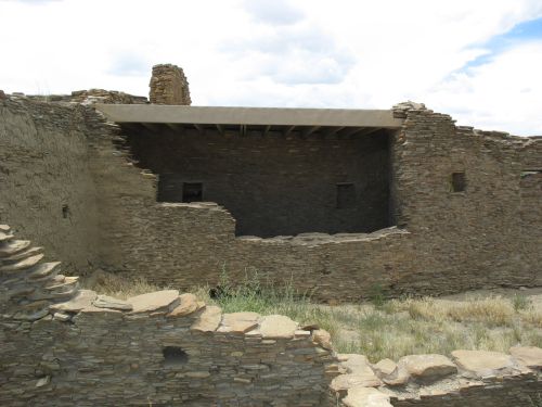
Western Burial Rooms in Old Bonito
Of the other Chaco samples, the western burials at Pueblo Bonito cluster most closely with those from both Hawikku and the ancestral Tewa site of Puye in the Rio Grande Valley. The burials from the small sites in the Fajada Butte area at Chaco pattern most closely with the ancestral Tewa site of Tsankawi, and in fact these two form a somewhat distinct group compared to most of the other samples. Finally, the burials from the small sites of Bc 51 and Bc 53, on the south side of the canyon across from Pueblo Bonito, pattern closely with those from Picuris, a Northern Tiwa Pueblo which is still occupied, as well as with those from the ancestral Tewa sites of Sapawe and Pindi.
Schillaci and Stojanowski conclude from this that there is no good reason to conclude that Chacoan society was matrilocal based on the practices of the likely descendants of the Chacoans, among whom they have identified both eastern and western Pueblos practicing various forms of postmarital residence. They do acknowledge that they weren’t able to include any Hopi samples in the analysis, so the western Pueblos are represented only by the two Zuni-area sites, which leaves open the possibility that the Hopis are closely connected to Chaco, which would strengthen Peregrine’s position and weaken theirs. On the other hand, other lines of evidence suggested somewhat weaker ties to Chaco among the Hopis than among most other modern Pueblos, so this probably isn’t a major problem. In his response, Peregrine notes the possibility that bilocality among the eastern Pueblos is a post-contact development related to declining population and therefore not necessarily relevant to the prehistoric evidence. He doesn’t challenge the overall validity of the analysis, however, which is our main concern here.
This is an interesting study, and it identifies some later sites with at least a high probability of including people descended from the Chacoans, but the facts that these sites don’t particularly pattern with each other and that there was considerable diversity within Chaco itself point to how complicated the picture seems to be. Overall, this evidence seems to support the idea that most of the modern Pueblos include at least some people who are descended from the Chacoans, and it provides particular support for such ties among the Zuni, Tewa, and Northern Tiwa. It also supports the previously existing evidence for considerable population diversity at Chaco itself. As we’ll see in the next post, this is not very different from where the DNA evidence leads.
![]()
Schillaci, M., & Stojanowski, C. (2002). A Reassessment of Matrilocality in Chacoan Culture American Antiquity, 67 (2) DOI: 10.2307/2694571


