Feeds:
Posts
Comments

Archive for the ‘Irrigation’ Category

United Country Mimbres Realty, Silver City, New Mexico

Inspired by my recent visit to the Gila Cliff Dwellings, I’ve been reading about the Mimbres Mogollon culture of southwestern New Mexico.  As I noted earlier, the cliff dwellings themselves aren’t actually Mimbres, instead belonging to the Tularosa Mogollon culture more common to the north, and they postdate the “Classic” Mimbres period (ca. AD 1000 to 1150, exactly contemporary with the florescence of Chaco further north) by over a century.  They do, however, fall well within the area occupied by the Classic Mimbres, and there is in fact a Mimbres village, the TJ Ruin, within the monument boundaries.  The upper Gila River valley was a major area of Mimbres settlement during the Classic period, and it had some of the largest Classic villages, although it is not nearly as well understood as the Rio Mimbres valley which is often considered the Mimbres “heartland” and which gave the culture its name.  A review article by Michelle Hegmon from 2002 provides a good and relatively recent overview of the major issues in Mimbres archaeology.

The Mimbres are best known for their pottery, some of which features elaborately painted naturalistic designs unlike anything else known from the prehistoric Southwest.  This pottery was painted with black paint on a white slip, as was Anasazi pottery from Chaco and other areas at the time, and many of the abstract geometrical designs that form the bulk of the decorated pottery are reminiscent of Anasazi styles.  There’s no equivalent among the Anasazi to the naturalistic designs, however, which show elaborately detailed people, animals, possible mythical scenes, and much else.  No two designs are exactly alike.  Most of the figurative designs were on bowls which were placed with burials, usually with a “kill-hole” through the center of the vessel, which was then placed over the face of the buried individual.  Iconographic study of Mimbres pottery dates back nearly a century, starting with the work of Jesse Walter Fewkes of the Smithsonian in the 1910s, but in the past 20 years it has been supplemented by studies taking a more technological approach.  Particularly important has been a series of studies using instrumental neutron activation analysis (INAA) to determine the sources of the clay used in the pots and untangle patterns of production and exchange.  The results of these studies have generally been consistent with widely distributed production of pottery throughout the region, which is in contrast to other documented cases of community-level specialization in pottery production known from other parts of the Southwest at various times.  Design analysis has led some to suggest that the finest of the black-on-white bowls were made by a very small number of potters, however, which implies that perhaps a few specialists in villages scattered across the region made almost all of the well-known naturalistic vessels.

Tune Town Music Exchange, Silver City, New Mexico

Speaking of villages, one of the most interesting things about the Mimbres is that theirs were quite different from communities found throughout the rest of the Southwest during the Classic period.  While most areas, including the Chaco region, had communities of loosely clustered small house sites, the Mimbres were aggregated into large, dense villages made up of roomblocks very similar to those that would become increasingly common in Pueblo sites to the north starting in the thirteenth century and continuing into the historic period.  Indeed, some have argued that the Classic Mimbres invented the “Pueblo” as a type of community, and even that many of the social institutions of the modern Pueblos, such as the kachina cult, derive ultimately from Mimbres precursors.  There is definitely a clear continuum in artistic style from Mimbres pottery through Jornada Style rock art to the Rio Grande style of rock art and mural painting that appears among the northern Pueblos beginning around AD 1300.

After the decline of Chaco around AD 1130, the northern Southwest witnessed a pattern of ever-increasing aggregation eventually resulting in the modern Pueblos with their very Mimbres-like plans and institutions.  There have been various explanations offered for why this occurred, and I think those that attribute it largely to increased warfare are among the most persuasive.  There is definitely much more direct evidence for violence after about AD 1150 than before then.  Whatever was causing trouble in Pueblo societies at this time, it seems very likely that solutions drawn from the Mimbres experience became increasingly attractive further north.

But what was that experience?  Why did the Mimbres aggregate into large Pueblos at a time when everyone else lived in scattered small houses?  The Classic Mimbres period coincides with a time of remarkable peace throughout most of the Southwest, so defense seems less likely as an explanation here than it does later on.  Some of the Mimbres pots do show scenes of violence, including a well-known beheading, but it’s not at all clear that these show actual events rather than myths.  In general, there doesn’t seem to be any more evidence for warfare among the Classic Mimbres than anywhere else at the same time, which makes their much denser settlement pattern particularly mysterious.  It may have had something to do with irrigation agriculture, which the Mimbres had probably adopted somewhat earlier under the influence of the Hohokam in southern Arizona, who were by far the most accomplished irrigators of the prehistoric Southwest.  Among the Mimbres, as among other Mogollon groups, there was extensive Hohokam influence early on, which seems to have largely ceased by AD 1000, possibly replaced by increased influence from the Anasazi to the north (although this is controversial).  Steve Lekson, who has done a lot of work in the Mimbres area in addition to his work at Chaco, has argued that the Classic Mimbres consists of “an Anasazi lifestyle supported by Hohokam infrastructure,” and I think there may be something to that.  The labor demands of irrigation may have led to residential aggregation, although it’s important to note that the Hohokam themselves never aggregated to anything like the same degree despite their much more elaborate irrigation systems.

Welcome Sign, Truth or Consequences, New Mexico

What’s even more puzzling about the Mimbres, however, is what they did after the end of the Classic period.  The large villages and figurative pottery seem to come to a rather sudden end around 1150, about the same time that Chaco declined and the northern Southwest entered a long, difficult period of warfare, aggregation, and regional abandonment.  It used to be thought that the Mimbres just “collapsed” at this time, with their ultimate fate unknown, but more recent research, especially in the eastern Mimbres area along the Rio Grande near the modern town of Truth or Consequences, has shown that the real story is more complicated.  Margaret Nelson has been researching settlement patterns in the eastern Mimbres area, and she has found that one notable shift after the end of the Classic period involved the dissolution of the aggregated Classic villages and the dispersal of people into small hamlets, often built on the sites of Classic fieldhouses.  She also sees continued production of Mimbres pottery, although apparently without the distinctive naturalistic designs, for a long time after the end of the Classic.  Hegmon, who has collaborated with Nelson on much of this work, has proposed calling these occupations “Postclassic Mimbres.”  They show much more extensive trade of pottery with surrounding areas than during the Classic period, as well as more variable architecture, implying that whatever social controls had held the large Classic villages together had broken down and been replaced by a more flexible social system.

What’s remarkable about this is that it’s basically the opposite of what was happening everywhere else in the Southwest, where the dominant trend during this period was aggregation.  The Mimbres, at least in the east, were instead dispersing.  The picture is less clear in the Mimbres and Gila valleys further west, but at least some of the Classic villages seem to have continued to be occupied at lower population levels (similar to what was going on at Chaco), while a new type of occupation seen at some sites in the area, known as the Black Mountain Phase, may or may not represent a change in Mimbres culture.  There is debate over whether the Black Mountain Phase actually shows continuity with Classic Mimbres or not.  It’s also possible that some people headed south, to the rising center at Casas Grandes, in which case they would be participating in the trend toward aggregation.

It’s becoming increasingly clear, then, that the Mimbres didn’t really collapse or totally abandon their region in 1150.  Instead, they seem to have sort of splintered, with some scattering to hamlets on the sites of former field houses, others possibly reorganizing their communities into Black Mountain Phase sites, and still others migrating away from their region either south to Casas Grandes or east to the Jornada area, where the very Mimbres-like Jornada petroglyph style seems to appear around this time.  This process of dispersal when everyone else was aggregating, combined with their earlier aggregation when everyone else was sprawling across the landscape, gives a distinct “out of phase” feel to Mimbres cultural dynamics.

I certainly don’t have any solutions to propose to the mysteries of the Mimbres, and as far as I can tell no one else really does either.  They’re among the most fascinating of the many peoples who inhabited the prehistoric Southwest, and while they are by no means the most obscure, outside of specialist circles they are known almost exclusively for their pottery.  The pottery is amazing, of course, and quite deserving of attention, but there’s much more to the Mimbres than their pots.
ResearchBlogging.org
Fewkes, J. (1916). Animal Figures on Prehistoric Pottery from Mimbres Valley, New Mexico American Anthropologist, 18 (4), 535-545 DOI: 10.1525/aa.1916.18.4.02a00080

Gilman, P., Canouts, V., & Bishop, R. (1994). The Production and Distribution of Classic Mimbres Black-on-White Pottery American Antiquity, 59 (4) DOI: 10.2307/282343

Hegmon, M. (2002). Recent Issues in the Archaeology of the Mimbres Region of the North American Southwest Journal of Archaeological Research, 10 (4), 307-357 DOI: 10.1023/A:1020525926010

Hegmon, M., Nelson, M., & Ruth, S. (1998). Abandonment and Reorganization in the Mimbres Region of the American Southwest American Anthropologist, 100 (1), 148-162 DOI: 10.1525/aa.1998.100.1.148

Nelson, M., & Hegmon, M. (2001). Abandonment Is Not as It Seems: An Approach to the Relationship between Site and Regional Abandonment American Antiquity, 66 (2) DOI: 10.2307/2694606

Read Full Post »

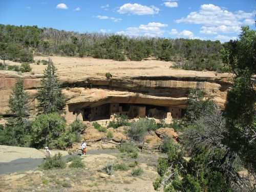
Spruce Tree House, Mesa Verde

This is a fascinating example of a serious attempt to design an urban cooperative community based on the concept of a canyon.  The term “urban canyon” is often used to describe the narrow streets surrounded by skyscrapers in many big cities, and I think there is actually more to that comparison than the people who make it often realize, but this project takes the idea in a very different direction.  Produced for a design competition in Dallas a couple of years ago where the goal was to come up with a totally sustainable urban block, “Co-op Canyon” is clearly influenced by Anasazi precedents, and the architects even used the term “cliff dwelling” in describing it (although they don’t mention the Anasazi specifically).  It goes well beyond just copying the outward forms of Anasazi architecture, as modern architects often do, and incorporates agriculture throughout the staggered terraces that make up the inward-facing development with an internal “canyon” at its center.  There’s also an innovative cooperative concept for the organization of the community, in which residents contribute work in the gardens or in other parts of the community to earn their keep, along the lines of Habitat for Humanity’s  “sweat equity,” in which residents help to build their own houses in order to purchase them.  This cooperative idea is probably influenced by popular ideas about Anasazi social organization as well, although for the Mesa Verde cliff dwellingsspecifically this may not be very accurate.  The design didn’t win, so it won’t actually be built in Dallas, but it’s a great example of architects really thinking through the possibilities and implications of precedents drawn from the archaeological record.

Cliff Palace and Sun Temple, Mesa Verde

Read Full Post »

Sleeping Ute Mountain and Surrounding Landscape from Four Corners

If you stand at the Four Corners monument and look in the direction of Colorado you will see Sleeping Ute Mountain dominating the view.  From this direction you are looking at the southwest side of the mountain, and in front of it you see the southern piedmont.  On the right side of the piedmont, though not visible from this distance, is Cowboy Wash.  It’s one of several ephemeral streams running from the mountain itself across the piedmont to the San Juan River.

One thing that might strike you about the view from this perspective is that it looks like an awfully dry, desolate, uninhabitable wasteland.  And you would be correct to think that.  The southern piedmont of Sleeping Ute Mountain is an extremely arid and inhospitable environment even by the standards of the Southwest, which is saying something.  It’s only a few miles from Mesa Verde to the east and the Great Sage Plain to the north, both areas that get relatively abundant rainfall and supported large and prosperous prehistoric communities, but it is worlds away from them environmentally.  While those areas get sufficient rainfall to support dry farming, and the Great Sage Plain is commercially farmed even today, the southern piedmont does not, and any type of agriculture there would have to rely on some sort of irrigation.  Today the Ute Mountain Ute tribe has a large irrigation project in the area, using water brought in from McPhee Reservoir, 45 miles to the north, via the Towaoc Canal.  The construction of the reservoir and the canal was part of the Dolores Project, which involved substantial archaeological excavation of the inundated area that significantly improved archaeological understanding of the prehistory of the region.  This work took place from 1978 to 1985 and was known as the Dolores Archaeological Project, the largest salvage archaeology project in US history.

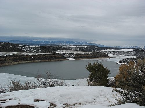
McPhee Reservoir, Dolores, Colorado

The creation of the irrigated fields on the piedmont resulted in further salvage excavations in the 1990s.  Among the sites excavated was 5MT10010, which contained considerable evidence of a gruesome incident of probable cannibalism around AD 1150.  It is not the only site in the area to show evidence of cannibalism during this period; in fact, three other sites in the same community, excavated slightly earlier in connection with the construction of the canal, also showed evidence of having been destroyed in an incident involving extensive processing of human remains in a way suggesting cannibalism, and there are several other sites in the area showing similar assemblages, most from the same period but at least one from a later period.  It is at 5MT10010 that the most solid evidence for actual cannibalism, as opposed to processing of bones in a way that may or may not indicate actual consumption of human flesh, in the form of a coprolite that tested positive for the presence of human muscle tissue.

There are many questions that arise from these findings, but one of the most puzzling is also one of the simplest: what were people doing living at Cowboy Wash in the first place, and how did they manage it?  After all, they weren’t building giant dams and canals of the sort involved in the Dolores Project.  In many parts of the Southwest, especially upland areas like Mesa Verde, dry farming using only rainfall was standard during this period, and water control techniques were generally used only for domestic water if a nearby spring or other reliable source was not available.  There are a few springs on the southern piedmont that probably would have supplied sufficient domestic water for the small number of people living there, but the rainfall would definitely not have been sufficient to farm with.  The only source of water at all sufficient for agriculture would have been the occasional floods, from spring snowmelt and summer thunderstorms, that would flow through Cowboy Wash itself and the other drainages on the piedmont.  None of these flows permanently today, and there is no evidence that they ever did.  As at Chaco Canyon, then, which is similarly dry, farming would have to have been based on some sort of technique for capturing the floodwater.

Flowing Chaco Wash and Cliffs below Peñasco Blanco

There are a variety of ways this might be done, including diverting the rainwater from cliffs, as was done at Chaco, planting along the sides of the drainage where the floods would regularly overflow the banks, and what is known as “ak-chin” farming, as practiced by the O’odham of southern Arizona, which involves planting right in the path of the runoff at places where the velocity of the water is relatively low, as at the mouths of tributaries to main arroyos.  There are no sheer cliffs on the southern piedmont like the ones at Chaco, so probably a mix of overbank and ak-chin farming would have been practiced at Cowboy Wash.

A paper by Gary Huckleberry and Brian Billman addresses the nature of farming at Cowboy Wash, and also addresses a related issue, which is whether periodic entrenchment of arroyos due to drought played a role in the patterns of abandonment and migration that characterize Southwestern prehistory.  It is pretty clear by now that the paleoclimatological record shows periods of drought corresponding to periods of abandonment of certain parts of the Southwest, and one proposed mechanism for how this would have worked is that drought would have led to increased erosion and/or hydrological changes in the water table that led to the entrenchment of arroyos, which would have been disastrous for populations dependent on certain types of floodwater farming (especially overbank), as the broad floodplains of the local drainages would have been replaced by deep channels that took the water away quickly instead of letting it overflow to water the crops.  Ak-chin farmers would not necessarily have been affected to the same degree, but if the side drainages they used became entrenched as well they would not have been able to use their techniques either.  Thus, drought would lead to arroyo-cutting, which would lead people to leave formerly productive areas for others that were less affected.  This theory has been proposed as an explanation for certain events at Chaco, with the idea being that some of the social changes late in the Chacoan occupation were due to degradation of the Chaco Wash and the need to change agricultural strategies.  The phenomenon of arroyo-cutting in general is richly illustrated in historic times at Chaco.  The early reports of the Chaco Wash from the nineteenth century indicate that it was a shallow, meandering drainage, much like the current condition of the Escavada Wash to the north and the “Chaco River” that is formed by the confluence of the two at the western end of the canyon and flows north to the San Juan.  By the early twentieth century, and accelerating since then, however, the Chaco Wash through the canyon has cut down significantly and there is a very deep arroyo channel apparent today.

Entrenched Arroyo at Chaco

The drought-downcutting-abandonment theory makes sense as far as it goes, but as Huckleberry and Billman point out there are some problems.  For one thing, the extent to which arroyo-cutting is actually linked to drought, rather than other factors including the specific geology of the area, is hotly debated and there is no consensus.  The idea that while drought may be one factor causing arroyo-cutting there are other factors involved as well is supported by the fact that in different drainages in the Southwest that have been studied in depth the periods of arroyo-cutting do not necessarily correspond to region-wide droughts or other climatic changes.  In some areas they do, but in other areas they don’t.  At Cowboy Wash specifically, the available evidence indicates that the wash began to entrench sometime before AD 950, and that it began to refill with sediment sometime between AD 1265 and 1400.  If abandonment does in fact correspond to arroyo-cutting, then presumably the Cowboy Wash area should have been abandoned between 950 and 1265, and possibly occupied before and after this.  If downcutting results from drought, there should also be evidence of drought during the 950 to 1265 period.

The basic upshot of the Huckleberry and Billman paper is that neither of these expectations is met.  The evidence for drought conditions at Cowboy Wash generally matches that for the rest of the region, with the major droughts in the mid-twelfth century and late thirteenth century AD and several smaller droughts at irregular intervals before then.  This doesn’t show any particular relationship to the stratigraphic evidence for arroyo-cutting, which seems to have been going on to some degree throughout the period from AD 950 to at least AD 1265.  Furthermore, the evidence for settlement doesn’t line up either.  The marginal nature of the Cowboy Wash area implies that it would probably not have been occupied for most of prehistory, and this was indeed the case.  There were a few ultimately unsuccessful attempts to colonize the southern piedmont, however, and they don’t show any particular relationship to the periods of arroyo-cutting (although they do perhaps relate to periods of drought).  The first agricultural occupation of the area came during the Basketmaker III period, when a few pithouses were apparently used seasonally as summer fieldhouses, presumably associated with nearby fields, from about AD 600 to 725.  After these were abandoned, at a time which may correspond to a drought, the area does not seem to have been occupied again for more than three hundred years.  Then, around AD 1050, a few permanent, year-round sites were built.  These seem to have been occupied for only a few years, however, as there was no significant buildup of trash associated with them.  After they were abandoned, three larger villages, including one at Cowboy Wash, were established around AD 1075.  These had extensive trash deposits and seem to have been occupied for one or two generations.  These communities were apparently abandoned, however, when the next occupation began in the 1120s by a population with apparent links to the Chuska Mountain area to the south.  This occupation at Cowboy Wash is the community that was apparently destroyed around AD 1150 (again coincident with a major drought) when its inhabitants were mutilated and cannibalized.  After this event, the area was once again abandoned until about AD 1225, when two new communities were founded, including one again at Cowboy Wash.  Within a few decades the population at Cowboy Wash appears to have aggregated at Cowboy Wash Pueblo, following a typical pattern for the region.  Also typical of the region, the whole southern piedmont seems to have been abandoned by AD 1280, at the time of the “Great Drought” that coincides with major changes throughout the Southwest.

Entrenched Chaco Wash from Cliff Top near Pueblo Bonito

So basically, all of the attempts at year-round occupation of the southern piedmont seem to have occurred during the period that Cowboy Wash was being downcut.  While these were all ultimately unsuccessful, some lasted for a few decades, so clearly they were able to grow some food at some times.  This strongly implies that at least in this case, arroyo-cutting was not particularly linked to abandoned, although drought probably was.  Huckleberry address the issue of how farming could have been done during periods of downcutting by looking at Cowboy Wash and its tributaries today.  They find that while some portions of the main wash, especially, are indeed heavily downcut, other portions are not, and they label this type of drainage a “discontinuous ephemeral stream,” which is to say, a normally dry wash with some portions that are severely downcut and others that are not.  On the uncut portions, which include much of the length of the tributaries, overbank or ak-chin farming could easily be done today, and this was presumably the case in antiquity as well.  The hydrology of the area is such that the areas of downcutting would not have been stable, and would have tended to migrate upstream, but the complexity of the system is also such that this would not have made the entire system unusable; while some parts were being newly cut, others would be filling in, and prehistoric farmers would merely have to move their fields around a bit rather than abandoning the area entirely.

All that being said, however, the question of why people were trying to settle this quite harsh and difficult area in the first place.  It is interesting to note that the attempts at settlement generally came during periods of relatively favorable environmental conditions, which would have made this area a bit less forbidding than usual, as well as during times of increased regional population, when all the good land may well have been taken and some people were forced to seek out the more marginal areas.  The violence that appears to have accompanied the drought of the twelfth century, especially, suggests that when the good times came to an end social relations got very bad very fast.  Huckleberry and Billman suggest that the reason people did end up abandoning Cowboy Wash, the times when they were not attacked, was merely drought itself, which they were unable to cope with as well as other populations, even those who also used floodwater farming techniques, because the size of the watershed was relatively small and the amount of rainfall feeding the washes was also small, so the total amount of water they had to work with was much smaller even in good times than at place like Chaco with large watersheds.  In that context, even a small decrease in annual precipitation could be devastating, leading to failed harvests and the need to move away.

Non-Entrenched Escavada Wash from New Mexico Highway 57

Indeed, there is evidence that the time of the massacre at Cowboy Wash was very difficult for the people there.  Archaeobotanical studies of pollen and other plant remains showed that there was apparently little or no maize in or around 5MT10010 at the time of abandonment, which is quite surprising for a Pueblo site.  The plant remains that were there were mostly from wild plants such as chenopod, amaranth, and tansy mustard, all of which would have been available in the spring and likely would have been intensively collected if there were no stored corn available due to a failed harvest the previous fall.  In addition to pinpointing the season in which the incident occurred, this implies that times were very tough for the inhabitants of 5MT10010, and perhaps for their attackers too.  The coprolite showed no sign of having plant material in it, which suggests that whoever left it had not just eaten some corn at home before setting out to attack 5MT10010.

Another paper associated with the project, by Patricia Lambert, suggests another problem the Cowboy Wash inhabitants apparently had: disease.  In this paper Lambert reports on analyses of ribs of individuals at 5MT10010 and other sites in the Cowboy Wash area dating to various periods of occupation that had lesions on them suggestive of those seen in modern collections of individuals known to have died of tuberculosis and (to a lesser extent) other respiratory diseases.  These lesions were found in 11 of 32 individuals from Cowboy Wash that had enough of their ribs left to examine.  One of the individuals with lesions was from 5MT10010.  This was an adult woman who was not one of the victims of the attack at site abandonment but who had instead died earlier and been formally buried.  Lambert also examined comparative collections of remains from Pueblo Bonito at Chaco and Elden Pueblo near Flagstaff Arizona.  Only 3 of the 45 individuals from Pueblo Bonito and 2 of the 20 from Eldon Pueblo had similar lesions, suggesting that this disease was much more prevalent at Cowboy Wash than at these other sites, even though it was not absent at them.  Lambert notes that tuberculosis is an opportunistic disease that tends to strike people whose systems are compromised by other problems such as hunger and stress.  The evidence for physical violence in the Cowboy Wash sample, even setting aside the cannibalism assemblages, was much greater than in the other two samples as well.  Combined with the harsh environment, this suggests strongly that Cowboy Wash was a difficult place to live for several reasons.  Farming was possible but risky, and when conditions turned bad both hunger and violence from other hungry people were constant threats.

Given this context, the occurrence of extreme events such as cannibalism incidents at Cowboy Wash starts to make some sense.  Cowboy Wash is a place of extremes.
ResearchBlogging.org
Huckleberry, G., & Billman, B. (1998). Floodwater Farming, Discontinuous Ephemeral Streams, and Puebloan Abandonment in Southwestern Colorado American Antiquity, 63 (4) DOI: 10.2307/2694110

Lambert, P. (2002). Rib lesions in a prehistoric Puebloan sample from southwestern Colorado American Journal of Physical Anthropology, 117 (4), 281-292 DOI: 10.1002/ajpa.10036
Read Full Post »

Civil Engineering Plaque at Mesa Verde

I’ve previously discussed water control technologies at Chaco, where they were particularly important given the extreme aridity of that area even by Southwestern standards.  There is abundant evidence, however, that water control was a widespread activity throughout the ancient Southwest, even in areas with more reliable water sources.  The best-studied water control systems have been the impressive large-scale canal systems built by the Hohokam in southern Arizona, but less elaborate systems are known in the northern Southwest as well.

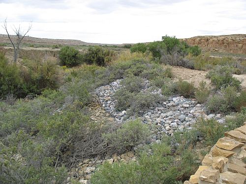
Among the better-studied of these systems are those in the Mesa Verde area of southwestern Colorado.  In comparison to Chaco especially this area is much more suitable for agriculture.  The Mesa Verde proper in particular is high enough that it gets quite a bit of regular precipitation, and it is generally thought that the majority of agriculture on the mesa throughout its occupation was dry farming on the mesa top, depending only on direct rainfall.  Interestingly enough, however, there is extensive evidence of water control features even in this more favorable environment.  A detailed description of some of them can be found in an article by Arthur Rohn published in 1963.  He focused on two main types of soil and water control: checkdams forming small terraces, presumably agricultural, along intermittent drainages and large reservoirs, probably for domestic water.  The checkdams, which have since been discovered in other parts of the greater Mesa Verde region such as Hovenweep as well as other regions of the northern Southwest (including Chaco), consisted of small masonry walls, laid without mortar, which served to hold back water and soil which would otherwise drain right off the mesa top during rainstorms.  Some drainages had dozens of these, typically about a yard high and a few yards apart.  Most had been breached at some point after the abandonment of the area and were visible only as rock alignments of varying lengths and heights, but some apparently still held soil and water back well enough that they were covered in vegetation, preventing Rohn from observing much about them.  The agricultural function of these terraces is suggested by the frequent association with them of small structures generally interpreted as seasonal field houses.

Checkdam, Hovenweep National Monument

It is not at all clear, however, why the people on Mesa Verde would have needed to go to the effort to build all these terracing systems when they had so much fertile land right on the mesa top.  Rohn calculated that the likely extent of the terraces added only about 1% of the total area of tillable land on top of the mesa.  He suggested several potential reasons for their construction, including depletion of mesa-top soils, increasing population and subsequent need for more intensive farming, and cultivation of specialized crops of high value that made the additional effort invested in constructing the terraces worthwhile.  Ultimately, however, Rohn had insufficient data to come to any firm conclusions about the purposes of the terraces, and as far as I can tell the situation has not improved much since his time despite the much more extensive paleoclimatic data now available.

The other water control features that Rohn described were the large reservoirs associated with certain of the more densely populated areas of the mesa.  Most of these consisted of large dams, much larger than the small checkdams, across certain canyon heads, where they likely impounded water either for use right there or to soak down through the porous sandstone to feed springs underneath.  These reservoirs thus used the natural characteristics of the canyon heads and required relatively little additional effort to store water for human use.

Far View Reservoir, Mesa Verde

The best-known reservoir on Mesa Verde, however, which Rohn described in detail, was quite different.  Rohn called it Mummy Lake, which was the standard name for it in his time, but it is now often known as Far View Reservoir.  This is a large oval masonry structure, of mostly artificial construction and about 90 feet in diameter.  It is near the cluster of sites known as the Far View Group, including Far View House, which is often claimed to be an outlying Chacoan great house.  These sites mostly date to the Pueblo II period in the eleventh and early twelfth centuries AD (contemporaneous with the height of the Chaco system), which makes them earlier than the most impressive sites on the mesa, which date to the Pueblo III period (late twelfth and thirteenth centuries AD) when Mesa Verde apparently had its highest population.

Far View Reservoir Intake Channel, Mesa Verde

Far View Reservoir was apparently not used for agricultural irrigation, as it has an intake channel but no outlet.  It was fed by an elaborate canal system upstream that channeled water to down the mesa.  Rohn noted that the intake channel was of quite sophisticated design:

The feeder ditch coming from the north did not empty directly into the north side of the reservoir, but rather ran by the west uphill side until it met the mouth of the intake channel at the southwest corner. There water was diverted into the inlet around a right-angle turn and conducted in a northeasterly direction into the reservoir. Such a complicated maneuver caused the suddenly slowed water to drop its silt burden in the intake channel, which could be easily dredged, rather than in the deepest part of the reservoir, where dredging operations would be difficult and would muddy the water.

Trenching of the reservoir by Earl Morris in 1934 revealed that the original bottom lay about 12 feet below the intake.  This would give the reservoir a maximum capacity of about 76,000 cubic feet, equivalent to about 1.74 acre-feet or 568,000 gallons.  That’s a lot of water.

Since there was no outlet from the reservoir, it presumably didn’t feed a system of irrigation canals.  What, then, was this water for?  Rohn’s answer, with which most other archaeologists have agreed, was that it was used for domestic water.  Trenching of the walls of the reservoir revealed pottery of Pueblo II date, contemporaneous with the nearby Far View sites, which makes sense.  A small ditch led off from the main ditch leading to the reservoir, emptying some of the water diverted from upstream into a small drainage with a series of checkdams similar to those documented elsewhere on the mesa, which were presumably farmed by the Far View residents.  Most of the water, however, went into the reservoir, from which it could be easily extracted with pots and brought home for cooking and other daily uses.  Residents of other parts of the mesa seem to have used nearby springs (perhaps fed by canyon-head reservoirs above them) for their domestic water, but there are no springs near the Far View group, so this elaborate reservoir seems to have been built to support the community there, which as Rohn pointed out was the largest concentration of population on this part of the mesa before the Pueblo III period.

Cliff Palace, Mesa Verde

At some point in late Pueblo II or early Pueblo III a very elaborate ditch was built carrying water from the Far View area south almost to the very end of the mesa.  This ditch skirts the Far View sites, suggesting that they were still occupied when it was constructed, but it heads toward the major cliff dwellings to the south that became the major focus of occupation in late Pueblo III.  It’s not clear exactly what this ditch led to, but the fact that it heads toward the major cluster of sites including Cliff Palace, in an area with few springs but a very large population during late Pueblo III, suggests that it likely supplied domestic water for these sites, especially after the abandonment of the Far View sites allowed the intake channel to Far View Reservoir to be blocked and all of the water from the whole system to be brought south.

Rohn mentioned in his article that while Far View Reservoir is the only such reservoir known from this part of Mesa Verde proper, there are several other such facilities known from elsewhere in the region, especially in the Montezuma Valley to the northwest.  A more recent article by Rich Wilshusen, Melissa Churchill, and James Potter (from 1997) provides a valuable summary of information known on reservoirs throughout the region, as well as detailed information on one reservoir studied intensively by the Crow Canyon Archaeological Center.  This reservoir is known as Woods Canyon Reservoir after Woods Canyon Pueblo, a late Pueblo III site nearby.  Also in this general area are a Chaco-era (late Pueblo II) outlying great house known as the Albert Porter site and a site called Bass Ruin that apparently dates to the poorly understood early Pueblo III period, in between the decline of Chaco and the rise of the large aggregated pueblos and cliff dwellings in late Pueblo III.  This reservoir much less elaborate than the Far View one, consisting merely of an earthen dam built across a natural drainage, impounding the water behind it.

Excavation of both the dam and the impounded reservoir area, along with surface collection of sherds, showed that the dam was likely constructed during early Pueblo III or possibly earlier.  An innovative use of tree-ring dates from trees growing on top of the dam in the 1950s, which must have begun growing after the reservoir no longer held water, put the date of dam failure at no later than about AD 1350.  Assuming that it would have taken a century or two for the reservoir to fill with enough sediment for the dam to fail, the authors put the likely usage of the reservoir in early Pueblo III.  These two lines of evidence converge nicely.

White Ware Bowls at Chaco Visitor Center Museum

Another striking aspect of the potsherd evidence was the extraordinarily high prevalence of white wares (77%) and of jars (71%).  The predominance of white wares and the low occurrence of gray utility wares suggests that most of the sherds came from white ware jars used to carry water from the reservoir to habitation areas which broke in the process, and the lack of bowls shows that those habitation areas were not in the immediate vicinity of the reservoir.  Habitation sites usually have assemblages consisting mainly of gray ware jars, which were used for cooking, with large numbers of white ware bowls, which were used to serve food, as well.  The authors mention that previous work at Far View Reservoir (after Rohn) had shown a similar distribution of ceramic wares and forms, and the few sherds mentioned in Rohn’s article also show this distribution.  Given this, as well as the lack of nearby canals or soils suitable for farming, the authors conclude that this reservoir was likely used primarily or solely for storage of domestic water, as Rohn had argued for Far View Reservoir.  They also note that the dating was surprisingly early; these reservoirs are usually found in association with late Pueblo III aggregated sites, and there has been a frequent assumption that they served those communities.  The evidence from Woods Canyon, however, suggests that the reservoir was actually constructed well before Woods Canyon Pueblo, at a time when the local population lived at Bass Ruin or even in the Chacoan community around the Albert Porter site.

Gray Ware Jars at Chaco Visitor Center Museum

In addition to this interesting information about this one reservoir, the authors collected all the information available at the time on other reservoirs in the Mesa Verde region, including the extensive information published only in the so-called “gray literature” (i.e., reports from salvage excavations and other cultural resource management projects that are not easily available to the general scholarly community).  From this data set they find that there are two main categories of reservoirs: those built as integral parts of late Pueblo III aggregated villages and those like Wood Canyon Reservoir built near such villages but probably dating to an earlier period and associated with Chaco-era or immediate post-Chaco communities.  This implies that these large reservoirs may not have been a response to drought as climatic conditions deteriorated in the twelfth and thirteenth centuries, as is often assumed, but that they may instead have been monumental public architecture, like great houses, great kivas, and roads, associated with Chacoan communities and used to sustain the large populations of those communities.  As conditions did deteriorate, however, the existence of these communities and their dependable water sources may have encouraged others to join them, leading to the well-known process of aggregation and formation of large villages during the late Pueblo III period.

Furthermore, the creation of these large, permanent features would have required substantial labor and indicated a commitment of a community to a particular location for the long term.  This was likely a new development in the northern Southwest during Pueblo II, perhaps associated with Chacoan influence; previously, sites had been mostly occupied for quite short periods of time, and people seem to have moved very frequently.  From the eleventh century on, however, the trend is toward increasing commitment to particular localities, although the actual sites in which people lived didn’t necessarily last very long.  Multiple sites occupied one after another in a given area, with the general trend toward increased aggregation and more defensive locations, is typical throughout the Mesa Verde region in the period between AD 11oo and 1300, when the whole area was abandoned.  The role of Chaco Canyon, which is both one of the longest-occupied areas in the prehistoric Southwest and one where water control is most necessary, in all this is interesting to ponder.

Pueblo Bonito and Basin with Captured Rainwater

Finally, it’s worth noting the distinction between different uses of water here.  The largest quantities of water would have been needed for agriculture, but only at certain times of the year, and with careful planning the seasonal rains and spring runoff could be harnessed to adequately water the crops.  The amount of water needed for domestic use was much smaller, but it was needed all the time.  Springs were likely adequate for domestic use as long as populations remained small, but as larger communities developed in some areas with few springs more elaborate measures were necessary to ensure sufficient water was available at all times.  This was most obvious in very dry places like Chaco, but even better-watered areas like Mesa Verde began to have to deal with these issues as population increased and the climate changed.
ResearchBlogging.org
Rohn, A. (1963). Prehistoric Soil and Water Conservation on Chapin Mesa, Southwestern Colorado American Antiquity, 28 (4) DOI: 10.2307/278554

Wilshusen, R., Churchill, M., & Potter, J. (1997). Prehistoric Reservoirs and Water Basins in the Mesa Verde Region: Intensification of Water Collection Strategies during the Great Pueblo Period American Antiquity, 62 (4) DOI: 10.2307/281885

Read Full Post »

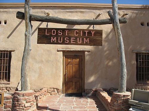
Lost City Museum, Overton, Nevada

Yesterday the water level in Lake Mead hit its lowest point since the lake was originally filled in the 1930s.  John Fleck was there to mark the occasion, and he has some interesting thoughts on this historic event.  The importance of this milestone is more symbolic than practical; the lake level has not yet become low enough to trigger an actual shortage of water.  Nevertheless, this is an important reminder of the importance of water in the Southwest and the brave new world it is entering as the climate changes and conditions become both drier and less predictable.

Read Full Post »

Volcano on West Mesa from North Valley, Albuquerque, New Mexico

The terrain around the city of Albuquerque is divided topographically into two major regions: the valley and the mesas.  The valley is the thin strip of land on either side of the Rio Grande, while the mesas rise up from it on either side.  The East Mesa continues to rise gently for several miles until it reaches the foothills of the Sandia Mountains, and the West Mesa rises a smaller amount up to a row of extinct volcanoes.  The Sandias on the east and the volcanoes on the west form the rough boundaries of the metropolitan area in those directions.  The river runs from north to south, so in those directions there are no significant natural barriers to development.  There are barriers to development that form edges of the city, at least for now, but they take the very different, and potentially more malleable, form of Indian reservations: Sandia Pueblo to the north and Isleta Pueblo to the south.

Valle del Norte Community Center, Albuquerque, New Mexico

Most of the development in Albuquerque since the coming of the railroad in 1880, and there has been a lot of it, has taken place on the mesas.  While the grid of streets next to the railroad tracks, known as New Town when it was originally laid out in the late nineteenth century and now known as Downtown, lies in the valley on the east side of the river, and the much older Hispanic settlement known today as Old Town lies to the west of it and even further into the valley, by the early twentieth century it was becoming clear that the mesas were where the action was.  The neighborhood known as Huning Highlands, one of the first additions to the original New Town and one of the most successful, starts at the eastern edge of the tracks and extends up to the western edge of the East Mesa.  Land speculators platted additions in the empty space between Old Town and New Town along Central Avenue, but they filled slowly while other additions heading east from Huning Highlands thrived.

Big, Elaborate House in North Valley, Albuquerque, New Mexico

There are a variety of factors that likely contributed to the growth of the mesas and the stagnation of the area around Old Town.  One was the decision, made by the New Mexico territorial legislature in 1889, to put the campus of the University of New Mexico on the East Mesa.  The site chosen was at the time quite some distance from the developed parts of Albuquerque, but once classes began development started to follow.  Central Avenue extended east from Huning Highlands to form the southern boundary of the campus, and subdivisions began to spring up all along it.  A streetcar line followed, easily linking the new developments to the commercial Downtown.  The streetcar system, originally intended to link New Town to Old Town and to draw the two together into a single city, ultimately had the opposite effect: it connected the mesa developments to Downtown, but was unable to establish any strong linkages further west.  As a result, the mesa boomed while Old Town stagnated.  With car-oriented development accompanying the massive investment in the area by the government during World War II, sprawl continued to rapidly expand over the East Mesa, and similar developments began to occur on the West Mesa as well.  By the 1980s, the east side of town was almost entirely built-out, and development had shifted mainly to the west side, including the new suburb of Rio Rancho to the north.

Valley High School, Albuquerque, New Mexico

The valley, however, experienced a very different trajectory of growth over this same period.  While the mesas had consisted almost entirely of empty rangeland before being subdivided and developed, the valley was home to a string of small Hispanic farming villages.  Most of these had been founded in the nineteenth century, although a few were much older.  Atrisco, on the west side of the Rio Grande, actually predated the founding of Old Town Albuquerque on the east side directly across from it in 1706.  Most of these villages grew up around the large landholdings of individual wealthy families, from which they tended to take their names.  Thus, the string of villages along the river, extending both north and south of what is now the Albuquerque metropolitan area, included such places as Los Griegos, Los Candelarias, Los Duranes, Los Barelas, and Los Lunas.  Not all of the villages were named after families, however, and some had names like Algodones, Los Corrales, Los Ranchos de Albuquerque, Pajarito, and Valencia.  These villages were predominantly agricultural and Hispanic long after the city of Albuquerque began to sprawl onto the mesas with subdivisions composed of suburban-style ranch houses filled with predominantly Anglo white-collar workers.

Sign for Candelaria Village, Albuquerque, New Mexico

Over time, however, development began to reach the valley as well, and here it took a very different form.  Instead of the suburban developments modeled after similar neighborhoods being built throughout the country in the postwar era, developments in the valley were based more on local Hispanic architectural and site-planning principles.  The houses were often made of adobe, or at least designed to look like they did.  Gated communities reminiscent of the old family compounds of the wealthy families after whom the villages were named became much more common than on the mesas, where open subdivisions of tract houses predominated.  The very wealthy built huge houses close to the river and the strip of cottonwood forest next to it known as the Bosque.  The more middle class began to build on the farmland between the old villages.  The city, having already grown accustomed to using its annexation powers to include the mesa developments, began to annex more and more of the valley development too.  Some of the old villages, however, managed to incorporate on their own and avoid being swallowed up by the behemoth that Albuquerque was becoming.  As these processes continued, the valley began to finally become part of the overall city, and the decline of Old Town began to reverse.  Today Old Town is a charming and largely tourist-oriented area with cute shops and several museums, while the residential areas to the north of it have largely become quiet neighborhoods that still retain much of their rural character.  There are still a few agricultural fields sprinkled among the gated communities and odd little businesses, and the old network of irrigation ditches known as acequias stills winds through the area.

Big Houses on Acequia in North Valley, Albuquerque, New Mexico

This increasing development, however, also had the effect of splitting the valley into two very different parts.  Development and annexation was largely confined to the area north of Old Town, which became known as the North Valley.  The old villages in this area either incorporated and established independent identities (Corrales, Los Ranchos) or were swallowed up entirely by the city and lost whatever identity they had once had (Los Candelarias, Los Griegos).

Sign for Los Griegos Neighborhood, Albuquerque, New Mexico

South of Old Town, however, this didn’t happen.  This area, known as the South Valley, saw little development and remained mainly rural, agricultural, Hispanic, poor, and outside the Albuquerque city limits.  It remains so to this day, and has a rather bad reputation as a high-crime, low-income area.  The old villages have seen a bit of new commercial development, and a few housing developments, but nothing like what has happened further north, and most remain individual communities separated by farmland.

Lock on Acequia in North Valley, Albuquerque, New Mexico

It’s not clear why the North Valley saw so much investment and so many changes while the South Valley, which started out more or less the same, was allowed to stagnate.  One possible answer has to do with topography.  It just so happens that the North Valley is mostly on the east side of the river, directly adjacent to Old Town and convenient to Downtown, while the South Valley is mostly on the west side, which has seen a lot of recent residential and commercial development but has always been relatively peripheral to the major activities of the city.  All the main government functions are concentrated on the east side, as are the major banks and other high-level commercial functions.  This topographical oddity occurs because the river happens to run directly along the bluffs forming the eastern edge of the West Mesa for most of the North Valley, then curves to the east (forming the curve in which Old Town lies) to run approximately halfway between the two mesas through the South Valley.  Because of the shape of the mesas themselves and the way it interacts with the river channel, there ends up being more land available on the west bank for this stretch.  Thus, the South Valley villages were considerably more isolated, especially in the early days when the river could only be crossed by ferry or unreliable pontoon bridge, which may have made it less of an option for developers looking to make a quick buck off of rich people’s desire to combine the charm of old New Mexico country life with the convenience of proximity to the big city.

Bridge over Acequia in North Valley, Albuquerque, New Mexico

Read Full Post »

Boundary Peak, the Highest Point in Nevada

Boundary Peak, the Highest Point in Nevada

John Fleck points to a fascinating prototype for an underground city in the Nevada desert.  It’s very clever, and a really interesting idea for how to deal with extreme aridity in a possible future southwest.  Not that something like this would ever get built, of course.  It’s much more likely that people would just abandon the southwest if things got so bad that this became a plausible option.  Still, I’m intrigued by the idea, which vaguely recalls the semi-subterranean pithouses of the Basketmaker period, when settled agricultural groups first began to grapple with the problems of living in the harsh and unpredictable environment of the southwest.

Pithouse at Lost City Museum, Overton, Nevada

Pithouse at Lost City Museum, Overton, Nevada

Read Full Post »

Chaco Wash Flowing

Chaco Wash Flowing

Chaco Canyon is a pretty dry place.  Its position in the rain shadow of the Chuska Mountains to the west gives it a semiarid climate with an average of about eight and a half inches of precipitation per year.  While it does snow, and that provides some moisture, the major source of water is the summer storms which come during the “monsoon season” from late July to early September and provide about a third of the annual precipitation in most years.

Chuska Mountains from Peñasco Blanco

Chuska Mountains from Peñasco Blanco

This is not the kind of environment in which a spectacular cultural flowering is generally expected.  And yet, the Chaco phenomenon that was centered in the canyon but spread throughout the region in the eleventh and early twelfth centuries was nothing if not spectacular.  Looking at the remains of the great houses in the canyon today, it’s hardly a surprise that many of the most common questions visitors ask are about water.  Where did they get it?  How did they store it?  Was it wetter then than it is now?

Drainage on Mesa Top

Drainage on Mesa Top

The answer to the last question is no, which comes as a considerable surprise to many visitors.  Some of them even seem very skeptical, like I’m trying to trick them.  It defies common sense to think that anything like what we see at Chaco could have arisen in an environment as dry as what we see today.  And, indeed, many early archaeologists who worked on Chaco assumed that the climate must have been more favorable, and there has been a considerable amount of research into this topic over the past few decades, much of it using the precision available through tree-ring studies to great effect.

Side Wash by Chetro Ketl

Side Wash by Chetro Ketl

Rather surprisingly, what that research has shown is that the climate has not changed significantly in at least the past several thousand years.  There were variations in the amount of precipitation on the order of decades, but always within the range seen in modern records.  So while there were wetter periods and drier periods, and these may have corresponded to important events in the development of the Chacoan system, it was always pretty dry, and never an attractive environment for a sedentary agricultural society displaying the level of complexity seen in the archaeological remains.

West Wing of Pueblo Bonito

West Wing of Pueblo Bonito

In that case, then, if Chaco wasn’t a more attractive place to live then than it is now, why on earth did people choose to live there and do the things they did there?  This is, in some ways, the biggest question out there about Chaco, and also one of the most difficult to answer.  There have been various answers proposed, but none of them seems totally convincing to me.  This is one of the most enduring mysteries about Chaco, and it’s likely to remain so for a long time to come.

Drains on West Side of Pueblo Bonito

Drains on West Side of Pueblo Bonito

Okay, so, given that there was no more water available to the Chacoans than there is now, where did they get the water to do everything they did?  This is another very interesting question that has been the subject of considerable research, and in this case we do have some answers (although a lot of questions remain).

Drainage Path over Slickrock

Drainage Path over Slickrock

The main scholar who has worked extensively on this issue is R. Gwinn Vivian, who taught at the University of Arizona for many years until his retirement.  He has probably spent more time at Chaco than anyone else alive today; his father, R. Gordon Vivian, was the park archaeologist for decades, and Gwinn literally grew up at the park and went on to devote his career to the study of Chaco.  His theories about the Chacoan system are in some ways a throwback to an earlier era of archaeological thought, and in recent years whatever consensus there has been about Chaco has largely moved away from him, but his studies of the water control systems in the canyon have been widely considered the most extensive and reliable work on the issue available.

Modern Erosion-Control Measures in Chaco Wash at Pueblo del Arroyo

Modern Erosion-Control Measures in Chaco Wash at Pueblo del Arroyo

In a short but important paper published in 1992, Vivian laid out what is probably the most concise and accessible account of the various activities for which the Chacoans would have needed water and the probable ways they fulfilled them.  He divides the needs into three categories: domestic, construction, and agricultural.  While these were all important, they involved different amounts of water and different levels of immediate necessity.

Cly's Canyon

Cly's Canyon

The most immediate and constant need would have been for domestic water, largely for drinking, washing, and cooking.  The amount required would of course depend heavily on the population of the canyon, which is one of the most contentious issues in discussions of Chaco.  Vivian tends to favor a higher population estimate, and he runs through a series of calculations to get a rough sense of how much water would have been required at different times of year for domestic purposes.  He argues that the main source for domestic water would have been the various seeps and springs in the side canyons, which in historic times were heavily utilized by the local Navajo population and today provide water for the park wildlife as well.  Even given a fairly high population estimate, Vivian concludes that with sufficient maintenance these springs would likely have produced enough water for domestic use except during period of extreme drought.  While domestic use is the most necessary and constant of the needs for water, it also involves by far the least water.

Remnants of Original Wall Plaster at Pueblo Bonito

Remnants of Original Wall Plaster at Pueblo Bonito

The next main need for water would have been construction.  The Chacoan style of masonry architecture required considerable quantities of water for mud mortar and plaster.  While this is obviously not necessarily a constant need, and could easily be postponed if necessary, Vivian points out that it seems to have been more or less continual in the canyon during the height of the Chaco Era, and some of the building projects at the great houses were of sufficient scale to require vast amounts of water over relatively short periods of time.  While it would certainly have been possible for construction water to have come from the same springs that supplied domestic water, Vivian notes that domestic use would surely have been the priority in times of shortage, and he considers it likely that water from these sources would only have been used in small, low-level construction projects (if, indeed, it was used for construction at all).  He considers it most likely that construction water came from runoff impounded in reservoirs or left in pools, either natural or man-made, in the bed of the Chaco Wash after the high flow from the summer storms had subsided.  With the amount of water that flows through the canyon during the summer, it would take just a bit of ingenuity to divert an amount that, in any given year, would likely have easily been sufficient for construction needs.  It is also possible, though hard to determine, that for construction purposes it was mud rather than standing water that was collected.  The amount of mud left in the bed of the wash (and elsewhere) following a large rain would have been considerable, and using it directly would have conserved any remaining liquid water for other uses.  In either case, it seems quite clear that there would generally have been enough water for construction, although the construction events would likely have needed to be timed just right to take advantage of it.

Mud between Housing Area and Visitor Center after Rain

Mud between Housing Area and Visitor Center after Rain

The third major use of water, and perhaps the most contentious among archaeologists today, was agriculture.  The Chacoans were certainly an agricultural people, and abundant amounts of corn, beans, and squash have been found at sites in the canyon.  While there is recent evidence that at least some of the corn was being imported from elsewhere, it has generally been assumed that there was at least some agriculture in the canyon itself.  The main source of water for this, as for construction, would have been the runoff from the summer rains.  Vivian has put considerable effort over the years into studying the elaborate water control systems on the north side of the canyon, involving diversion dams at the base of the cliffs that lead to canals that lead to fields laid out in very formal grids.  While the best-known of these is one just east of Chetro Ketl and can be seen clearly on aerial photography, Vivian argues that there are many other examples of this sort of pseudo-irrigation elsewhere in the canyon, and mentions one example near Peñasco Blanco in particular.  He runs through a number of possible runoff amounts from rainfall events based on modern measurements of annual precipitation, and finds that the amount available for the fields would vary considerably depending on the parameters set for the calculation.  Thus, while the dams, canals, and fields are certainly there, how they would have actually worked is a subject for debate.  Vivian also argues that other sorts of farming, such as planting directly in the path of runoff and on terraces on the mesa tops, would have supplemented the gridded fields.  In the end, despite the ambiguous nature of the runoff calculations, he notes that the very existence and size of the water-control systems suggests that they must have handled quite large amounts of runoff at least some of the time.

Storm in the Distance through Fajada Gap

Storm in the Distance through Fajada Gap

However it was managed and used, and however many people were using it, water was the limiting factor at Chaco.  Anything else the Chacoans needed they could have imported from elsewhere, and there is a growing amount of evidence showing that they did import all kinds of things: wood, corn, pottery, and even stone for tool manufacture (though not for construction).  With the technology they had, however, they couldn’t effectively transport large volumes of water over any significant distance.  They didn’t have the technology to build aqueducts or other sorts of long-distance pipelines, and while they could certainly carry water in jars, and likely did for short distances within the canyon, those jars would both too heavy and too likely to break to carry over the long distances necessary to reach Chaco from any better-watered area.  As a result, they put as much effort as they could into harnessing every drop of water they could find in the canyon, and they seem to have done a fantastic job of it.  Whatever the situation with agriculture, the sheer amount of construction that they were obviously able to accomplish testifies to their success in controlling, managing, and using the scarce water in their dry location.

Rainbow at Fajada Butte Viewing Site

Rainbow at Fajada Butte Viewing Site

Read Full Post »