Feeds:
Posts
Comments

Archive for the ‘South Chaco Slope’ Category

Visitor Center and Fajada Butte from Una Vida

Visitor Center and Fajada Butte from Una Vida

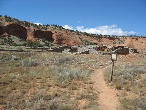
Chapter five of Crucible of Pueblos brings us to Chaco Canyon and the surrounding area. This is an area of particular interest for me, and I presume for most readers of this blog as well. While the rise of Chaco in the tenth and early eleventh centuries AD was clearly a development rooted in earlier events, there has long been less information available for the area of Chaco itself than for the areas to the north that have seen extensive relatively recent excavations of sites dating to the Pueblo I period. The Pueblo I occupations of those areas, the subjects of the earlier chapters in this book, are now fairly well understood, although there of course remain a lot of questions and gaps to fill. Further south the picture is still much murkier.

This chapter is written by prominent Chaco specialists Tom Windes and Ruth Van Dyke, and is particularly important and useful because it includes the first published synthesis of the work Windes has been doing for many years to identify sites in and around Chaco dating to the Pueblo I period. This work was written up as part of the series of reports on the work of the Chaco Project, but that report, dated 2006, remains unpublished. I presume that this is a deliberate decision on the part of the National Park Service to keep sensitive information on site locations from becoming public (although I don’t actually know for sure). This chapter, then, appears to serve as the published record of this important work, which significantly alters the conventional interpretation of Pueblo I in Chaco.

The authors define their geographic scope as what they call the “Chaco Basin,” which is essentially equivalent to what is commonly know in the Chaco literature as the “San Juan Basin.” I think this is a useful change to the terminology, since “San Juan Basin” in the hydrographic sense refers to a much larger area than it is used for in this context, and while some use terms like “San Juan Physiographic Basin” to clarify this, it’s more straightforward to redefine the area and use a new term. “Chaco Basin” is a good term to use because the area more or less corresponds to the drainage basin of the Chaco River, including its tributaries, although it extends a bit beyond to the east and south into the Puerco Valley and Red Mesa Valley respectively. However it’s labeled, this region is roughly bounded by the San Juan River to the north, the Chuska Mountains to the west, the Zuni Mountains to the south, and the Jemez Mountains to the east.

Temporally, the authors restrict their attention in this chapter to the period from AD 700 to 925, unlike some other authors in this volume who also address the preceding Basketmaker III period. This is understandable but in some ways unfortunate, since there was an important Basketmaker III occupation of Chaco Canyon that was likely important in setting the context for Pueblo I developments, just as those developments were important in setting the context for Pueblo II. Confusingly, they use the term “Pueblo I” for sites dating from AD 700 to 875 and “late Pueblo I” for sites dating from AD 875 to 925. As we’ll see below, the distinction between these two periods is important in this region, as population and settlement patterns changed significantly at around AD 875. The specific terms they use still seem odd and liable to cause confusion, however.

Part of the reason the authors argue that the Pueblo I occupation in this region is poorly understood is that the ceramic chronology is different from that of the better-known sites to the north, and using the same types to identify time periods for sites in both regions leads to problems. They carefully define the types they use to identify sites to time period, and also use architectural criteria (which are however difficult to apply to unexcavated sites).

Most of this chapter is a summary of what is known about Pueblo I settlement in each subregion of the Chaco Basin, based in large part on hitherto unpublished fieldwork. As a result, I will structure this post according to the same subregions in the same order and summarize the information on each.

Northern and Northeastern Areas

The heading for this section says “Northwestern” rather than “Northeastern,” but it’s clear from the text that this in error. These areas, north and northeast of the Chaco River but still within the drainage of the San Juan, were sparsely populated throughout the Pueblo period. Windes and Van Dyke note that the Largo and Gobernador canyons, to the northeast of Chaco, may have served as conduits for populations migrating south from the Mesa Verde region into the Chaco Basin in late Pueblo I. A recently discovered village at the confluence of Largo and Blanco Washes included a great kiva and at least 22 habitation sites, with tree-ring dates from the great kiva pointing to construction at about AD 828. This area is roughly due south of the Cedar Hill and Ridges Basin areas of the Animas Valley, considered part of the Eastern Mesa Verde region in this volume, which had extensive but short-lived populations early in Pueblo I. The tree-ring dates from the Largo-Blanco village suggest that it may have been associated with the initial migration out of the Ridges Basin/Durango area in the early 800s rather than the larger migration in the late 800s. The Chaco River may have been another conduit for migrants from the north, as Windes and Van Dyke note that surveys have found a major increase in sites dating to the late 800s along the east side of the Chaco, compared to a virtual absense of sites for earlier in Pueblo I. This will be a recurring pattern in the region.

Chaco Canyon Proper and Environs

The initial survey work of the Chaco Project in the 1970s identified a fairly extensive Pueblo I occupation in and around the canyon, and publications from that time posited a gradual increase in population over the course of Pueblo I leading up to the florescence of Chaco as a regional center in Pueblo II. Based on his more recent work with ceramic classification and dating, however, Windes disputes this account. He argues that the number of sites assigned to Pueblo I in those surveys is vastly inflated, and that for most of the Pueblo I period the Chaco area had a small population which increased dramatically, presumably due largely to immigration, in the late Pueblo I period. In this chapter Windes and Van Dyke (though clearly this part is mostly Windes) summarize the results of Windes’s reevaluations of the Pueblo I occupation in and around the canyon, moving from east to west.

Pueblo Pintado Great House at Sunset

Pueblo Pintado Great House at Sunset

At the east end of Chaco Canyon, the Pueblo Pintado area was apparently unoccupied until about AD 875, when it was colonized by two groups who had markedly different material culture and appear to have come to the canyon from different directions. They formed separate site clusters about 3 km apart, north and west of the later great house of Pueblo Pintado.

The first cluster, located just north of the great house, includes one exceptionally large roomblock more than 50 meters long, accompanied by a trash midden that is also unusually large. Based on the temper of early ceramics in this cluster, the people appear to have come from the Mesa Verde region to the north, presumably as part of the mass exodus following the collapse of the Dolores villages in the late ninth century.

The second cluster, 3 km west of the first one, appears to have also been founded around AD 875 but continued in use well into the Pueblo II period. The ceramics are quite unusual in manufacture for the Chaco area and indicate origins to the south in the Mt. Taylor area. Interestingly, the roomblocks in this cluster were aligned along the road connecting the Pueblo Pintado community to the core area of Chaco Canyon, implying that this road may date to the late Pueblo I period.

Moving west, the next major cluster of Pueblo I sites is what is known as the Chaco East community, which also featured a later great house. This area also appears to have been unoccupied until about AD 875, when it was colonized by a group occupying small residential sites, possibly only seasonally. In the 900s the community grew considerably, and initial construction of the great house may date to this period, although it’s impossible to tell for sure without excavation.

Third-Story Walls with Type I Masonry at Una Vida

Third-Story Walls with Type I Masonry at Una Vida

Fajada Gap, at the eastern end of the main concentration of sites in Chaco during Pueblo II, is one of the areas where early surveys indicated a dense Pueblo I occupation which Windes disputes based on current understandings of the ceramic chronology. In fact, while there was unquestionably a small occupation of the area throughout Pueblo I involving scattered hamlets, this appears to be yet another part of the canyon where there was an influx of people in the late 800s who established the basis for the community that developed subsequently. There are two great houses in this community, Una Vida and Kin Nahasbas, both of which were constructed beginning in the late ninth century.

The largest Pueblo I (pre-875) settlement in the Chaco area is actually outside the canyon, along the South Fork of the Fajada Wash. This community contained 26 sites in an arc along the west side of the South Fork; no contemporary sites are present on the east side. The community is loosely clustered around a complex of four roomblocks which were connected by a short road to a great kiva, and it likely included about 230 people overall. Its main occupation was around AD 800, making it contemporary with the earlier villages in the Mesa Verde region, but the layout of the community is more like later villages such as those at Cedar Hill and in the Largo drainage. (The description of the community in this chapter is very confusing and it’s hard to tell in what respects it’s being described as similar to or different from villages in other regions.)

Many of the potsherds from the South Fork community were tempered with chalcedonic sandstone, which is typical of sites to the south near the modern community of Thoreau. There is also an unusually high abundance of yellow-spotted chert among the chipped stone assemblage, again indicating connections to the south. This type of chert occurs in the Zuni Mountains near Thoreau and is common in sites in that area.

Although this was the largest Pueblo I community in the Chaco area, it appears to have been very short-lived, with little trash accumulation. This suggests that the Pueblo I period was a dynamic time of extensive population movements in this area just as it was in the better-understood areas to the north. The subsequent Pueblo II occupation of the South Fork was much more extensive than the Pueblo I occupation and quite different, with sites dispersed up and down the valley rather than clustered in one area. A similar though somewhat smaller cluster of sites dating to the Pueblo I period was also present in the upper reaches of Kin Klizhin Wash to the west of Fajada Wash.

Old Bonito

Old Bonito

Returning to the main canyon, there were a few scattered Pueblo I hamlets between Fajada Gap and South Gap, but the occupation doesn’t seem to have been extensive. Even in South Gap itself, an area of considerable density during Pueblo II and the location of the cluster of great houses known as “Downtown Chaco,” Pueblo I occupation was sparse, with a few scattered sites in the gap. Apparently the only Pueblo I site known in this part of the canyon proper is Pueblo Bonito, where the earliest construction of the great house, known as “Old Bonito,” dates to the mid-800s (or possibly even earlier) and there is also an earlier pit structure excavated by Neil Judd in the 1920s. Judd thought the pit structure reflected an earlier occupation unrelated to the great house, but with improved dating showing that the great house was begun earlier than had been thought the idea of continuity is beginning to seem more likely.

There is no evidence for Pueblo I occupation between South Gap and the mouth of the canyon, possibly on account of flooding creating an intermittent lake on the canyon floor. At the mouth of the canyon itself, the Peñasco Blanco great house, begun in the late 800s, sits atop West Mesa, and right next to it is the important Basketmaker III village of 29SJ423. The period between these two important occupations, however, appears to have involved only minor settlement, although there are a few scattered Pueblo I sites. Just west of the mouth of the canyon, however, is Padilla Wash, which had a substantial Pueblo I occupation (possibly even more extensive than current records indicate, since many Pueblo I sites may have been misclassified as Basketmaker III in earlier surveys), another example of the main centers of Pueblo I population in the Chaco core being outside the canyon proper. Windes and Van Dyke note that Peñasco Blanco may have been an important focal point for migration into the canyon from the west and north during late Pueblo I, and that it was likely more important than Pueblo Bonito at this time.

The Chaco River

As noted above, the Chaco River (formed by the confluence of the Chaco and Escavada Washes at the mouth of Chaco Canyon) was likely one of the main conduits for migrants from the north, but it was much more than that. Pueblo I communities existed all along the Chaco and its tributaries, and some of these communities included early great houses that would have been influential in the development of the great house phenomenon that found its greatest expression in Chaco Canyon in the eleventh century. Windes and Van Dyke discuss a number of these communities, based on field research by Windes to reevaluate areas identified by early surveys as Chacoan outlier communities and to look for evidence of Pueblo I settlement and early great houses.

Just west of Padilla Wash is Kin Klizhin Wash, which was the site of extensive Pueblo II occupation but only has a few Pueblo I sites aside from the cluster at its upper reaches mentioned above. There is a late Pueblo I great kiva known as Casa Patricio in the upper part of the drainage, accompanied by a number of late Pueblo I residential sites; it’s not clear from the writeup here what relationship this site cluster has to the earlier Pueblo I cluster.

Just downstream from the mouth of Kin Klizhin Wash is the very important early site known as Casa del Rio. While this was initially labeled a large Chacoan great house, reexamination indicated that it is actually a composite of two building stages, both relatively early, with much of the bulk of the structure provided by a Pueblo I roomblock measuring 112 meters in length, with a later masonry great house built over the central portion beginning in the late ninth century. The early roomblock is by far the largest in the Chaco Canyon region, more than twice the length of the earliest construction stage at Pueblo Bonito, and it is estimated to have housed about 16 households or 88 residents. Windes and Van Dyke describe it as “reminiscent of those north of the San Juan River,” although again it is not clear what specific characteristics this refers to. A large number of food preparation tools were found in the area, although other residential sites are scarce. This was clearly an important site during the Pueblo I period which may have played a key role in attracting migrants to the area.

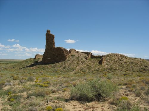
Looking North from Kin Bineola

Looking North from Kin Bineola

One of the most important tributary drainages of the Chaco River is Kim-me-ni-oli Wash, which extends from the Dutton Plateau north past the current site of Crownpoint. The drainage of this wash includes several great houses and extensive Pueblo settlement, and it likely served as an important conduit between Chaco Canyon and areas to the south and southwest. The extent of Pueblo I occupation, however, seems to be unclear. Windes and Van Dyke mention large circular structures near the Bee Burrow great house that resemble Pueblo I great kivas, as well as small Pueblo I roomblocks in the same general area. The area around the Kin Ya’a great house at the upper end of the drainage appears to not have any Pueblo I occupation based on existing survey data, although there is a large Basketmaker III-Pueblo I site just west of Crownpoint and one arc-shaped roomblock near Kin Ya’a recorded as dating to Basketmaker III looks a lot more like a Pueblo I site. At Kin Bineola, site of a major great house dating to the early 900s or possibly slightlier earlier, there is a very small Pueblo I occupation that increased substantially after AD 875 as in many other parts of the region.

At the mouth of the Kim-me-ni-oli Wash near the current Lake Valley Mission there is a small cluster of Pueblo I sites “architecturally identical” to the South Fork cluster, with very sparse refuse indicating a very short occupation. A later occupation in the late 800s was more substantial, with three masonry roomblocks “sometimes portrayed as small great houses” and “enormous amounts of refuse” that Windes and Van Dyke describe as “excessive for normal domestic activities.”

Further down the Chaco drainage, the Willow Canyon area is unusual in showing evidence of both middle and late Pueblo I occupation in close proximity. The middle Pueblo I community consists of eight sites that show the typical “scattered hamlet” settlement pattern, while the eleven late Pueblo I sites are tightly clustered and associated with a large amount of refuse, leading the authors to interpret this as “a large group” that immigrated into the valley together. These sites show unusual amounts of Type I masonry, associated with later great house construction, although the authors declare that there is no “obvious” great house. It’s not clear what definition of “great house” they are using here, as one site in particular (known as the “House of the Weaver”) shows not only Type I masonry but a prominent mesa-top location with a broad view of the surrounding area, another common characteristic of later great houses. Another community south of Willow Canyon near the later Whirlwind great house also shows a similar pattern but has less information available. The Great Bend area, where the Chaco River turns from flowing west to flowing north toward the San Juan, also shows this pattern. The possible use of the river as a corridor for populations migrating from the north after the collapse of the Dolores villages makes this potentially an important area for understanding regional prehistory.

Chuska Mountains from Peñasco Blanco

Chuska Mountains and Chaco River from Peñasco Blanco

The eastern flanks of the Chuska Mountains, which parallel the north-flowing segment of the Chaco River and form the western side of its drainage basin, are also important for understanding Pueblo I settlement but are poorly known. The general pattern seems to be the same as elsewhere in the Chaco Basin, with a scattered occupation in early and middle Pueblo I that sees a huge increase, presumably from immigration, in late Pueblo I after AD 875, but due to depositional factors it’s likely that the earlier Pueblo I occupation has been underestimated. A few sites dating to this period have been excavated through salvage projects. Late Pueblo I sites are more common and seem to provide more evidence for the use of the river as a corridor from the north. The largest concentrations are in the Skunk Springs and Newcomb areas, both of which would become major Chacoan outlier communities in Pueblo II. At Newcomb, at least, there seems to be some evidence of a preexisting Pueblo I occupation. It’s not clear if there is any similar evidence at Skunk Springs, where the earliest stage of construction on the great house seems to date to late Pueblo I. Given the importance of Chuskan imports to Chaco at its peak, more research on the background of these communities would be helpful in understanding Chaco’s origins.

The Red Mesa Valley

The Red Mesa Valley is the area between the Dutton Plateau on the north and the Zuni Mountains on the south. It is topographically rather than hydrologically defined, and straddles the Continental Divide, with the western part drained by the Rio Puerco of the West and the eastern part drained by the Rio San Jose. This means it falls outside of the “Chaco Basin” as hydrologically defined, of course, but its culture history means that it makes sense to include it with areas to the north for purposes of this chapter. This valley was presumably an important travel corridor prehistorically, as it certainly was historically with the railroad and Route 66 running through it and remains today with Interstate 40.

Casamero Pueblo

Casamero Pueblo

This area has been the main focus of Van Dyke’s research, and it is clear that she rather than Windes is responsible for most of this section of the chapter. The same issues of ceramic identification as in the Chaco Basin make understanding the Pueblo I sequence here difficult, but the same basic pattern appears to apply as further north. Early in Pueblo I there was a small, scattered occupation, exemplified by a site on the mesa above the later Chacoan outlier community of Casamero. This site consists of at least two arcs of surface rooms fronted by five to seven pit structures, and resembles White Mound Village further west along the Puerco, which was excavated by Harold Gladwin in the 1940s and dates to the late 700s and early 800s. Another site like this from the same period was excavated near Manuelito during the construction of I-40 in 1961.

This sparse population expanded immensely in late Pueblo, when many of the later Chacoan great house communities were founded. Some of the earliest great house construction in the region took place in these communities, which Van Dyke has elsewhere used to argue that great houses were not initially associated particularly with Chaco Canyon specifically. The huge increase in population at this time seems to indicate immigration, but this chapter doesn’t address the issue of where the people in this area might have come from. Given the similarities to the communities to the north in the Chaco Basin, that seems like an obvious point of origin (with earlier origins probably further north in the Mesa Verde region), but developments to the south are poorly understood and can’t be ruled out as important factors. As noted above, some of the immigrants to Chaco Canyon and its surrounding area appear to have come from the south rather than the north, and southern origins would presumably be even more likely for the Red Mesa Valley populations given their location. The fact that the influx here appears to happen at the same time as the northern one is an interesting complication, however.

The Eastern Chaco Basin

This area, stretching from the area south of Chaco Canyon across the Continental Divide to the Rio Puerco Valley of the East, shows very little evidence for Pueblo I occupation. Today this is a very sparsely populated area used mainly for cattle ranching, primarily on private land, so there has been little archaeological survey, but what survey has been done shows very little prehistoric occupation at all. Only two exceptions are noted by Windes and Van Dyke. One is a recently discovered Pueblo I community southeast of Mt. Taylor, about which little is known. Detailed information from the survey that identified this community is apparently not going to be released. It’s not clear from the brief writeup if this has anything to do with the fact that the survey was for proposed uranium mining.

The other exception is the Puerco Valley of the East, around the later Chacoan outlier of Guadalupe. Here, survey by Eastern New Mexico University in the 1970s identified a “modest but scattered” Pueblo I occupation, which increased substantially in late Pueblo I and Pueblo II, culminating in the Guadalupe community with its apparently close connections to Chaco Canyon. Windes and Van Dyke note that the Puerco may have served as an important conduit connecting the Chaco Basin to areas further east, although it remains poorly understood. The eastern associations of Chaco are poorly understood in general, and this appears to be the case as much for Pueblo I as for Pueblo II.

Storm in the Distance through Fajada Gap

Storm in the Distance through Fajada Gap

After going through the detailed geographical summaries, the authors briefly address some region-wide issues important for understanding the patterns they describe. They acknowledge environmental factors as probably important in understanding population shifts, pointing in particular to an apparent “spike” in rainfall in the immediate area of Chaco Canyon between AD 885 and 905 that might have served as a “pull” factor bringing people in from other areas. Conditions in the Chuskas and Red Mesa Valley appear to have been generally unfavorable during this period in which they, too, saw significant immigration, so clearly rainfall totals weren’t the only factor.

They also discuss violence, noting that there is very little evidence for it in this region, particularly in the central Chaco Basin, during Pueblo I, especially compared to areas further north where burned structures are common. There are more burned structures in the Chuskas and near Mount Taylor, on the edges of this region, however, and it is possible that the lack of them in the central basin relates more to the lack of construction wood than to any lack of violence. The authors suggest that, given the known evidence for strife and community abandonment in the Mesa Verde region, one attraction of the Chaco Basin might have been its relative emptiness, which may have drawn people into this much harsher and less fertile region. There’s a general tendency for settlement to cluster around drainages and particularly at  confluences of drainages, likely because these locations offered the best agricultural potential in a very dry area even by Southwestern standards. Regardless of what it was that initially drew people into this area, it’s becoming increasingly clear that this influx of population was a key factor in the later rise of Chaco.

Peñasco Blanco Framing Huerfano Mesa

Peñasco Blanco Framing Huerfano Mesa

The authors also discuss visibility and sacred geography, which has been a key concern of Van Dyke’s in her previous work. Many of the prominent community buildings in late Pueblo I sites in this region, whether or not they can be considered “great houses,” are situated in locations where important regional landmarks can easily be seen. This indicates that the concern with visibility associated with later Chacoan great houses likely had its roots in this period.

Finally, the authors summarize community settlement patterns in the region. One interesting pattern they note is that in late Pueblo I communities great houses and great kivas don’t tend to occur together, with great houses being more common in the Chaco Basin and great kivas in the Red Mesa Valley. This suggests that two different community integration systems may have been in place in the region during this time. The great house pattern at more northerly sites is interesting in the context of the “proto-great-houses” apparently present at some Dolores area communities further north, especially McPhee Village, and it’s quite likely that there is a direct connection between the two. Great kivas are also common further south, and while they were present at some Mesa Verde Pueblo I sites they weren’t very common. This suggests that at least some of the Red Mesa Valley late Pueblo I communities were in fact settled by immigrants from the south rather than from the Chaco Basin. Some of the earliest communities showing both features were in Chaco Canyon, and it may well be that one factor in the rise of Chaco was the ability of emerging elites there to combine the two traditions into a new social and ideological system, one that would spread far and wide, remaking the course of Southwestern prehistory.

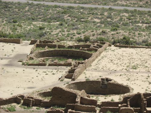
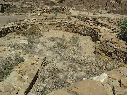
Great Kivas A and Q, Pueblo Bonito

Great Kivas A and Q, Pueblo Bonito

Read Full Post »

Looking East from Casamero Pueblo

Looking East from Casamero Pueblo

Unmanned aerial vehicles (UAVs), popularly known as “drones,” have become increasingly common in recent years as the technology behind them has developed. Some uses are controversial, such as military applications and uses that might violate privacy expectations or be dangerous to other aircraft, but other uses are more benign and can potentially open up new frontiers.

In archaeology, UAVs are increasingly being used for aerial photography and remote sensing in many places around the world. These are types of research that have been established for decades, but that until recently were prohibitively expensive for most archaeologists since they required both expensive camera equipment and the use of airplanes or helicopters. With the development of both lighter, less expensive cameras and UAVs that are robust enough to carry them, this type of research is now much more practical.

A recent paper by a team of researchers including Jesse Casana of the University of Arkansas and John Kantner of the University of North Florida reported on research using a UAV to take infrared thermal imagery, or aerial thermography, as well as color photography, of sites in the Blue J community south of Chaco Canyon, New Mexico. (Casana has the paper posted on his Academia.edu page.) Kantner has been studying Blue J and the surrounding area for several years and has come up with some interesting results.

Blue J is in an area at the southern edge of the San Juan Basin that is thick with Chacoan outlier communities, most of which date to fairly early in the Chacoan era and many of which were apparently abandoned while the Chaco system was flourishing. Casamero Pueblo is one site very close to Blue J where a great house has been excavated and is open to public visitation. These communities typically have one or more great houses and great kivas, and in fact it is unusually common for communities here to have multiple great houses compared to other Chacoan outlier communities. At Blue J, however, Kantner has so far not identified any great houses or great kivas. As he says on his website:

Turquoise, marine shell, jet, azurite, malachite, and other exotic materials attest to the success of Blue J’s inhabitants. Oddly, however, what was originally thought to be a great house turned out to be a normal residential structure, making Blue J the only community for miles around without Chacoan architectural influence.

Now, part of what’s going on here may have to do more with how archaeologists define “great house” than with anything about Blue J specifically. The function of the monumental buildings that have been given this label remains a point of active contention among scholars, with some arguing that they were primarily residential, perhaps housing community elites or religious leaders, and others arguing that they were non-residential public architecture, perhaps with ritual significance as sites of pilgrimage and/or communal feasting. Kantner belongs to the latter camp, so finding “normal” residential features at a suspected great house removes it from consideration as such, whereas another archaeologist might interpret such findings differently. (It’s worth noting that many if not most excavated “great houses” have showed at least some evidence for residential use, and in some cases they have not been noticeably different from other residential structures in a community except in size and location.)

The focus of the recent study was on demonstrating the potential for using UAVs to do fast, inexpensive survey of large sites and to identify buried features. Blue J is well suited for this on both counts. It is located at the foot of a steep cliff, which has resulted in many sites in the community being covered with substantial deposits of sediment carried by water and wind, making them difficult to identify on the surface. It is also fairly large for a Chacoan outlier community, with over 50 residential sites identified through previous surveys, which makes a fast method of survey over a large area an attractive proposition.

The study consisted of doing several flights with a UAV over the site, at different times of day and night, primarily with the infrared thermal camera to capture differences in temperature that are expected to be present between archaeological features and the dry desert soil. The original intent was to do some of the flights in the hottest part of the afternoon, but high winds ended up making this impossible. The results were nevertheless impressive: one site that had been previously identified through survey and limited excavation showed up clearly in the imagery, with buried walls visible in some of the images. Several other sites that had been identified but not excavated showed up as well, with buried walls again visible. A large circle showing a possible great kiva is particularly interesting given that no great kiva has yet been identified from surface survey.

Obviously further work is necessary to confirm some of the results from the imaging, but this is a very successful demonstration of the potential for this technology to improve survey and site identification so that further research can be focused on the most promising locations for sites. Other sensing techniques such as ground-penetrating radar have also been tried in the Southwest, but they are much slower and can be thrown off by some characteristics of the desert environment. Aerial thermography using UAVs offers another option that seems to have a lot of potential and it will be interesting to see how it is used as the technology continues to advance.
ResearchBlogging.org
Casana, J., Kantner, J., Wiewel, A., & Cothren, J. (2014). Archaeological aerial thermography: a case study at the Chaco-era Blue J community, New Mexico Journal of Archaeological Science, 45, 207-219 DOI: 10.1016/j.jas.2014.02.015

Read Full Post »

Looking South from Kin Ya'a

One of the most notable examples of an assemblage of highly mutilated human remains from the Southwest being attributed to witchcraft execution rather than cannibalism, in accordance with J. Andrew Darling’s theory discussed in the previous post, is Ram Mesa, southwest of Chaco Canyon near Gallup, NM.  This site was excavated by the University of New Mexico as a salvage project, and the relevant assemblage was reported by Marsha Ogilvie and Charles Hilton in 2000.

The Ram Mesa assemblage, consisting of 13 individuals, is pretty similar to many other assemblages in the Southwest attributed to cannibalism, but Ogilvie and Hilton make a plausible case that while the remains are clearly highly “processed” there isn’t a whole lot tying this dismemberment and mutilation to actual consumption of the remains.  Few of the bones showed any evidence of burning, a condition which applies to several other cases of alleged cannibalism as well.  The few cut marks, which were mostly found on children’s skulls and lower jaws, weren’t particularly indicative of the removal of large muscles that might be expected if consumption were the object.  On the other hand, however, relatively few of the bone fragments were sufficiently large to be identified to body part, and any diagnostic evidence from these tiny fragments was clearly destroyed by the thoroughness of the processing.  It’s not clear, therefore, how representative the larger fragments with surviving evidence of burning and cutting are of the entire assemblage.  The most I would say about this site is that the evidence is not sufficient to make a positive diagnosis of cannibalism, and other explanations are therefore plausible.

However, as I noted before in discussing Darling’s arguments, witchcraft execution and cannibalism are not necessarily mutually exclusive.  Indeed, the execution of suspected witches may well have involved some level of cannibalism among some Southwestern groups in prehistoric times, thought there is certainly no evidence that it did in historic times as documented by ethnographers.  There are some other oddities about the Ram Mesa site that suggest that it might not be expected to pattern with the majority of the suspected cannibalism assemblages, so it is certainly possible that it represents a variation on the same behavior that may not have included cannibalism.

For one thing, this is an odd place for one of these assemblages.  Although some early excavations at Chaco Canyon and in northern Arizona have been proposed as showing evidence of cannibalism, the vast majority of the well-documented cases are in southwestern Colorado, especially around the modern town of Cortez.  This includes the Cowboy Wash site, the site with the best evidence for cannibalism of any of them.  Given the known cultural differences between prehistoric populations at the northern and southern edges of the San Juan Basin (the San Juan and Cibola Anasazi, respectively), it’s quite possible that the cultural activities resulting in similar assemblages in these two areas may have been somewhat different, with the San Juan groups practicing cannibalism and the Cibola groups not.

Furthermore, there may be differences in the dating of the sites.  Most of the well-documented Cortez-area sites date to right around AD 1150, and they may all represent part of a single event at that time, which was in the midst of a severe drought when social structures were likely under extreme stress.  The Ram Mesa site is dated by six radiocarbon dates to a period that Ogilvie and Hilton describe as “AD 978 to 1161.”  They do clarify that these are calibrated dates, which is helpful, but it would have been better if they had shown the ranges for the individual dates, as well as the materials that were dated, which would give a better idea of the most likely dating for the human remains.  On the assumption that the remains date to the latest period of occupation, which seems plausible based on comparison to similar assemblages elsewhere, this puts the latest date at 1161, which is interestingly close to the dates for the similar Cortez sites.  Due to the lack of information of the dates, however, it’s not clear is this is an intercept (i.e., most likely) date or the late end of a range; if the latter, it’s possible that the assemblage dates to somewhat earlier than the Cortez sites.  In that case it would not be part of the same phenomenon, whatever that was, and the postulated lack of cannibalism may be related to that.

In any case, this site definitely seems to have been within the Chacoan sphere of influence, which makes the interpretation of the remains there important for understanding the relationship of alleged cannibalistic events to the rise and fall of Chaco.  Christy Turner has famously argued that they represent the expansion of the Chacoan system and the use of brutal force by the rulers of Chaco (hypothesized on very dubious evidence to be Toltec immigrants from central Mexico) to ensure that outlying communities were incorporated into the system and supplied tribute to the canyon.  This idea is pretty implausible based on the evidence from the Cortez area, where most of the assemblages date to the period of Chaco’s decline rather than its rise.  If Ram Mesa dates to the same period it would support that evidence, whereas if it dates to earlier it could conceivably either support Turner’s ideas or point to a different interpretation, perhaps having something to do with the well-known fact that the outlying Chacoan communities to the south of Chaco seem to have been abandoned beginning much earlier than those in other directions.  There are a lot of outlying Chacoan great houses in this area, including Casamero and Kin Ya’a, but they seem to have rather different histories than those to the north, such as Aztec Ruins and Yellow Jacket.

Like most research related to Chaco, this paper ultimately raises more questions than it answers.  That’s not necessarily a bad thing, however, especially when it comes to a topic as controversial and poorly understood as these assemblages suggesting cannibalism.
ResearchBlogging.org
Ogilvie, M., & Hilton, C. (2000). Ritualized violence in the prehistoric American Southwest International Journal of Osteoarchaeology, 10 (1), 27-48 DOI: 10.1002/(SICI)1099-1212(200001/02)10:13.0.CO;2-M

Read Full Post »

Pueblo Bonito from Peñasco Blanco

The paper I discussed earlier about evidence that corn was imported to Chaco was interesting, but while it provided important information about the poorly understood “Mesa Verdean” period after the fall of the Chaco system it didn’t address the question of food imports during the operation of that system.  This has been a topic of considerable debate, and the extent to which corn was being imported to Chaco from outlying areas versus being grown in the canyon itself has major ramifications for which theories about the nature of the system seem most plausible.  Luckily, however, that paper was just one in a long series reporting on research done by Larry Benson and others on this topic, and a slightly earlier one by Benson, H. E. Taylor, and our old friend John Stein addresses the question of earlier (and later) periods.

Peñasco Blanco from Pueblo Bonito

This paper uses the same basic methodology of the other one, based on strontium isotope ratios, and it also attempts to use concentrations of other trace elements to further narrow down source areas for corn cobs from archaeological sites.  Unfortunately, however, most of the trace elements the researchers looked at had their concentrations heavily skewed by post-depositional contamination, which made them useless for determining sources.  The only elements that seemed to be mostly unaffected by this problem were potassium and rubidium, so the paper uses the ratio of these two elements as an additional marker for places where the cobs may have been grown, although it cautions that it’s not yet totally clear that this ratio is actually as meaningful as the analysis implies.

Aztec West Great House, Aztec Ruins National Monument

This study looks at more cobs than the other one.  These are from both Chaco and Aztec, and the Chaco ones come from a variety of sources.  The most numerous are from Gallo Cliff Dwelling and are part of the large group with nearly identical radiocarbon dates in the late 12th century that was analyzed in the more recent paper.  This paper conducts a similar analysis and comes to similar conclusions about the wide range of possible sources for these cobs.  This group also includes a few cobs from Pueblo Bonito, Chetro Ketl, and Kin Kletso, although the authors caution that the late dates on these cobs don’t necessarily imply that these great houses were still occupied at this late date; the cobs could also result from people living in small sites like the Gallo Cliff Dwelling dumping their trash in the abandoned buildings.  While most of the Chaco cobs come from this narrow time period, and the Aztec cobs (which have not been carbon-dated) likely date from a roughly comparable time as well, some Chaco cobs are dated to both earlier and later times.  The later ones, some of which date to the nineteenth century, are presumed to reflect the later Navajo occupation of the area.  It’s the earlier ones that are of interest for the light they can shed on the operation of the Chaco system in its heyday.

Pueblo Bonito from Above

There are six cobs with carbon dates earlier than the major drought of the mid-12th-century.  Five of these come from Pueblo Bonito, and one comes from the Gallo Cliff Dwelling.  The Gallo one is puzzling, since all the other Gallo cobs date to much later and cluster tightly together, and the site itself was probably not occupied early enough to account for the early cob.  It’s possible that this date is due to something odd going on with the radiocarbon dating, and in any case it seems hard to generalize from, so I’m not going to discuss it further here and will instead focus on the five cobs from Pueblo Bonito.

Interior T-Shaped Doorway, Pueblo Bonito

Four of these come from Room 3; the other one comes from Room 170.  These are both interesting rooms in their own right, but first let’s talk about the cobs.  Although the authors of the paper classify them only as “pre-AD-1130” (i.e., before the drought that is thought to have coincided with the fall of Chaco), they actually all date considerably earlier than that.  The earliest, which unfortunately seems to have been contaminated and thus unusable for the strontium analysis, is from Room 3 and has a calibrated radiocarbon date range of AD 765 to AD 902 with 95% confidence (2σ).  The other four are somewhat later and cluster tightly together, with 95% confidence intervals of AD 944–1052 (this is the one from Room 170), AD 892–1034, AD 893–1026, and AD 889–1021.  This means that these cobs all date to a period before the Chaco system reached its full florescence, which is generally dated to the late eleventh century.  They also seem to date earlier than the expansion of Pueblo Bonito in the 1040s.  The 95% confidence interval for the cob from Room 170 does make it possible that it dates to the period of the expansion, but at a lower level of confidence (1σ) it has a tighter range of AD 974 to AD 1040, which means it too probably predates the expansion.

Old Bonito

Thus, all these corn cobs seem to have been grown and eaten during the period when Pueblo Bonito consisted only of the original arc of rooms, constructed with early, Type I masonry, that we now call Old Bonito.  This makes their geographical origin even more interesting to investigate.  During this period, consisting of the ninth, tenth, and early eleventh centuries, Chaco Canyon seems to have been growing in regional importance, as evidenced by the construction of the early great houses, but it doesn’t seem to have yet attained the preeminent position and centrality it would achieve in the late eleventh and early twelfth centuries before its collapse.  The earliest cob, which probably dates to the ninth century, which is when the early great houses were first being constructed, would be of particular interest in determining where the people in Chaco were getting their food at that time.  It’s very unfortunate, then, that its origin can’t be determined from strontium analysis because of its apparent contamination.  The other three cobs, however, which probably date to the late tenth or early eleventh century, were included in the strontium analysis, so it’s worth looking closely at what the results of that analysis can tell us.

Type I and Type II Masonry Abutting at Peñasco Blanco

These cobs date to a period when there seems to have been little or no construction at Pueblo Bonito, Una Vida, and Peñasco Blanco, the three earliest great houses in the canyon.  All three saw extensive construction in the late ninth and early tenth century, and major expansion starting in the middle of the eleventh.  The time of the cobs, then, seems to have been a relatively quiet period in the canyon, although the early stages of construction at some of the other great houses, such as Chetro Ketl and Hungo Pavi, may date to this period.  There doesn’t seem to have been a whole lot of great-house construction outside of the canyon, either; there were already quite a few great houses out there, especially to the south in the Red Mesa Valley and to the west along the Chuska Slope, but most had already been built, and the biggest of the outliers, especially to the north, wouldn’t be built until considerably later.

Side Wash by Chetro Ketl

So, if the strontium evidence were to suggest that the cobs from this period were grown in the canyon, that would suggest that local agricultural production was important at Chaco, and it would support theories that attribute Chaco’s rise to regional dominance as having to do at least in part with agricultural surplus during favorable climatic conditions.  If, on the other hand, the strontium evidence were to suggest that the cobs were grown outside of the canyon, that would be evidence in favor of other theories that see the rise of Chaco as due not to local production but to the Chacoans’ ability to somehow acquire food from other areas with better growing conditions.  This would be particularly the case if the cobs came from areas that had early outliers.  It would also be interesting if the cobs came from areas that aren’t known to have had outliers this early but did have them later (e.g., the Totah).  These theories propose a variety of answers for how the Chacoans could have done this, of course, ranging from coercive political domination to inspirational spiritual power.

High Walls at Kin Bineola

So, with that in mind, what does the strontium (and potassium/rubidium) evidence say?  In brief, it supports the latter option.  The strontium ratios in the cobs are close to the values at a few of the sampled sites in and around the canyon, but when the potassium/rubidium ratios are added in, they narrow the potential sources down considerably, and none of the local Chaco sources makes the cut.  So, to the extent that the potassium/rubidium evidence is useful (which, remember, is still not totally clear), it seems that the Chacoans were importing corn at least as early as the early eleventh century, and possibly a century earlier.  This seems to support the theories that hold that local agricultural production was not the main driver of Chaco’s rise, although this is of course a very small sample and it would be foolish to draw too many firm conclusions from it.

Sign at Kin Bineola

So if the corn wasn’t being grown at Chaco, where was it grown?  Unlike with the later cobs, and again likely owing at least in part to the small sample size, the number of potential source areas identified here is pretty small.  A couple are in the Totah near Aztec, but all the rest are in the area surrounding Chaco often called the “Chaco Halo” and consisting of the parts of the Chaco Wash drainage both upstream and downstream from the canyon, including the South Chaco Slope area on the north side of Lobo Mesa.  The specific sampling sites with matching ratios were near a number of important Chacoan outliers, including Kin Ya’a, Kin Klizhin, Kin Bineola, and Pueblo Pintado.  Interestingly, of these four only Kin Bineola is known to have been built at this time, and the others were not built until considerably later, at least in their current form.  The fact that Kin Bineola is one potential source area, as are a few smaller early great houses that were present at this time, suggests that the later outliers may have been built on top of earlier versions, or at least that the communities surrounding them may have been incorporated into the Chaco system earlier than the dates of their great houses would imply.  Of course, it’s also possible that all of these cobs came from one or a few of the areas with known early great houses; the fact that a large number of areas could have grown these cobs doesn’t mean that they all did, and in fact given the small number of cobs it would be impossible for all the areas identified to have contributed to growing them.

Kin Bineola from a Distance

It’s not necessarily surprising to find that nearby areas known to have been in close contact with Chaco would have been supplying it with corn.  Indeed, many of these areas are considerably better for agriculture than the canyon, and there has long been speculation that at least some of the outliers were founded specifically in order to supply the canyon with food.  What is somewhat surprising here, however, is the early date at which this appears to have already been happening.  The great houses at Chaco would not necessarily have been any more impressive than those in many other local communities at this point, and given the lack of construction activity in the canyon it would be quite reasonable to suppose that Chaco was not yet considered exceptional within the region.  This evidence, however, suggests that there was already something unusual going on in the canyon, and that something was getting people around it to supply it with at least some food.

Early Masonry at Kin Bineola

One more thing to consider about these cobs is where they were found.  Since Pueblo Bonito was definitely around at the time they were grown, imported, eaten, and presumably thrown away, and since they were found at Pueblo Bonito, it seems logical to conclude that the rooms where they were excavated were the same rooms where they had originally been tossed.  This is almost certainly not true, however.  Rooms 3 and 170, where they were found, had not yet been built in the early eleventh century.

Room 3, Pueblo Bonito

Room 3 is part of an arc of rooms fronting on the western section of Old Bonito.  Unlike the rooms behind it, however, it is built out of late core-and-veneer masonry, and it was likely built considerably later than those rooms, which are built with early masonry.  The difference is quite noticeable.  The spaces later enclosed by it and the other plaza-facing rooms in this arc was probably originally enclosed by a ramada or awning, or perhaps a wattle-and-daub (or “jacal”) wall, which was later replaced with masonry.  The sequence of construction in this part of the site is hard to untangle, and Room 3 produced no tree-ring dates, but it is pretty clear that it must have been constructed at some point after AD 1040, just judging from the masonry, and the presence of the cobs in it likely dates to a time long after its initial construction when it was used for dumping trash.  One of the other cobs found in this room was part of the late-12th-century date cluster, so that may be when this trash deposit originated.

Room 170, Pueblo Bonito

Similarly, Room 170 is part of the southernmost block of rooms, which was one of the last parts of the site to be built.  It seems to have been built as part of the construction of the southeast corner of the site, one of the largest single building projects in Chaco’s history, which probably took place around AD 1080.  Room 170 has an odd set of internal features; its first story was at some point divided by an east-west wall, and the part of the room north of the wall was filled in, with a space left, however, to allow access to the second floor of both it and the room north of it.  There is also a small opening just south of the dividing wall leading into the next room west, and a step below it.  Again, this room was likely not originally used for trash dumping, and the trash deposits in it likely date to a later period.

Metate Fragment at Pueblo Bonito

Since neither of these rooms was used for dumping trash until quite late, perhaps even after the fall of Chaco as a regional center, why did they contain corn cobs from centuries earlier?  Probably because the trash being dumped in them was being moved from wherever it had originally been dumped.  Where that would have been, who would have been doing this, when, and why are all very difficult questions to answer, but I don’t see any other explanation to reconcile the dates of the corn cobs with their locations.  This also means that, while these cobs were found at Pueblo Bonito, they weren’t necessarily originally brought there.  They may have been, of course, and I’d even go so far as to say that they probably were, but it’s also possible that the trash deposit in which they were originally placed was somewhere else in the canyon, perhaps even associated with another site.

Sealed Vent, Pueblo Bonito

Like all good papers about Chaco, this one answers some questions but opens up others, and it definitely provides plenty of (imported) food for thought.  There’s still a lot we don’t know about the Chacoans, even such basic things as where they  got their food, but the process of finding these things out is quite a ride and full of surprises.
ResearchBlogging.org
BENSON, L., STEIN, J., & TAYLOR, H. (2009). Possible sources of archaeological maize found in Chaco Canyon and Aztec Ruin, New Mexico Journal of Archaeological Science, 36 (2), 387-407 DOI: 10.1016/j.jas.2008.09.023

Read Full Post »

Exterior of Reconstructed Great Kiva, Aztec Ruins National Monument

One of the most interesting and potentially productive lines of research in Southwestern archaeology these days involves the use of chemical analyses of various archaeological materials to extract more information about the societies that used them than is apparent just from looking at them.  The oldest and most established type of research like this is radiocarbon dating, which has historically been used less in the Southwest than elsewhere because it’s both expensive and less precise than tree-ring dating, which was invented in the Southwest and has been extremely important in the study of its prehistory.  Lately, however, archaeologists in the Southwest have been using radiocarbon more and more, since it can be used on anything organic (useful for sites which produce no datable wood but plenty of other organic material) and it’s been around for so long that the dates are considered very reliable.  They’ve also begun to use some other techniques that are newer but have enormous potential, which is already starting to be realized, to illuminate aspects of the past that have been the cause of much debate.

Intact Roof at Aztec Ruins National Monument

The most important of these is strontium isotope analysis, which we’ve seen before in the analysis of the wood brought to Chaco for architectural use.  Like radiocarbon dating, strontium analysis is based on looking at the ratio of two isotopes of an element, one of which is stable and the other of which is produced by the radioactive decay of another element and therefore varies.  Unlike radiocarbon, however, strontium cannot be used for dating on archaeological timeframes, since the half-life of the radioactive decay process involved (the conversion of rubidium-87 to strontium-87) is 48.8 billion years.  It can, however, be used to identify locations, since the amounts of strontium and rubidium in different areas vary a lot and strontium is absorbed unchanged by organisms from their environment.  Thus, in theory, one could test an organic artifact for its strontium ratio, then compare that to the strontium ratios of the water or soil in various places where the artifact may have originated and figure out where it came from.  This would then allow all sorts of archaeological conclusions.

Intact Roof at Pueblo Bonito

Of course, it’s never quite that simple, as the case of the wood shows.  It was relatively easy to use this analysis for the high-elevation types of wood that occur in relatively few places in the Southwest, but when the technique was extended to the very common ponderosa pine beams the number of possible origins increased so much that few definite conclusions could be reached.  There is also the problem of making sure that the strontium ratios found in the archaeological material actually resulted from growth processes rather than contamination by later mineral deposits.  Since this technique is relatively new, the methodology for it is not yet totally worked out, and not every attempt to use it ends up working.

Row of Metates, Aztec Ruins National Monument

Both the promise and the pitfalls of strontium analysis are shown clearly by a new paper by Larry Benson of the United States Geological Survey.  Benson has made something of a name for himself as the main player in the increasingly important analysis of corncobs found in Southwestern archaeological sites.  Corn is a useful plant to use for this sort of thing for a number of reasons:

  • It’s pretty common, especially in sites like cliff dwellings and Chacoan great houses with especially good preservation of organic material.  The Anasazi depended heavily on corn for their diet, so there are corncobs all over the place.
  • It grows quickly.  This is not important from the perspective of strontium analysis, but it means that radiocarbon dating can provide a very accurate range of dates within which the corn was grown and eaten.  This is in contrast to slow-growing plants, such as trees, which have the problem that the part tested may happen to be much older than the date of use.  The combination of accurate dating with strontium-based source determination makes corn a very powerful source of information.
  • It bears directly on a variety of important cultural questions.  Since corn was the main source of food for the Anasazi, finding out if they were growing it themselves or importing it from elsewhere has major implications for models of cultural systems and their means of support.  This is a longstanding issue in the study of Chaco specifically.

This particular paper addresses several issues, both substantive and methodological.  Substantively, Benson analyzes a set of corncobs excavated from the Gallo dwelling in the Chaco campground in the 1950s and adds the data derived from them to the data from earlier studies of cobs from this site as well as from Pueblo Bonito and Chetro Ketl.  He also reports on strontium isotope ratios from several agriculturally productive areas of the Zuni Reservation and adds them to the previously reported data from other parts of the Colorado Plateau.  He then combines this new information with the previously reported data to draw some specific conclusions about the sources of some of the cobs.  Importantly, however, he does not come to any conclusions about the sources of the newly analyzed Gallo cobs.

Metate at Pueblo Bonito

The reason for this lies in the methodological side of the paper, which may be the most important in the context of overall research on this topic.  The cobs Benson reports for the first time here, unlike the previously analyzed cobs, were not burned, and part of the purpose of this research was to see if the procedures used to prepare and analyze the burned cobs could be used for unburned cobs as well.  As it turns out, they can’t, and the strontium ratios from the unburned cobs appear to come from post-depositional mineral contamination rather than growth conditions.  This seems to be because the act of burning effectively “seals in” the trace minerals in the cobs, protecting them from contamination.  While this result is somewhat disappointing, in that it means that the strontium data from the new cobs can’t be used to draw any conclusions, it is important in informing others that if they want to do this kind of research on unburned corn cobs they need to come up with new procedures.  In the course of doing this analysis Benson also uses some data on recent experimental growing of Pueblo varieties of corn in Farmington that provides valuable reference material on just how closely strontium ratios in corncobs can be expected to correspond to the ratios in the soil and water in the area.  The answer is closely, but not perfectly, which is also useful information for future researchers.

Keyhole-Shaped Kiva, Aztec Ruins National Monument

Despite those issues, however, this paper does include some important substantive conclusions.  Although the new cobs couldn’t be used for strontium analysis, they did produce radiocarbon dates, which correspond very closely to the dates on the earlier Gallo cobs as well as some of the ones from Pueblo Bonito and Chetro Ketl.  Interestingly, these dates all cluster tightly around the AD 1180s.  As Benson points out, this is after the major drought of the mid-twelfth-century, which is generally interpreted as marking the “collapse” of the Chaco system and the possible depopulation of Chaco Canyon.  It has long been known that the canyon was occupied later, from the late twelfth century until the total abandonment of the region during the “Great Drought” of AD 1276 to 1299, but it’s unclear if the population at that time consisted of a remnant from the earlier Chacoan occupation or a reoccupation by people from elsewhere who may or may not have been descended from the earlier Chacoans.  In any case, whoever the people were who lived in the canyon in the 1180s, these are their corn cobs.

Keyhole-Shaped Kiva at Pueblo Bonito

They didn’t grow them, though.  In what is probably the most interesting conclusion of Benson’s paper, and certainly the most surprising, he goes through a careful analysis of the strontium data, excluding the data from the unburned cobs, and finds that the values from the cobs do not overlap with any of the locations in the Chaco area, either in the canyon or around it, that have been tested.  It’s certainly possible that they come from somewhere nearby that hasn’t been tested, but at this point a lot of potential growing locations in and around the canyon have been analyzed, so there aren’t a whole lot of additional options.  It’s not a very promising area for agriculture, after all, and pretty much all of the obvious places have now been tested for strontium ratios.

Hubbard Tri-Wall Structure at Aztec Ruins National Monument

So if these cobs didn’t come from Chaco, where were they grown?  Benson compares their strontium ratios to data from several areas in and around the San Juan Basin: in addition to the newly reported Zuni sites, these include Lobo Mesa, the Red Mesa Valley, the Rio Puerco of the West, the Defiance Plateau, Chinle Wash, the Four Corners area, Mesa Verde, the Totah, and the Dinetah.  This covers almost the whole area once occupied by Chacoan outliers, and several places beyond.  The cob ratios turn out to overlap considerably with one of the Zuni areas, the Mesa Verde/McElmo Dome area, the Totah, the Defiance Plateau, Lobo Mesa, and the Rio Puerco valley.  For some reason Benson doesn’t mention the Puerco in the text of the article, but in the figure showing the boxplots of the values for the various regions it clearly overlaps a bit with the cob values.

Tri-Wall Structure at Pueblo del Arroyo

Unfortunately, the strontium analysis itself doesn’t provide any way to choose which of these areas is the most likely source of the corn.  Any of them is consistent with the evidence.  Benson therefore turns to other lines of evidence to narrow down the choice.  He eliminates Lobo Mesa and the Defiance Plateau because of evidence that they were not occupied during this period; he doesn’t go into a whole lot of detail on what this evidence is, which is unfortunate.  As I mentioned above, he doesn’t discuss the Puerco at all, which is also unfortunate.  This leaves Zuni, the Totah, and Mesa Verde as the remaining options.  These are all areas that had Chacoan outliers during the height of the Chaco system and probably experienced immigration of people from Chaco after the system’s collapse, and they were all home to significant populations during this relatively wet period, so they are all plausible sources of corn imported to Chaco.  Benson concludes that the Totah is the most likely source based on the fact that it is the closest of the three areas and the one that seems to have had the strongest connections to Chaco, and while he acknowledges that this is little more than a guess, it sounds plausible enough to me.  Certainly Aztec, which is often interpreted as a successor to Chaco in some sense, was a major center in the late twelfth century, as was Salmon, and the material culture of the people living in Chaco at the time shows considerable influence from areas to the north (although it’s not entirely clear how to interpret this).

Aztec West Great House, Aztec Ruins National Monument

This paper is part of a growing corpus of data, much of it contributed by Benson, showing that the inhabitants of Chaco at various times did in fact import corn to the canyon.  This seems to largely settle one of the longstanding disputes in Chacoan archaeology, and it further points out the pointlessness of trying to estimate the population of the canyon by first estimating its agricultural potential.  What remains puzzling is how this system would have worked, and why.  Beyond the obvious question of who was supplying the corn, which is partially addressed in this paper, the question of what leverage the canyon inhabitants would have had to get those people to supply them remains open.  This paper, in fact, seems to raise more questions than it answers in this respect.  While during the height of the Chacoan system it is relatively easy to come up with theories for how the canyon inhabitants could have acquired supplies from the surrounding area, in the post-collapse period, when the canyon population was tiny and regional importance had clearly shifted elsewhere, explaining how the few people left at Chaco managed to get others to grow food for them becomes a daunting task.  It’s this sort of challenge, however, that I think makes Chaco so fascinating and ensures that it will continue to be a place worth studying for a long time to come.
ResearchBlogging.org
Benson, L. (2010). Who provided maize to Chaco Canyon after the mid-12th-century drought? Journal of Archaeological Science, 37 (3), 621-629 DOI: 10.1016/j.jas.2009.10.027

Read Full Post »

Doorway at Far View House, Mesa Verde

Doorway at Far View House, Mesa Verde

M. J. Hinton very kindly links to my post on Chacoan timber sources, and mentions another theory that I didn’t talk about in the post:

I’m certain it is not for lack of knowledge that he doesn’t mention that some think Chimney Rock was an outpost for gathering wood that might have been floated as far as Chaco. I don’t know if there is any merit to this idea. However, waterways may explain why wood would come from some areas and not others. In particular, Jemez may not be upstream from Chaco.

Kiva Pilaster at Escalante Pueblo

Kiva Pilaster at Escalante Pueblo

I am indeed aware of this idea, and I don’t buy it.  I see a variety of possible objections,  some more reasonable than others.

  1. Chimney Rock is about twice as far from Chaco as any of the established sources for timber.  I don’t think this is really the strongest objection, since arguments that the Chacoans are unlikely to have done something because it was impractical or inefficient tend to founder on the considerable evidence that the Chacoans did all sorts of things that were impractical and inefficient.  They really seem to have had access to virtually unlimited amounts of labor, and they used it in all sorts of ways that don’t seem to make much logical sense.
  2. There’s no clear evidence that any of the wood at Chaco came from Colorado.  While the spruce/fir study I mostly focused on in the last post didn’t look at the La Platas or San Juans as possible sources of timber, the subsequent ponderosa study did, with ambiguous results.  The strontium isotope ratios they found for the Colorado mountains overlapped with those for both the Chuskas and the Hosta Butte/Lobo Mesa area to the south of Chaco (which wasn’t included in the earlier study because it’s too low for spruce or fir).  While they did find some wood with isotope ratios in this range, with the data they had it was impossible to tell if it came from Colorado or from the other areas with similar ratios.
  3. There is considerable evidence that at least some of the large primary beams were left to dry for a few years after being harvested, presumably to reduce their weight.  Floating them down a river after this would waterlog them and totally undo any effect of the curing.  This is particularly important since even after being floated the beams would still have to be carried the thirty miles or so from the San Juan River to Chaco.  While I’m generally skeptical about arguments based on practicality, for reasons mentioned above, the evidence for curing makes this one more plausible than most.
  4. If the beams were in fact floated, they would presumably end up with a lot of scratches and scuff marks from hitting things in the river.  Floating logs down a river, especially with the technology the Chacoans had available, is not the easiest method of transportation to control.  And yet, the beams found at Chaco are remarkably pristine.  There’s barely a scratch on any beam in the whole canyon.  There aren’t even any axe marks from debarking, which is in striking contrast to beams at other sites such as Mesa Verde.  This suggests an amazing degree of care taken in the transportation of the beams, which is very hard to imagine if they were ever floated down a river.  I think this is probably the most devastating piece of evidence against the flotation theory.
Animas River, Farmington, New Mexico

Animas River, Farmington, New Mexico

In addition to the objections above to the specific idea of beams being floated down from Colorado, there are a lot of problems with the more general idea of timber sources being determined by waterways:

  1. This idea isn’t actually consistent with beams being floated down from Colorado, since they could only be floated as far as the San Juan River and would then have to be carried the remaining 30 miles to Chaco.  It’s hard to see how an emphasis on waterways as routes for timber transportation could have led to a decision to do this.  Since there is no real evidence that any of the timber did come from Colorado, however, this isn’t necessarily a major problem for the general idea.
  2. Most of the drainages in the southern San Juan Basin are intermittent and only flow at certain times of the year, which would have made transportation of beams a matter of careful timing.  Again, the Chacoans certainly had the ability to time things like this well enough, so this isn’t the most devastating objection.
  3. Perhaps more importantly, the known sources of timber (established in the strontium isotope studies) are not upstream from Chaco.  The eastern slope of the Chuskas does drain into the Chaco River via a series of eastward-flowing washes, but these washes enter the Chaco a considerable distance downstream from the canyon.  Trees from the Chuskas, therefore, which seems to have been the primary source of timber for the canyon, could not have been floated and would have to have been carried.  The other major source area that has been identified, around Mt. Taylor, is on the other side of the Continental Divide from Chaco and drains in the opposite direction.
  4. Furthermore, the Jemez, which doesn’t seem to have been a significant source of timber for the canyon, is upstream from Chaco.  More precisely, while the Jemez Mountains themselves are on the other side of the Continental Divide, they are just barely so, and the Chaco Wash originates right along the Divide near Star Lake, about 20 miles from Cuba.  Since the Chacoans were clearly carrying beams 50 miles from the Chuskas and Mt. Taylor, they could easily have carried them 20 miles from the Jemez to the wash and floated them in the late summer when it flowed high from the monsoon rains.  The fact that they didn’t seems to clearly indicate that waterways were not a factor in the decision-making process related to timber procurement.
Sign in Cuba Pointing to Chaco

Sign in Cuba Pointing to Chaco

I’m not sure where this idea came from originally, but it’s certainly out there and I’ve heard it several times.  It may have started as a way to explain the anomalous location of Chimney Rock, which really is odd in a number of ways, including its combination of considerable distance from Chaco with extensive Chacoan influence.  I think the evidence for an astronomical basis for the foundation of Chimney Rock is a lot more plausible than the idea that it was a lumber camp.  The idea of logs being floated from Chimney Rock to Chaco really doesn’t make much sense, and until any evidence for it surfaces (which I think is pretty unlikely) I’m not inclined to give it much credence.

Sign for Chaco Wash Laundromat (Formerly Pueblo Alto Trading Post)

Sign for Chaco Wash Laundromat (Formerly Pueblo Alto Trading Post)

Read Full Post »

California Welcome Sign Riddled with Bullet Holes

California Welcome Sign Riddled with Bullet Holes

It’s absolutely true that people in the rural west will shoot at anything and everything they can, in addition to the sorts of run-of-the-mill vandalism and graffiti that are widespread everywhere, and it’s important to keep that in mind when making decisions about what sorts of signs to put where and what to make them out of.  Within national parks this is much less of an issue than elsewhere, given the presence of law enforcement on a regular basis at most parks, but some parks, including Chaco, have outlying units that are not regularly patrolled and are vulnerable to these risks.  (Depending on how things go with the new concealed-carry regulations if and when they go into effect, more isolated portions even of regularly patrolled parks may become vulnerable as well.)

Kin Ya'a

Kin Ya'a

When I went down with some colleagues to Kin Ya’a, one of our outlying units, on a training trip not long after I started working at Chaco, one of our tasks was to replace a sign there that had been pretty badly pockmarked by bullet holes.  We carried out our duty, although it required a run into Crownpoint to get a screwdriver when we realized we didn’t have one in our vehicle.

Old Sign at Kin Ya'a, Riddled with Bullet Holes

Old Sign at Kin Ya'a, Riddled with Bullet Holes

This isn’t really that big a deal in the grand scheme of things, but it’s an example of the sorts of small decisions that comprise preservation and management of resources that parks and other agencies have to deal with all the time.  The National Park Service has the resources to deal with this stuff pretty easily, but many archaeological sites are managed by state, local, or nonprofit organizations that have fewer resources and are often faced with tough decisions.  Management of cultural resources is a remarkably complicated matter on both the philosophical and practical levels.

New Sign at Kin Ya'a, Free of Bullet Holes

New Sign at Kin Ya'a, Free of Bullet Holes

Read Full Post »