Feeds:
Posts
Comments

Archive for the ‘Salvage’ Category

kotzebueskyline

Kotzebue, Alaska

From time to time I like to point out interesting resources I come across, even if they’re not directly related to Southwestern archaeology. One that I just saw via an article in my local paper today is a new website with pictures and information on artifacts discovered in 2013 during construction of a fiber optic line in Kotzebue, Alaska by the Alaska-based telecom company GCI. The artifacts, mostly bone tools, date to the thirteenth century AD based on two radiocarbon dates, and are associated with the Thule culture, which is directly ancestral to the Inupiaq people who now live in Kotzebue and the surrounding region.

kotzebuewindfarm

Wind Farm, Kotzebue, Alaska

I’ve been to Kotzebue several times, and it’s an interesting place. It is located slightly north of the Arctic Circle and serves as a “hub” community for the Northwest Arctic region of Alaska, which means it’s a larger community (with a population of about 3,000) that provides services to the smaller villages in the region. Relevant to my own work, Kotzebue has also been a pioneering community for renewable energy development in Arctic environments. Like most rural Alaska communities, Kotzebue is not interconnected to a larger electric grid, so it runs its own system, which has historically been primarily based on diesel generation. However, the local electric utility has been integrating wind turbines into its diesel-based power system for about 20 years now, and wind currently provides a substantial portion of its total power production (18.5% in State Fiscal Year 2015). It doesn’t get as much attention as Kodiak, another pioneering Alaska community that has used a combination of hydro and wind power to make its electrical system virtually 100% renewable, but it’s nevertheless an impressive achievement in a very challenging environment.

kotzebuewindaerial

Aerial View of Wind Farm, Kotzebue, Alaska

Read Full Post »

chacomuseumsandals

Plaited Sandals at Chaco Museum

Chapter nine of Crucible of Pueblos looks at perishable artifacts (i.e., those made of materials that are often not preserved in the archaeological record, such as yucca fiber, animal hair, and cotton) during the Pueblo I period. Written by Laurie Webster, one of the most prominent experts on prehistoric Southwestern perishables, this chapter functions partly as an inventory and description of all known perishables from Pueblo I sites, and as such it is highly technical in nature and not very accessible for a casual reader. For this summary, therefore, I will focus on the high-level conclusions that can be made about Pueblo I cultural dynamics and relationships from the perishable evidence, rather than the evidence itself.

Those conclusions are quite interesting, as it turns out, especially when it comes to the patterning of different types of artifacts. Webster covers several different types of artifact, but I will focus on two with the most interesting cultural implications: sandals and textiles.

First, however, a note about the data. As Webster notes, the Pueblo I period has historically been poorly represented in the perishable data compared to earlier and later period that are known for extraordinary preservation from caves and rock shelters, especially the Basketmaker II and Pueblo III periods. People made much less use of caves and rock shelters during Pueblo I, and as a result many more of their perishable artifacts have, well, perished, and those that do survive are mostly in poor condition. Indeed, most of the best-preserved Pueblo I perishables are from areas like Tsegi Canyon and Canyon del Muerto in northeastern Arizona where caves did continue to be used in Pueblo I, although the Pueblo I occupation in these areas is poorly understood and it is not always clear that artifacts assigned to Pueblo I by early excavators really do date to this period. Luckily, however, the nature of perishable artifacts means that they can be directly radiocarbon-dated, and Webster mentions several examples that have been and many more that could be.

With that caveat out of the way, sandals. These were generally made out of yucca fiber and appear to have been a key way people at the time signaled their cultural identity, based on the geographic patterning of different types, and they likely had symbolic importance as well at least for some groups, based on the elaboration of some examples, implying an immense amount of labor, as well as the depiction of sandals in rock art and the creation of clay effigies (often called “sandal lasts” although that doesn’t appear to have been their actual function). In particular, highly elaborate twined sandals were common in western areas during Pueblo I, a continuation of a tradition from Basketmaker times. Pueblo I examples are known from northeastern Arizona, the eastern slope of the Chuska Mountains in New Mexico, the Dolores area in Colorado, and Chaco Canyon. In contrast, only one example is known from the Animas River Valley, and none from further east, despite the large recent excavations in this area in conjunction with large development projects.

durangoanimas

Animas River, Durango, Colorado

A different type of sandal dominates in these eastern areas, a twill-plaited design that appears to date back to the Basketmaker II sites near Durango, Colorado. This type dominates in the Ridges Basin and Blue Mesa area of the Eastern Mesa Verde region and is also found in the Navajo Reservoir area further south, as well as at Grass Mesa Village in the Dolores area. The last is particularly interesting given that there is other evidence that Grass Mesa was settled by people from areas further east. It is also interesting that McPhee Village, also in the Dolores area, shows mainly twined sandals, again supporting other evidence suggesting western connections for this site. Similarly, the one site in the Animas Valley showing evidence for twined sandals also has other evidence of western connections.

A third type of sandal, plain weave with a rounded or pointed toe, appears to also have a western distribution extending from southern Nevada to northeastern Arizona and southeastern Utah but not into Colorado or New Mexico. Less is known about this type than the other two and its cultural significance is not clear.

While in general Webster concludes that Pueblo I perishables mostly continue Basketmaker III patterns without major innovations, she does note one major innovation by late Pueblo I: the increasing use of cotton. While many of the cotton textiles from northeastern Arizona attributed to Pueblo I have questions about their dating and associations, there is one example of a sash from Obelisk Cave in the Prayer Rock District (extreme northeastern Arizona) that has been directly dated to the AD 700s (early Pueblo I). One particularly interesting thing about this sash is that it actually consists of a mixture of cotton and dog hair, clearly showing the transition from animal hair and cotton for textiles. While the form of this item and the use of mixed materials strongly implies that it was made locally, it is not clear if the cotton was in fact grown locally or imported from the Hohokam in southern Arizona, who had a well-established tradition of cotton agriculture by this time.

By late Pueblo I, however, there is strong evidence that at least some Pueblo groups were growing their own cotton. At Antelope House in Pueblo del Muerto, cotton cloth in contexts dating to the AD 900s was found along with cotton seeds and bolls, clearly implying that cotton was being grown in this area by then, as it continued to be throughout the Pueblo period. Interestingly, there is no evidence for Pueblo I use of cotton textiles further east, again implying some sort of major cultural boundary. This is in contrast to later periods, when cotton grown in northeastern Arizona was traded to various other parts of the Pueblo world.

So anyway, those are the major points of interest about Pueblo I perishables. I find the most interesting point from the perspective of Chaco to be the fact that it patterns with the western rather than the eastern style of sandal, which reinforces other evidence for western connections for at least some of the people who came to Chaco in late Pueblo I and contributed to its rise into a dominant regional center in the northern Southwest.

penascoblancochuskas

Chuska Mountains from Peñasco Blanco

Read Full Post »

Little Colorado River from Homol'ovi Ruins State Park

Little Colorado River from Homol’ovi Ruins State Park

Chapter six of Crucible of Pueblos brings us to the area immediately to the south and west of the areas previously considered. The region, which the authors call the Little Colorado after its main river, consists mostly of the drainage basin of that river but with some modifications. The southwestern part of the drainage around the modern town of Flagstaff, Arizona is excluded, as its culture history is quite different. Included despite being outside the Little Colorado drainage are the Chinle Wash area in northeastern Arizona and the Acoma area just across the Continental Divide in New Mexico. As the authors note early on, this region is geographically larger than all the previous regions in the book put together, but it makes sense to include it as a single chapter for several reasons. In addition to making it easier to track movement and changes across broad spatial scales, an important goal of this volume, considering this area as a whole helps to avoid some of the problems with considering its subregions separately, as is typically done. The Little Colorado straddles what have been considered the boundaries between traditional archaeological culture areas, and as a result its subregions have often been treated as peripheral to better-known areas rather than central in their own right. Particularly for understanding the Early Pueblo period (here defined as AD 600 to 925), however, it is useful to look at the Little Colorado region as a unit centered on the Rio Puerco of the West, which appears to have been the center of regional population for the period.

I say “appears” because another characteristic of the Little Colorado is that its archaeological record is not nearly as well understood as those of the regions to the north and east, especially for the early period. There are several reasons for this that the authors review:

  • Surface architecture was generally less substantial and pit structures were shallower than in other areas, so they are harder to identify in surveys.
  • Many parts of this region are very sandy and windy, so sites are often covered by large amounts of windblown sand to the extent that they can’t even be seen on the surface at all.
  • While there has been a fair amount of excavation in connection with individual salvage projects for infrastructure like highways, much of this work has been in areas without significant Early Pueblo occupation, and there have not been any major projects on the scale of the Dolores or Chaco Projects combining extensive excavation with a focus on cultural synthesis.
  • The regional ceramic sequence for the early periods is poorly defined and dated, making it hard to interpret the artifact collections that do exist from survey and excavation projects.

The authors suggest some ways to address these issues, and express a desire that this chapter serve as a starting point for synthesizing what is currently known about the Early Pueblo period in the Little Colorado region.

The overall picture they paint is of regional stability and gradual change over the centuries, which they note is quite different from the more dynamic picture emerging from work further north. This certainly is a plausible interpretation of the available evidence, but it’s worth noting (and they actually do) that a similar gradualist interpretation was also applied to the northern regions before the major excavation projects starting in the 1970s refined the picture. Could it be that the apparent gradual change in the Little Colorado is also due to the low resolution of the current data? The authors don’t discuss this possibility, but it jumps out at me.

Nevertheless, there are some differences between the Little Colorado and other regions that may well mean that developments here really were more gradual and stable. For one thing, there is strong evidence for the very early presence of maize agriculture (as early as 2000 BC) in several parts of the region, and evidence for irrigation canals in the Zuni area as early as 1000 BC. This earlier appearance of agriculture compared to areas further north isn’t necessarily surprising given its even earlier presence in the southern Southwest and Mesoamerica, but it does provide a potential reason that the arid but fertile river valleys of the Little Colorado drainage would have had more stability than the more marginal areas to the north and east.

With this regional background in mind, the authors give brief summaries of each of their subregions then address some of the key topics that are emphasized throughout the book. I will briefly summarize their summaries below.

Rio Puerco of the West and Train Tracks at Petrified Forest

Rio Puerco of the West and Train Tracks at Petrified Forest

As I mentioned before, the valley of the Rio Puerco of the West seems to be a key subregion during this period. Early Pueblo sites are rare in the upper valley, but are very common from the Manuelito area to Petrified Forest (where the Puerco flows into the Little Colorado). Basketmaker II and early Basketmaker III settlement (before AD 600) is concentrated around Petrified Forest at the western end of the valley, where there are large pithouse sites that seem to mainly consist of repeated seasonal occupation. Population increased dramatically in this area in early Pueblo I and continued growing more slowly through Pueblo II, with occupation largely by scattered individual households and small hamlets. Throughout the valley mobility seems to have been frequent and perhaps seasonal, with a wide variety of site sizes and types that makes the settlement pattern hard to determine. There are a few larger sites that may have been comparable to the early villages further north, but even these are diverse in size and structure and it’s not clear how many of them were actually permanent aggregated communities as opposed to sites occupied seasonally over the course of many years. Some of those sites that have been dated show continuity between Pueblo I and Pueblo II, in striking contrast to the depopulation of the Mesa Verde region at the end of Pueblo I. This suggests that the Little Colorado really did have a different history and that the appearance of continuity is not just due to limited data.

The authors include the Zuni and Acoma areas as a single subregion, divided into three “districts”: Lower Zuni, Upper Zuni, and Acoma. The Lower Zuni and Upper Zuni are those parts of the Zuni River valley downstream and upstream of the modern Pueblo of Zuni respectively. There has been a lot of survey in the Upper Zuni district in recent years, but much less in the Lower Zuni and Acoma districts. This is unfortunate for understanding the Early Pueblo period, when the Lower Zuni was the main area of settlement. This is probably linked to its proximity to the Puerco (of which the Zuni is a tributary), given the extensive occupation there described above. There were small populations in the Upper Zuni and Acoma districts during Pueblo I that expanded rapidly in Pueblo II. Large settlements were rare throughout the subregion during Pueblo I except in the Hardscrabble Wash and Jaralosa Draw areas of the Lower Zuni district. Hardscrabble Wash includes the important but poorly understood site of Kiatuthlanna, excavated by Frank H. H. Roberts in the 1920s, and there are a couple of large settlements along Jaralosa Draw showing continuity between Pueblo I and Pueblo II.

Northeastern Arizona, considered as a single subregion here despite its size and diversity, had only a small and scattered occupation during Pueblo I, in contrast to marked increases in population after AD 1000 in several parts of it. Despite its small size, the early occupation in some parts of this subregion such as Black Mesa shows evidence for substantial storage implying year-round sedentism, in contrast to the apparent mobility in the more densely populated Puerco Valley. It’s worth noting that Black Mesa is one of the areas with very early evidence for maize agriculture. Despite the low overall population, there were some large and apparently permanent sites during Pueblo I, some of which, especially on the Defiance Plateau, continued to be occupied into Pueblo II when they began to include great houses and other Chacoan features.

The final subregion is the Mogollon Rim Margins at the southern edge of the region. This area forms the boundary between the Anasazi and Mogollon culture areas as traditionally defined by archaeologists. It was relatively sparsely populated during Pueblo I, but some areas saw a substantial increase in population around AD 850. There were some large sites, but as in other subregions they are hard to interpret and it’s not clear how many of them were permanent villages rather than long-term seasonal occupations. As might be expected, many sites in this subregion show mixed pottery assemblages of “Anasazi” gray wares and “Mogollon” brown wares, but what this means in terms of population movements and contacts is hard to say given the sparse data available.

Turning to bigger questions, the authors make an attempt at reconstructing population dynamics but it is very tentative given the limited data. What it does seem to show is that the Puerco and Lower Zuni areas were important population centers throughout the Early Pueblo period, with the Defiance Plateau becoming an additional center late in the period. A more scattered but persistent population elsewhere in the region supplemented these centers throughout the period.

Public architecture mainly involved great kivas, which existed in this region throughout the Early Pueblo period and were often associated with larger settlements with large amounts of storage capacity, implying a role as community centers for a large area. There were also a few isolated great kivas without associated settlements, which are hard to interpret. Several of the communities with early great kivas also had later Chacoan great houses, another piece of evidence for the persistence of these places as important centers. Interestingly, the general pattern in this region is of continuity between Pueblo I and Pueblo II, with an abrupt break and change in settlement patterns (though not a regional depopulation) at the end of Pueblo II associated with the decline of Chaco. This contrasts with the Mesa Verde region, where there was an abrupt break and regional depopulation at the end of Pueblo I, a repopulation late in Pueblo II associated with Chacoan influence, and continuity between the Pueblo II occupation and later Pueblo III communities before the total and permanent depopulation of the region at the end of Pueblo III. It’s not clear what this implies about the culture history of the two regions, but it certainly is interesting.

There seems to be little evidence for violence in the Little Colorado region during the Early Pueblo period, again in contrast to the Mesa Verde region, although it’s worth noting that the available data is much more limited. Still, the generally small size of sites and lack of defensive settings or defensive features like stockades does suggest that, for whatever reason, things were generally more peaceful here.

Cultural diversity and migration have long been topics of interest in this region due to its position across traditional boundaries, but the authors argue that some lines of evidence that have been used in the past to assess cultural differences and connections, especially ceramic styles and pit structure architecture, could use a fresh look in the light of new theoretical approaches and the much larger dataset available from salvage projects. Again, the need for a new emphasis on synthesis and a broader perspective in understanding this region becomes apparent.

Overall, this was one of the most informative chapters in the book for me. This region is very important for understanding the rise of Chaco, given the apparent southern connections of some of the migrants who contributed to its rise, but it has remained much less understood than the well-studied areas to the north that contributed other migrants. This chapter shows clearly how much less is known but also how much potential there is to know more, and hopefully it will spur further investigations of these important issues.

Read Full Post »

McPhee Reservoir and Mesa Verde Escarpment from McPhee Campground

McPhee Reservoir and Mesa Verde Escarpment

The second chapter of Crucible of Pueblos discusses the Central Mesa Verde region, which is defined as basically the southwestern corner of Colorado, bounded on the west and south by the modern borders with Utah and New Mexico, on the east by the La Plata River valley, and on the north by the highlands north of the Dolores River. This is the region where Pueblo I period villages have been most extensively studied, primarily by the Dolores Project during the construction of McPhee Reservoir in the 1980s and in subsequent research by archaeologists building on that work. As a result, there’s not a whole lot that’s new in this chapter for someone who has been following the literature on this topic, although it does make a good introduction to the subject for someone who hasn’t. It also discusses some parts of the area, especially the northern and eastern fringes, that have seen much less research than the well-studied Great Sage Plain (including the Dolores sites) and Mesa Verde proper. Overall, the data assembled here is among the most detailed and reliable available to analyze demographic trends and population movements during the Pueblo I period in the northern Southwest.

Among the key factors that the authors discuss are the inherent attractiveness of this region to early farmers because of its good soil and relatively favorable climatic conditions compared to other nearby areas. Indeed, this is the only part of the northern Southwest that has seen extensive dry farming in modern times, and it is still primarily agricultural in use. This makes it unsurprising that early farmers would have concentrated here, as indeed they did, starting in the Basketmaker III period ca. AD 600 and increasing steadily in population through about 725. These early sites generally consisted of scattered hamlets presumably housing individual families. Villages, which in this context means clusters of multiple residential roomblocks in close proximity, began to appear around 750, often in association with great kivas, which had previously been rare in this region for reasons that are unclear.

Villages to both the west and east, discussed in subsequent chapters, date to the same period as these early ones in the Central Mesa Verde villages, and there was a striking variety in community organization and layout across the broader region. The dissolution of the eastern and western villages seems to have contributed to an influx of population into the Central Mesa Verde area in the early ninth century, resulting in the largest and densest concentration of population seen to that date. Village layout also became more standardized, with two main patterns dominating, one associated with great kivas and another including U-shaped roomblocks that were likely ancestral to later “great houses.” These villages, most extensively documented at Dolores, were however short-lived, and by the early tenth century the area was almost completely depopulated, with the former inhabitants apparently moving primarily to the south, into the southern part of the San Juan Basin, where they seem to have played a key role in the developments that led to the rise of Chaco Canyon as a major regional center in the eleventh century.

As I said before, none of this is groundbreaking information at this point, and I’ve discussed some of the implications of the Dolores data before. It is however useful to have a synthesis of this region during this important period to refer to, and this chapter works well for that purpose.

Read Full Post »

McPhee Reservoir, Dolores, Colorado

McPhee Reservoir, Dolores, Colorado

A few years ago I did a series of posts called “Aftermath” that consisted of short commentaries on the chapters in The Prehistoric Pueblo World, a volume edited by Michael Adler that synthesized information on the archaeology of the Pueblo III period (AD 1150 to 1350) in various regions of the Southwest. This period postdated the decline of Chaco Canyon as a major regional center, and understanding it is important for understanding the relationship between Chaco and the modern Pueblos, as well as for understanding some aspects of Chaco itself.

Another period that is of perhaps even greater interest for understanding Chaco is the Pueblo I period (generally defined as AD 750 to 900, but see below), which immediately predates Chaco’s rise to regional dominance. I was therefore pleased to see the publication in 2o12 of Crucible of Pueblos: The Early Pueblo Period in the Northern Southwest, a volume synthesizing information on the Pueblo I period along the same lines as Adler’s effort for Pueblo III. It’s edited by Rich Wilshusen, Gregson Schachner, and James Allison, all of whom have made important recent contributions to understanding of this under-researched period. I’m just now getting around to reading it, and I decided to do a similar series of posts commenting on the chapters as I read them. I’m entitling the series “Foreshadow” to indicate the way developments during this period seem to, well, foreshadow later developments at and involving Chaco.

This post addresses the introduction, which is by the three editors of the volume along with Kellam Throgmorton, who is not otherwise a familiar name (at least to me) but who is thanked in the acknowledgments for his work “reimagining” this chapter. He was apparently a graduate student at the University of Colorado at the time, and has since graduated and is now “doing contract archaeology work in New Mexico.” The introduction as it stands is very engaging and readable, so if that was Throgmorton’s doing I can see why the volume editors took care to thank him specifically.

This introductory chapter is primarily a history of archaeological research on the Pueblo I period in the Southwest, but it also situates that history in the context of archaeological understanding of that period and how it relates to others, which has changed markedly over time. It also explains the reasoning for this volume’s use of “Early Pueblo” rather than “Pueblo I” to describe the period of interest, which is defined more broadly than Pueblo I has traditionally been. As with so much else in Southwestern archaeology, the issues here go back to the classification developed at the first Pecos Conference in 1927. As this chapter makes clear, this was initially primarily a developmental sequence rather than a chronological one, and the Pueblo I period in particular has been misunderstood on this account. This volume therefore uses a more general “Early Pueblo” period of circa AD 650 to 950 to frame the developments in the regions it discusses, which covers the various definitions that have been used for Pueblo I in different areas, as well as parts of Basketmaker III in some because of the importance of immediately preceding events for understanding Pueblo I.

The bulk of this chapter relates the history of understanding of the Pueblo I period by archaeologists. This history follows the familiar sequence of culture history/classification followed by processualism/environmental determinism followed by post-processualism/neohistoricism, but with an emphasis on how the Pueblo I period tended to be subsumed by larger theoretical constructs until the rise of large cultural resource management projects in the 1970s and 1980s massively increased the data available and forced a reevaluation of the period. The most influential of these efforts was the Dolores Project, which happened to occur in an area that was one of the most important centers of Pueblo I village development. The massive scale of this project, the largest ever in the US at the time, led to a much more detailed understanding of the Pueblo I period and the recognition that, rather than a brief interlude in the sequence of development from small hamlets to large pueblos, this was a time of rapid formation of the first major agricultural villages in the northern Southwest, followed by their equally rapid dissolution and a massive outmigration of people from the region. The precision of tree-ring dating allowed for very fine-grained understanding of the chronology, and the results of the project showed a level of dynamism in population movement and culture change that was totally unexpected and hard to fit in the gradual progression paradigm underlying the traditional Pecos classification.

Furthermore, certain aspects of the short-lived Dolores villages were strikingly reminiscent of the well-known Chacoan communities that emerged to the south shortly afterward, which led to the increasingly accepted idea that the formation and dissolution of villages during Pueblo I in the Dolores area were events that directly influenced the rise of Chaco. Indeed, it is now considered quite likely that many of the people who were involved in the development of early great houses at Chaco had moved there from Dolores.

So that’s the main message in this chapter, which also serves as an introduction to the volume itself and the other chapters in it. The next few chapters cover the specifics of settlement patterns in several parts of the northern Southwest, including not just the Mesa Verde region (the focus of most Pueblo I research so far) but also Chaco and its surroundings as well as areas further south and east. The latter two areas are often not addressed very well in research on this period, so I’m very interested in seeing the information on them presented here. The next few chapters cover a few broad thematic issues of interest for understanding this period across all the regions, then there are concluding chapters by Steve Lekson and John Kantner putting all this in a larger perspective. Overall this seems like a well-designed and desperately needed synthesis of an important but poorly understood period in Southwestern prehistory, and I’m eager to dive into the details.

Read Full Post »

Looking South from Kin Ya'a

One of the most notable examples of an assemblage of highly mutilated human remains from the Southwest being attributed to witchcraft execution rather than cannibalism, in accordance with J. Andrew Darling’s theory discussed in the previous post, is Ram Mesa, southwest of Chaco Canyon near Gallup, NM.  This site was excavated by the University of New Mexico as a salvage project, and the relevant assemblage was reported by Marsha Ogilvie and Charles Hilton in 2000.

The Ram Mesa assemblage, consisting of 13 individuals, is pretty similar to many other assemblages in the Southwest attributed to cannibalism, but Ogilvie and Hilton make a plausible case that while the remains are clearly highly “processed” there isn’t a whole lot tying this dismemberment and mutilation to actual consumption of the remains.  Few of the bones showed any evidence of burning, a condition which applies to several other cases of alleged cannibalism as well.  The few cut marks, which were mostly found on children’s skulls and lower jaws, weren’t particularly indicative of the removal of large muscles that might be expected if consumption were the object.  On the other hand, however, relatively few of the bone fragments were sufficiently large to be identified to body part, and any diagnostic evidence from these tiny fragments was clearly destroyed by the thoroughness of the processing.  It’s not clear, therefore, how representative the larger fragments with surviving evidence of burning and cutting are of the entire assemblage.  The most I would say about this site is that the evidence is not sufficient to make a positive diagnosis of cannibalism, and other explanations are therefore plausible.

However, as I noted before in discussing Darling’s arguments, witchcraft execution and cannibalism are not necessarily mutually exclusive.  Indeed, the execution of suspected witches may well have involved some level of cannibalism among some Southwestern groups in prehistoric times, thought there is certainly no evidence that it did in historic times as documented by ethnographers.  There are some other oddities about the Ram Mesa site that suggest that it might not be expected to pattern with the majority of the suspected cannibalism assemblages, so it is certainly possible that it represents a variation on the same behavior that may not have included cannibalism.

For one thing, this is an odd place for one of these assemblages.  Although some early excavations at Chaco Canyon and in northern Arizona have been proposed as showing evidence of cannibalism, the vast majority of the well-documented cases are in southwestern Colorado, especially around the modern town of Cortez.  This includes the Cowboy Wash site, the site with the best evidence for cannibalism of any of them.  Given the known cultural differences between prehistoric populations at the northern and southern edges of the San Juan Basin (the San Juan and Cibola Anasazi, respectively), it’s quite possible that the cultural activities resulting in similar assemblages in these two areas may have been somewhat different, with the San Juan groups practicing cannibalism and the Cibola groups not.

Furthermore, there may be differences in the dating of the sites.  Most of the well-documented Cortez-area sites date to right around AD 1150, and they may all represent part of a single event at that time, which was in the midst of a severe drought when social structures were likely under extreme stress.  The Ram Mesa site is dated by six radiocarbon dates to a period that Ogilvie and Hilton describe as “AD 978 to 1161.”  They do clarify that these are calibrated dates, which is helpful, but it would have been better if they had shown the ranges for the individual dates, as well as the materials that were dated, which would give a better idea of the most likely dating for the human remains.  On the assumption that the remains date to the latest period of occupation, which seems plausible based on comparison to similar assemblages elsewhere, this puts the latest date at 1161, which is interestingly close to the dates for the similar Cortez sites.  Due to the lack of information of the dates, however, it’s not clear is this is an intercept (i.e., most likely) date or the late end of a range; if the latter, it’s possible that the assemblage dates to somewhat earlier than the Cortez sites.  In that case it would not be part of the same phenomenon, whatever that was, and the postulated lack of cannibalism may be related to that.

In any case, this site definitely seems to have been within the Chacoan sphere of influence, which makes the interpretation of the remains there important for understanding the relationship of alleged cannibalistic events to the rise and fall of Chaco.  Christy Turner has famously argued that they represent the expansion of the Chacoan system and the use of brutal force by the rulers of Chaco (hypothesized on very dubious evidence to be Toltec immigrants from central Mexico) to ensure that outlying communities were incorporated into the system and supplied tribute to the canyon.  This idea is pretty implausible based on the evidence from the Cortez area, where most of the assemblages date to the period of Chaco’s decline rather than its rise.  If Ram Mesa dates to the same period it would support that evidence, whereas if it dates to earlier it could conceivably either support Turner’s ideas or point to a different interpretation, perhaps having something to do with the well-known fact that the outlying Chacoan communities to the south of Chaco seem to have been abandoned beginning much earlier than those in other directions.  There are a lot of outlying Chacoan great houses in this area, including Casamero and Kin Ya’a, but they seem to have rather different histories than those to the north, such as Aztec Ruins and Yellow Jacket.

Like most research related to Chaco, this paper ultimately raises more questions than it answers.  That’s not necessarily a bad thing, however, especially when it comes to a topic as controversial and poorly understood as these assemblages suggesting cannibalism.
ResearchBlogging.org
Ogilvie, M., & Hilton, C. (2000). Ritualized violence in the prehistoric American Southwest International Journal of Osteoarchaeology, 10 (1), 27-48 DOI: 10.1002/(SICI)1099-1212(200001/02)10:13.0.CO;2-M

Read Full Post »

Train Station, Dolores, Colorado

Southwestern archaeology, especially in the Chaco area, is structured chronologically primarily by the Pecos Classification.  This system was initially worked out at the first Pecos Conference in 1927, and it was originally interpreted as a series of stages in cultural development, with the assumption that sites with similar characteristics and material culture were roughly contemporaneous.  Once tree-ring dating became available, however, it became clear that this wasn’t quite true, and furthermore that different sub-regions of the Southwest went through the stages at different times.  There have been a variety of approaches developed in the decades since to either redefine the Pecos system or abandon it.  In the Four Corners, the main approach has been to just recast the Pecos stages as chronological markers without any inherent cultural content.  The exact dates used for each stage vary by specific area and specific researcher, but here’s a rough outline of how they are often defined:

  • Basketmaker II: 500 BC to AD 500
  • Basketmaker III: AD 500 to 750
  • Pueblo I: AD 750 to 950
  • Pueblo II: AD 950 to 1150
  • Pueblo III: AD 1150 to 1300
  • Pueblo IV: AD 1300 to 1540

There’s no Basketmaker I.  The Pecos Conference attendees were unsure what, if anything, came before Basketmaker II, and they provisionally included an earlier stage in case there did turn out to be earlier sites.  As it turned out, there were, but they were sufficiently different from Basketmaker sites that they ended up being considered part of the Archaic period of hunter-gatherer societies predating the introduction of agriculture.  (Recent discoveries have begun to muddle this picture, at least for certain areas, but while not everyone still uses the term “Archaic” for the period just before Basketmaker II no one has yet begun to call it “Basketmaker I.”)

Camping at McPhee Campground for 2009 Pecos Conference

Although the stages are generally interpreted as chronological rather than developmental these days, there is still a general sense of what sorts of sites are “typical” or expected for each stage, and this has driven a lot of the variation in specific date ranges.  Basketmaker II sites are generally associated with corn and squash agriculture, a scattered settlement pattern, lots of basketry but no pottery, and the use of the atlatl.  In Basketmaker III this pattern was adjusted by the introduction of the bow and arrow, pottery, and beans, and people began to cluster in some cases into pithouse villages, although there were still many isolated hamlets in some areas.  Pueblo I was something of a transition between Basketmaker III and Pueblo II, with the first construction of significant above-ground architecture in addition to pithouses.  Pueblo II was associated with masonry roomblocks and kivas, generally organized as “unit pueblos” of a few rooms with a kiva and trash mound in front and loosely grouped into “communities.”  The height of Chaco dates to this period, and within the area of Chacoan influence these communities typically had great houses in addition to the unit pueblos but separate from them.  In Pueblo III people began to aggregate into larger, denser communities more like the “pueblos” of historic times.  The cliff dwellings at Mesa Verde and elsewhere date to this period and are the best known of these aggregated sites, but there were many others in a variety of locations.  At the end of the Pueblo III period almost all of the Four Corners area was abandoned and people aggregated further into even larger pueblos in the Rio Grande Valley and the Zuni and Hopi areas to the west, in addition to a few other areas.  The Pueblo IV period is marked by the increasing concentration of population into ever-larger sites and the clustering of these sites in particular areas separated from other clusters by uninhabited “buffer zones.”  This period also saw the apparent introduction of the kachina cult and various other novel social phenomena, and it continued until the Spanish showed up and smashed everything.

That’s the picture in a nutshell, but some periods are better-known than others.  Pueblo II and III have been particularly well-researched in the Chaco and Mesa Verde areas, although there is still plenty that remains unknown about them.  In contrast, Pueblo I was very poorly understood until the Dolores Project in the 1980s totally revolutionized our knowledge of it.  This project was a massive cultural resource management (CRM) salvage project in advance of the damming of the Dolores River and the creation of McPhee Reservoir.  At the time it was the largest CRM project ever, and it might still have that distinction.  Numerous sites in the Dolores River Valley were excavated carefully and thoroughly documented.

McPhee Reservoir from McPhee Campground, Site of 2009 Pecos Conference

It’s impossible to overstate how much our current knowledge of the Pueblo I period is based on the discoveries made at Dolores.  What the project found was that the Dolores Valley, although sparsely occupied both before and after Pueblo I, during Pueblo I contained numerous large, dense villages, most of which only existed for a very short period of time during the AD 800s.  As research continued throughout southwestern Colorado, it became more apparent that these villages were just part of the story of the incredibly dynamic Pueblo I period.  People were moving all over the place, very rapidly, and forming and dissolving villages within the space of one or two generations.  Abundant evidence for drought and conflict at certain key points during the period provided some explanation for why, but the really important thing that came out of the Dolores Project specifically was the detailed study of some of the specific villages that allowed reconstruction of their short histories with remarkable precision.

On a larger scale, it appears that the Pueblo I period involved the movement of people into higher elevations than they had occupied during Basketmaker III, followed by movement back down after 900 and into Pueblo II.  While areas with Pueblo I villages typically didn’t have substantial earlier or later occupations, many other areas (including Chaco) had major Basketmaker III and Pueblo II occupations but little evidence of use during Pueblo I.  This probably had to do with climatic changes, but there were clearly also a lot of social processes going on as well.  Since the rise of Chaco as a regional center began right after all of this, Chacoan specialists have been realizing recently that the evidence from Dolores is very important as background for understanding Chaco.

McPhee Reservoir, Dolores, Colorado

Particularly influential in shaping understandings of Chaco has been one of the Dolores villages in particular, known as McPhee Village.  Like the other Dolores villages, McPhee was founded around 840 as people began to move out of earlier villages further south around Mesa Verde and Durango.  Not everyone from these earlier villages went to Dolores (an important point), but many did, and the Dolores villages grew rapidly, only to decline just as rapidly as people moved out starting in the 870s and continuing until around 900, at which point there was only a very small remnant population in some of the villages.

The remarkable thing about McPhee Village was the presence of some roomblocks there that bore an uncanny resemblance to the early “great houses” that would arise in the San Juan Basin to the south, including at Chaco, shortly afterward.  Not all of the roomblocks were like this; most were small, linear unit pueblos typical of those in most other villages.  Two roomblocks in particular, however, known as McPhee Pueblo and Pueblo de las Golondrinas, looked astonishingly like the early form of Pueblo Bonito.  They were arc-shaped rather than linear, with two arcs making up McPhee Pueblo and Pueblo de las Golondrinas consisting of one larger arc.  (Note that “McPhee Pueblo” refers to a specific roomblock within “McPhee Village.”  The terminology is confusing.)  Furthermore, these roomblocks were made up of room suites consisting of three rooms, with one large room facing the “plaza” within the arc backed by two smaller “storage” rooms.  The “plaza” area within each arc contained pit structures presumably associated with these suites.  Again, this is much like the layout of Pueblo Bonito and other early Chaco great houses.  These roomblocks were also made largely of masonry rather than adobe, in contrast to most earlier sites as well as many other Dolores villages, which again linked them to the later Chaco sites.

Dolores Medical Center, Dolores, Colorado

A variety of studies have been done of these sites, particularly focused on what differentiated them from other roomblocks at McPhee Village.  James Potter did a study of animal remains at McPhee Pueblo and Pueblo de las Golondrinas, looking for evidence that the residents of these sites might have hosted community-wide feasts and/or conducted special rituals, either of which could have been ways for them to gain social power within the community.  Both sites contain, in addition to the standard residential pitstructures common at all sites in the village, special “oversized” pitstructures with more formal, elaborate features that could have served as special locations for feasts or rituals.  He found that McPhee Pueblo did indeed have a much higher number of different types of animal remains present, including many “non-economic” species such as carnivores and certain birds that may have had important ritual uses.  Furthermore, it had a higher proportion of rabbits than most other roomblocks, which is significant because among the modern Pueblos rabbits are often hunted communally and eaten in ritual feasts.  Interestingly, Pueblo de las Golondrinas, despite its size and the presence of an oversized pitstructure, did not have these characteristics, suggesting that its inhabitants may not have been as successful as those at McPhee Pueblo at hosting communal rituals and increasing their power.

Another take on this question comes from an analysis of ritual architecture by Gregson Schachner.  Starting from the assumption that times of significant environmental and social change, such as those that surely accompanied the rapid founding and dissolution of the Dolores villages, offer opportunities for ambitious individuals or groups to gain power and influence by taking control of ritual practices or introducing new ones, he noted that unlike some other Dolores villages McPhee Village doesn’t have a great kiva, the standard community ritual structure both before and after the Pueblo I period.  Instead, roomblocks like McPhee Pueblo and Pueblo de las Golondrinas have the oversized pitstructures that might have been used for special ritual practices that the inhabitants of those sites may have tried to introduce to their communities. Schachner assumes that these pitstructures were primarily ritual rather than residential, which I think is dubious, but otherwise his arguments make sense.  He basically sees the process as having involved certain individuals or groups having tried to introduce new rituals that gave them increased status and power in the context of the convulsions of the Pueblo I period.  Those rituals might have been adopted because they offered a new way forward during the drought that coincided with the founding of the Dolores villages in the 840s, but they might have lost their appeal as a new drought in the 880s led people in the village to reject the innovations of these would-be leaders.  As the village dissolved, construction seems to have begun on a new great kiva over the oversized pitstructure at Pueblo de las Golondrinas.  This great kiva was not completed, however, and the whole village was soon abandoned.  Great kivas continued to be a key part of the new villages further to the south that appear to have absorbed many of the people leaving Dolores after 880, but the oversized pitstructure does not seem to have continued as a recognizable architectural form.

Mac's Plumbing, Dolores, Colorado

The great house form, however, which began to proliferate in the San Juan basin starting in the tenth century, seems to have some connection to the arc-shaped roomblocks at Dolores.  Recently, a model for the rise of Chaco incorporating the insights of the Dolores Project has begun to gain increasing acceptance.  Under this model, the frustrated would-be elites from the Dolores villages moved south into Chaco and other communities and began to build similar structures to those they had lived in at Dolores.  This time, however, circumstances were better, and they were able to gain more control over their communities.  These communities were spread throughout the basin, but those in Chaco Canyon specifically eventually gained ascendancy over the others, and the Chaco Phenomenon was born.

There is a certain logic to this, and parts of it are likely true, but it’s important to note that the timing isn’t quite right for frustrated elites from Dolores to have founded the first great houses at Chaco.  The earliest parts of Pueblo Bonito are now thought to have been built by 860 and perhaps considerably earlier, while the Dolores villages didn’t start to dissolve until the 870s.  It’s quite possible that later additions to the site in the 890s and early 900s involved immigration from Dolores, and indeed it is these room suites that are particularly similar to those at McPhee Pueblo.  It’s worth considering, however, the possibility that the early history of Chaco involved people moving in from the south as well as the north, and we don’t know nearly as much about the Pueblo I period in that area.  Were there large, unstable villages with ambitious families or individuals there too, or was something totally different going on that led people to head north at the same time people were heading south from Dolores?  We can only guess at this point, but it’s important not to let our greater knowledge of developments at Dolores lead us to focus too much on it to the exclusion of other important areas.  Dolores was very important, no question, but it wasn’t the only important place at the time.
ResearchBlogging.org
Potter, J. (1997). Communal Ritual and Faunal Remains: An Example from the Dolores Anasazi Journal of Field Archaeology, 24 (3) DOI: 10.2307/530690

Schachner, G (2001). Ritual Control and Transformation in Middle-Range Societies:
An Example from the American Southwest Journal of Anthropological Archaeology, 20, 168-194 DOI: 10.1006/jaar.2001.0379

Read Full Post »

Kiva E, Aztec West

In July 1914 Earl Morris, the pioneering Southwestern archaeologist who would later become famous for his excavations at Aztec and other sites in the region, happened to visit one Eudoro Córdoba, who owned a farm on the Animas River a short distance upstream of the major ruins at Aztec.  On his mantelpiece were various artifacts which immediately attracted Morris’s attention, and when Morris asked about them Córdoba told him that he had collected them in the course of plowing over a series of small ruins that were obstructing the cultivation of his fields.  He was at the time working on the last of these sites, and gave Morris permission to excavate the remaining portion of it in a more rigorous manner.  There wasn’t a whole lot left, but Morris did manage to excavate six rooms and a small area to the east of the roomblock which contained several burials.  He published a short article describing the excavation and artifacts the next year.  This was one of the earliest examples of what would later become known as “salvage archaeology.”

There are several interesting statements in Morris’s article on the site.  For one thing, while this was the last of the “seven or eight small ruins which had obstructed [Córdoba’s] fields,” Morris noted that there had been many more sites in the area:

Roughly three quarters of a mile east of the great pueblos the river swings obliquely across its narrow valley from northeast to southwest. The broad bench thus left north and west of the river was till recently dotted upon all sides of the large ruins with the remains of many cobblestone and adobe structures. Within the last few years a number of these lesser sites have been destroyed in order that the owners of the land might increase the tillable area of their fields.

Córdoba was one of these landowners, of course.  It appears from Morris’s statement that a large number of what we would now call “small houses” existed in close proximity to the great houses at Aztec, much like at Chaco.  This is particularly relevant to the question of the extent to which the Totah was densely inhabited before the Chacoan immigration that many have posited as being behind the founding of Aztec and Salmon.  People have generally agreed that Salmon, which is on the San Juan rather than the Animas, was founded in a previously uninhabited or sparsely inhabited area, and some people claim the same for Aztec.  Since we don’t know when the sites Morris mentions near Aztec were inhabited, his statement doesn’t provide direct evidence either way, but it does point out the dangers of making judgments about prehistoric habitation based on currently visible site distributions.  The San Juan valley has been just as heavily developed in modern times as the Animas valley, and the larger size of the San Juan also implies that more sites are likely to be buried under sediment there.  I remain skeptical about claims that the Salmon area was uninhabited before 1090.

South Wing of Aztec West, Looking East

The site Morris excavated, however, seems to have clearly been contemporaneous with the Aztec complex rather than predating it.  There was no way for Morris to know this in 1915, of course, which was before he even started excavating at Aztec West, but it’s clear from the artifacts he shows in his article that the site was inhabited in the 1200s, and perhaps a bit earlier.  Most of the illustrated ceramics seem to be Mesa Verde Black-on-white, which is typical of this period.  The site itself was made of adobe with occasional cobbles, which is standard local architecture, and it was apparently two stories high in places.  This is unusual among small houses (though standard for great houses), and it suggests that this site may be a residence of local inhabitants of some distinction or, perhaps, a somewhat larger aggregated site comparable to those known from the Mesa Verde region to the north during this period.  The site was mostly gone before Morris got to it, so he couldn’t tell how large it had been originally.  We know so little about sites in this region other than Salmon and Aztec that it’s hard to say what this site may have originally been like, but the sites excavated on the Bolack Ranch on the south side of the San Juan by the Totah Archaeological Project may provide a useful point of comparison.

As was apparently the case for some of the Bolack Ranch sites, the Córdoba site contained many burials.  In addition to five adults and two infants buried a short distance to the east of the roomblock, nineteen people were buried in three of the six rooms Morris excavated.  Morris suggested that “calamitous circumstances such as siege, pestilence, or famine overtook the inhabitants and caused great mortality among them,” leading to the unusually high number of burials in so few rooms and the oddities of the way some of them were buried.  The site appeared to Morris to have been burned, which might indicate warfare in the region during the late 1200s.  This would not be surprising, as there is abundant evidence for warfare in many other nearby regions at this time.

South Wing of Aztec West, Looking West

Another interesting thing about this site was the burial of a badger just north of the human burials east of the roomblock.  According to Morris “the animal had been put away with all the care ordinarily bestowed upon a human being.”  Animal burials like this are pretty common at Pueblo sites.  They are most often of dogs or turkeys, but occasionally of other animals.  As far as I know no one has looked at the spatial and temporal patterns in which animals are buried where, but that might be one way of getting some evidence for possible migrations of specific groups that might have had particular attachments to different animals.

Overall, this is an interesting paper, with quite a bit of interesting information despite its short length and emphasis (typical for the time) on artifact description rather than discussion of larger issues.  It doesn’t seem to get cited very much, which is unfortunate because it provides a useful point of comparison for more recent excavations in the region.
ResearchBlogging.org
Morris, E. (1915). The Excavation of a Ruin near Aztec, San Juan County, new Mexico American Anthropologist, 17 (4), 666-684 DOI: 10.1525/aa.1915.17.4.02a00040

Read Full Post »

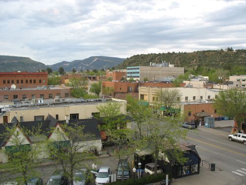
Durango, Colorado

The best-known of the various instances of alleged cannibalism in the prehistoric Southwest are a set of several that occurred around AD 1150 in the area around the modern town of Cortez, Colorado.  There are also scattered examples of similar assemblages dating to both before and after this and located both in southwestern Colorado and elsewhere, but most of them are not as well documented and they are therefore not easily comparable to the well-known assemblages.  One exception, so far the only known example of possible cannibalism dating to the period in the late thirteenth century when the Four Corners region was abandoned, is Castle Rock Pueblo at Canyons of the Ancients National Monument west of Cortez.  Earlier assemblages, in particular, are very rare, and the few known are generally not very well documented at all.  Cannibalism has thus generally been discussed in the literature as something that appears rather suddenly in the Southwestern archaeological record around 1150, perhaps indicating Mesoamerican influence that may or may not have had something to do with the rise and fall of the regional system centered on Chaco Canyon between about AD 1030 and 1130.  There have been some scattered references in the literature to earlier instances, but without good documentation they have not gotten much attention compared to the later ones.

That may now change, however.  An article published very recently reports on an astonishing assemblage recently documented in detail at Sacred Ridge, part of Ridges Basin south of Durango, Colorado (east of Cortez).  This site dates to around AD 700 to 800, during the Pueblo I period.  As part of salvage excavations in preparation for a reservoir project in the basin, archaeologists discovered one of the largest assemblages of intensively processed human remains known from the Southwest.  At least 35 people were represented in the assemblage, although the actual number present is exceptionally difficult to determine because the remains were fragmented to an enormous degree even compared to other heavily processed assemblages.   The ages of identifiable individuals ranged from infancy to adulthood.  The conditions of the deposition of the remains indicates that most were processed, possibly in connection with cannibalism, then dumped into one of the residential pithouses at the site.  Several artifacts found associated with the remains tested positive for human hemoglobin and/or myoglobin, indicating that they had come into contact with human blood and/or muscle tissue.

Francisco's Restaurante y Cantina, Durango, Colorado

This is a very large assemblage.  The well-documented assemblage at site 5MT10010 at Cowboy Wash, for example, consisted of only 7 individuals, and the other three sites in the Cowboy Wash community that have been excavated (all of which also showed evidence of cannibalism) ranged from 2 to 13 individuals.  Castle Rock had at least 41 individuals, but that was a large, aggregated community from a later period when the regional population was both larger and more concentrated in aggregated sites.  Finding 35 people killed at a Pueblo I village is extraordinary.

So who were these people?  The circumstances of the assemblage suggest that they were probably the inhabitants of the Sacred Ridge site, which contained several residential pithouses and constituted a relatively large portion of the overall Ridges Basin community.  Biometric analyses of the remains suggested that the individuals in the assemblage were both related to each other and distinct from the other people in the community.  This raises the possibility that they were recent immigrants who had attempted to move into the area, perhaps at a time when environmental conditions were difficult and some parts of the region had become less suitable for habitation, forcing their inhabitants to move into already-occupied areas where the local residents may not have been friendly.  This is similar to what some have proposed for Cowboy Wash, where ceramics indicate that the residents had strong ties to the Chuska Mountain region to the south and may have been recent immigrants into an area where they were not welcome.  The early AD 800s, when the Sacred Ridge massacre apparently occurred, does indeed seem to have been a time of difficult environmental conditions, as was the mid-1100s when the well-known cannibalism events such as the one at Cowboy Wash occurred.  The migration hypothesis thus seems fairly plausible to explain Sacred Ridge.

Railroad Station, Durango, Colorado

Not so fast, however.  In addition to doing the biometric analyses, the researchers in this case also did strontium analyses of the tooth enamel found in the assemblage.  Strontium isotope analyses can be used to determine where a person (or a tree) lived, which makes this type of analysis a useful way to directly test migration hypotheses.  Tooth enamel has a strontium ratio that reflects where a person lived as a child, since enamel is preserved throughout life after initially forming in childhood.  The strontium ratio of bone, on the other hand, reflects where a person lived shortly before death, since bone cells are continually being replaced throughout life.  In this case only tooth enamel was tested, but I’ve seen other studies comparing tooth and bone enamel to determine if a person lived in the same place at the beginning and end of life, which is just about the best way to test a migration hypothesis that I can imagine.  In the case of Sacred Ridge only tooth enamel was analyzed for some reason, but it still provides a way to determine if the individuals at Sacred Ridge had grown up in the Ridges Basin area or had moved at some point in their lives from somewhere else.

What the analysis showed was that all the analyzed individuals had likely grown up either in the immediate Ridges Basin area or nearby.  None could be conclusively identified as having grown up anywhere else.  This effectively falsifies the immigration hypothesis and requires a different explanation for the massacre.  It appears that the people who lived at Sacred Ridge were both local to Ridges Basin and distinct from the other inhabitants of the area, which the authors interpret as an “ethnic” difference.  They point to a variety of other indications in architecture and material culture suggesting that the area was quite diverse ethnically during this period, and they argue that the massacre represents ethnic violence within the community during a period of environmental deterioration likely leading to social stress.  The inhabitants of Sacred Ridge appear to have had greater access to large game animals than other members of the community, which may indicate that they were relatively well-off compared to others, who may have become resentful when times turned bad and taken out their frustrations through intensive violence, possibly involving cannibalism, which may have been so intense in part as an attempt to erase the identity of the victimized group.  The authors run through and discount a number of other explanations that have been offered for cannibalism assemblages, including warfare, social control, starvation, and witchcraft execution.  They reject these based on specific criteria they identify as the plausible archaeological correlates of each theory.  The specific correlates they offer strike me as dubious, and they do acknowledge that their “ethnic violence” theory is not necessarily incompatible with some of the others, but the approach is interesting.

Gaslight Theater, Durango, Colorado

There has been a recent trend in Southwestern archaeology toward trying to reconstruct ethnicity in the archaeological record, and there is an increasing sense that the Southwestern past may have been much more diverse ethnically than archaeologists have often assumed.  This paper takes that trend in an interesting direction by combining it with the contemporaneous trend toward greater interest in violence and warfare in the prehistoric Southwest.  The authors suggest that some of the later cannibalism assemblages might be profitably reexamined with the ethnic violence idea in mind, which is a good idea.  That said, “ethnicity” is a problematic concept when it comes to archaeological data, which is necessarily material in nature and not necessarily reflective of such an abstract concept.  It would be unreasonable to expect a short paper like this to address the issue at length, of course, and it appears that other publications from this project deal with it in more detail.  The innovative use of biodistance and strontium analyses to address these issues is a worthwhile development regardless of whether the trends identified correspond to ethnicity, however, and this paper makes for a very interesting contribution to the literature on violence and cannibalism in the Southwest that may require some adjustments to existing theories.
ResearchBlogging.org
Potter, J., & Chuipka, J. (2010). Perimortem mutilation of human remains in an early village in the American Southwest: A case for ethnic violence Journal of Anthropological Archaeology, 29 (4), 507-523 DOI: 10.1016/j.jaa.2010.08.001

Read Full Post »

Sleeping Ute Mountain and Surrounding Landscape from Four Corners

If you stand at the Four Corners monument and look in the direction of Colorado you will see Sleeping Ute Mountain dominating the view.  From this direction you are looking at the southwest side of the mountain, and in front of it you see the southern piedmont.  On the right side of the piedmont, though not visible from this distance, is Cowboy Wash.  It’s one of several ephemeral streams running from the mountain itself across the piedmont to the San Juan River.

One thing that might strike you about the view from this perspective is that it looks like an awfully dry, desolate, uninhabitable wasteland.  And you would be correct to think that.  The southern piedmont of Sleeping Ute Mountain is an extremely arid and inhospitable environment even by the standards of the Southwest, which is saying something.  It’s only a few miles from Mesa Verde to the east and the Great Sage Plain to the north, both areas that get relatively abundant rainfall and supported large and prosperous prehistoric communities, but it is worlds away from them environmentally.  While those areas get sufficient rainfall to support dry farming, and the Great Sage Plain is commercially farmed even today, the southern piedmont does not, and any type of agriculture there would have to rely on some sort of irrigation.  Today the Ute Mountain Ute tribe has a large irrigation project in the area, using water brought in from McPhee Reservoir, 45 miles to the north, via the Towaoc Canal.  The construction of the reservoir and the canal was part of the Dolores Project, which involved substantial archaeological excavation of the inundated area that significantly improved archaeological understanding of the prehistory of the region.  This work took place from 1978 to 1985 and was known as the Dolores Archaeological Project, the largest salvage archaeology project in US history.
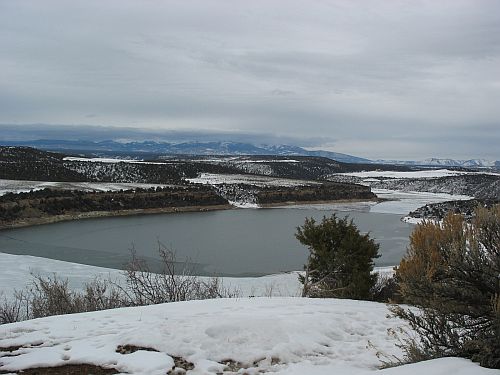
McPhee Reservoir, Dolores, Colorado

The creation of the irrigated fields on the piedmont resulted in further salvage excavations in the 1990s.  Among the sites excavated was 5MT10010, which contained considerable evidence of a gruesome incident of probable cannibalism around AD 1150.  It is not the only site in the area to show evidence of cannibalism during this period; in fact, three other sites in the same community, excavated slightly earlier in connection with the construction of the canal, also showed evidence of having been destroyed in an incident involving extensive processing of human remains in a way suggesting cannibalism, and there are several other sites in the area showing similar assemblages, most from the same period but at least one from a later period.  It is at 5MT10010 that the most solid evidence for actual cannibalism, as opposed to processing of bones in a way that may or may not indicate actual consumption of human flesh, in the form of a coprolite that tested positive for the presence of human muscle tissue.

There are many questions that arise from these findings, but one of the most puzzling is also one of the simplest: what were people doing living at Cowboy Wash in the first place, and how did they manage it?  After all, they weren’t building giant dams and canals of the sort involved in the Dolores Project.  In many parts of the Southwest, especially upland areas like Mesa Verde, dry farming using only rainfall was standard during this period, and water control techniques were generally used only for domestic water if a nearby spring or other reliable source was not available.  There are a few springs on the southern piedmont that probably would have supplied sufficient domestic water for the small number of people living there, but the rainfall would definitely not have been sufficient to farm with.  The only source of water at all sufficient for agriculture would have been the occasional floods, from spring snowmelt and summer thunderstorms, that would flow through Cowboy Wash itself and the other drainages on the piedmont.  None of these flows permanently today, and there is no evidence that they ever did.  As at Chaco Canyon, then, which is similarly dry, farming would have to have been based on some sort of technique for capturing the floodwater.

Flowing Chaco Wash and Cliffs below Peñasco Blanco

There are a variety of ways this might be done, including diverting the rainwater from cliffs, as was done at Chaco, planting along the sides of the drainage where the floods would regularly overflow the banks, and what is known as “ak-chin” farming, as practiced by the O’odham of southern Arizona, which involves planting right in the path of the runoff at places where the velocity of the water is relatively low, as at the mouths of tributaries to main arroyos.  There are no sheer cliffs on the southern piedmont like the ones at Chaco, so probably a mix of overbank and ak-chin farming would have been practiced at Cowboy Wash.

A paper by Gary Huckleberry and Brian Billman addresses the nature of farming at Cowboy Wash, and also addresses a related issue, which is whether periodic entrenchment of arroyos due to drought played a role in the patterns of abandonment and migration that characterize Southwestern prehistory.  It is pretty clear by now that the paleoclimatological record shows periods of drought corresponding to periods of abandonment of certain parts of the Southwest, and one proposed mechanism for how this would have worked is that drought would have led to increased erosion and/or hydrological changes in the water table that led to the entrenchment of arroyos, which would have been disastrous for populations dependent on certain types of floodwater farming (especially overbank), as the broad floodplains of the local drainages would have been replaced by deep channels that took the water away quickly instead of letting it overflow to water the crops.  Ak-chin farmers would not necessarily have been affected to the same degree, but if the side drainages they used became entrenched as well they would not have been able to use their techniques either.  Thus, drought would lead to arroyo-cutting, which would lead people to leave formerly productive areas for others that were less affected.  This theory has been proposed as an explanation for certain events at Chaco, with the idea being that some of the social changes late in the Chacoan occupation were due to degradation of the Chaco Wash and the need to change agricultural strategies.  The phenomenon of arroyo-cutting in general is richly illustrated in historic times at Chaco.  The early reports of the Chaco Wash from the nineteenth century indicate that it was a shallow, meandering drainage, much like the current condition of the Escavada Wash to the north and the “Chaco River” that is formed by the confluence of the two at the western end of the canyon and flows north to the San Juan.  By the early twentieth century, and accelerating since then, however, the Chaco Wash through the canyon has cut down significantly and there is a very deep arroyo channel apparent today.
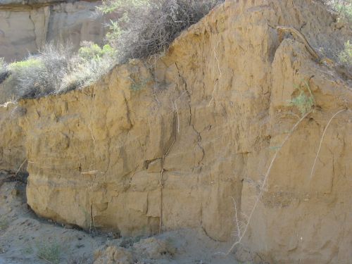
Entrenched Arroyo at Chaco

The drought-downcutting-abandonment theory makes sense as far as it goes, but as Huckleberry and Billman point out there are some problems.  For one thing, the extent to which arroyo-cutting is actually linked to drought, rather than other factors including the specific geology of the area, is hotly debated and there is no consensus.  The idea that while drought may be one factor causing arroyo-cutting there are other factors involved as well is supported by the fact that in different drainages in the Southwest that have been studied in depth the periods of arroyo-cutting do not necessarily correspond to region-wide droughts or other climatic changes.  In some areas they do, but in other areas they don’t.  At Cowboy Wash specifically, the available evidence indicates that the wash began to entrench sometime before AD 950, and that it began to refill with sediment sometime between AD 1265 and 1400.  If abandonment does in fact correspond to arroyo-cutting, then presumably the Cowboy Wash area should have been abandoned between 950 and 1265, and possibly occupied before and after this.  If downcutting results from drought, there should also be evidence of drought during the 950 to 1265 period.

The basic upshot of the Huckleberry and Billman paper is that neither of these expectations is met.  The evidence for drought conditions at Cowboy Wash generally matches that for the rest of the region, with the major droughts in the mid-twelfth century and late thirteenth century AD and several smaller droughts at irregular intervals before then.  This doesn’t show any particular relationship to the stratigraphic evidence for arroyo-cutting, which seems to have been going on to some degree throughout the period from AD 950 to at least AD 1265.  Furthermore, the evidence for settlement doesn’t line up either.  The marginal nature of the Cowboy Wash area implies that it would probably not have been occupied for most of prehistory, and this was indeed the case.  There were a few ultimately unsuccessful attempts to colonize the southern piedmont, however, and they don’t show any particular relationship to the periods of arroyo-cutting (although they do perhaps relate to periods of drought).  The first agricultural occupation of the area came during the Basketmaker III period, when a few pithouses were apparently used seasonally as summer fieldhouses, presumably associated with nearby fields, from about AD 600 to 725.  After these were abandoned, at a time which may correspond to a drought, the area does not seem to have been occupied again for more than three hundred years.  Then, around AD 1050, a few permanent, year-round sites were built.  These seem to have been occupied for only a few years, however, as there was no significant buildup of trash associated with them.  After they were abandoned, three larger villages, including one at Cowboy Wash, were established around AD 1075.  These had extensive trash deposits and seem to have been occupied for one or two generations.  These communities were apparently abandoned, however, when the next occupation began in the 1120s by a population with apparent links to the Chuska Mountain area to the south.  This occupation at Cowboy Wash is the community that was apparently destroyed around AD 1150 (again coincident with a major drought) when its inhabitants were mutilated and cannibalized.  After this event, the area was once again abandoned until about AD 1225, when two new communities were founded, including one again at Cowboy Wash.  Within a few decades the population at Cowboy Wash appears to have aggregated at Cowboy Wash Pueblo, following a typical pattern for the region.  Also typical of the region, the whole southern piedmont seems to have been abandoned by AD 1280, at the time of the “Great Drought” that coincides with major changes throughout the Southwest.

Entrenched Chaco Wash from Cliff Top near Pueblo Bonito

So basically, all of the attempts at year-round occupation of the southern piedmont seem to have occurred during the period that Cowboy Wash was being downcut.  While these were all ultimately unsuccessful, some lasted for a few decades, so clearly they were able to grow some food at some times.  This strongly implies that at least in this case, arroyo-cutting was not particularly linked to abandoned, although drought probably was.  Huckleberry address the issue of how farming could have been done during periods of downcutting by looking at Cowboy Wash and its tributaries today.  They find that while some portions of the main wash, especially, are indeed heavily downcut, other portions are not, and they label this type of drainage a “discontinuous ephemeral stream,” which is to say, a normally dry wash with some portions that are severely downcut and others that are not.  On the uncut portions, which include much of the length of the tributaries, overbank or ak-chin farming could easily be done today, and this was presumably the case in antiquity as well.  The hydrology of the area is such that the areas of downcutting would not have been stable, and would have tended to migrate upstream, but the complexity of the system is also such that this would not have made the entire system unusable; while some parts were being newly cut, others would be filling in, and prehistoric farmers would merely have to move their fields around a bit rather than abandoning the area entirely.

All that being said, however, the question of why people were trying to settle this quite harsh and difficult area in the first place.  It is interesting to note that the attempts at settlement generally came during periods of relatively favorable environmental conditions, which would have made this area a bit less forbidding than usual, as well as during times of increased regional population, when all the good land may well have been taken and some people were forced to seek out the more marginal areas.  The violence that appears to have accompanied the drought of the twelfth century, especially, suggests that when the good times came to an end social relations got very bad very fast.  Huckleberry and Billman suggest that the reason people did end up abandoning Cowboy Wash, the times when they were not attacked, was merely drought itself, which they were unable to cope with as well as other populations, even those who also used floodwater farming techniques, because the size of the watershed was relatively small and the amount of rainfall feeding the washes was also small, so the total amount of water they had to work with was much smaller even in good times than at place like Chaco with large watersheds.  In that context, even a small decrease in annual precipitation could be devastating, leading to failed harvests and the need to move away.

Non-Entrenched Escavada Wash from New Mexico Highway 57

Indeed, there is evidence that the time of the massacre at Cowboy Wash was very difficult for the people there.  Archaeobotanical studies of pollen and other plant remains showed that there was apparently little or no maize in or around 5MT10010 at the time of abandonment, which is quite surprising for a Pueblo site.  The plant remains that were there were mostly from wild plants such as chenopod, amaranth, and tansy mustard, all of which would have been available in the spring and likely would have been intensively collected if there were no stored corn available due to a failed harvest the previous fall.  In addition to pinpointing the season in which the incident occurred, this implies that times were very tough for the inhabitants of 5MT10010, and perhaps for their attackers too.  The coprolite showed no sign of having plant material in it, which suggests that whoever left it had not just eaten some corn at home before setting out to attack 5MT10010.

Another paper associated with the project, by Patricia Lambert, suggests another problem the Cowboy Wash inhabitants apparently had: disease.  In this paper Lambert reports on analyses of ribs of individuals at 5MT10010 and other sites in the Cowboy Wash area dating to various periods of occupation that had lesions on them suggestive of those seen in modern collections of individuals known to have died of tuberculosis and (to a lesser extent) other respiratory diseases.  These lesions were found in 11 of 32 individuals from Cowboy Wash that had enough of their ribs left to examine.  One of the individuals with lesions was from 5MT10010.  This was an adult woman who was not one of the victims of the attack at site abandonment but who had instead died earlier and been formally buried.  Lambert also examined comparative collections of remains from Pueblo Bonito at Chaco and Elden Pueblo near Flagstaff Arizona.  Only 3 of the 45 individuals from Pueblo Bonito and 2 of the 20 from Eldon Pueblo had similar lesions, suggesting that this disease was much more prevalent at Cowboy Wash than at these other sites, even though it was not absent at them.  Lambert notes that tuberculosis is an opportunistic disease that tends to strike people whose systems are compromised by other problems such as hunger and stress.  The evidence for physical violence in the Cowboy Wash sample, even setting aside the cannibalism assemblages, was much greater than in the other two samples as well.  Combined with the harsh environment, this suggests strongly that Cowboy Wash was a difficult place to live for several reasons.  Farming was possible but risky, and when conditions turned bad both hunger and violence from other hungry people were constant threats.

Given this context, the occurrence of extreme events such as cannibalism incidents at Cowboy Wash starts to make some sense.  Cowboy Wash is a place of extremes.
ResearchBlogging.org
Huckleberry, G., & Billman, B. (1998). Floodwater Farming, Discontinuous Ephemeral Streams, and Puebloan Abandonment in Southwestern Colorado American Antiquity, 63 (4) DOI: 10.2307/2694110

Lambert, P. (2002). Rib lesions in a prehistoric Puebloan sample from southwestern Colorado American Journal of Physical Anthropology, 117 (4), 281-292 DOI: 10.1002/ajpa.10036

Read Full Post »

Older Posts »